Spectrum Traverse, Edziza Provincial Park:
Colossal Effort and Reward
August 3-9, 2022
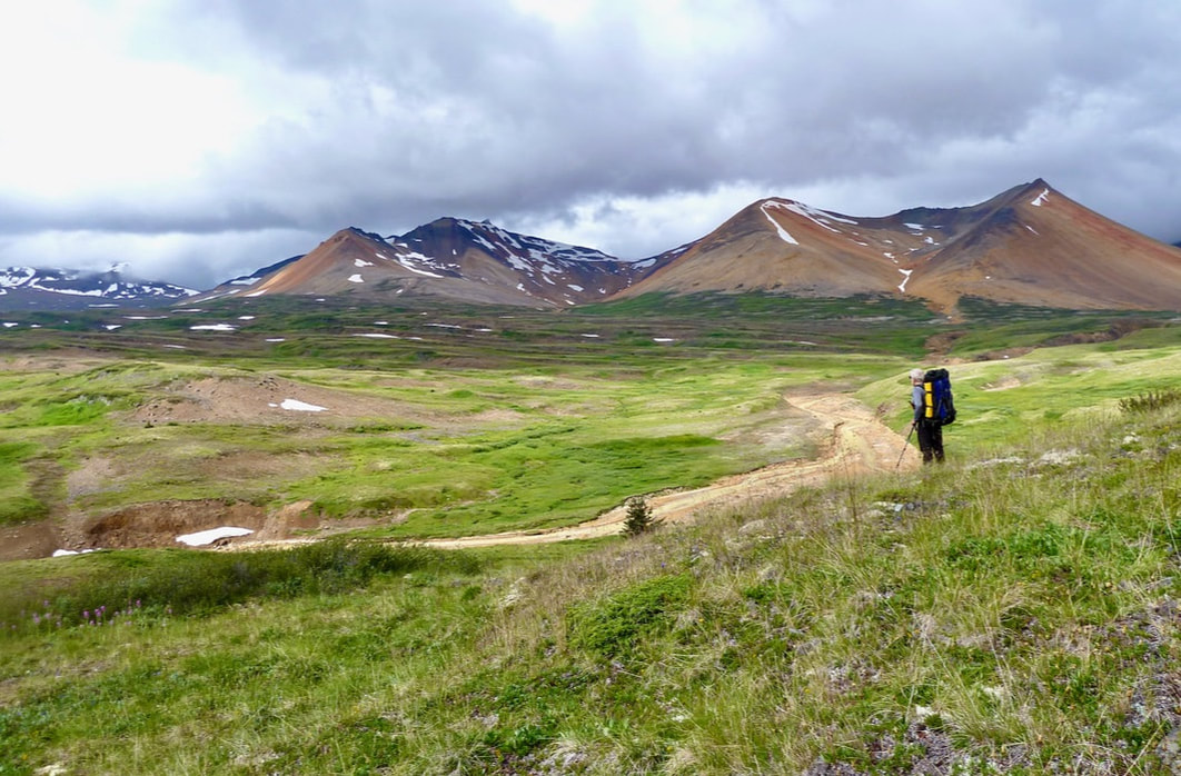
Henning and I had unfinished business in Mt. Edziza Provincial Park, northwestern B.C. We’d visited this vast and remote landscape in 2016 and 2018 but had yet to complete the last of the known routes, the Spectrum Traverse. In 2020 the north experienced unseasonably cold weather; in 2021 I put out my back. In August of 2022, despite both of us saddled with piriformis issues and the late snow melt threatening high river crossings, we felt it was now or never. Little did we know that this trek was to be our most physically and mentally demanding ever – that we’d be pushed to our limits. We traversed 85.8 km of challenging terrain with 2,984 m of elevation gain over seven days. Three of those days the elevation gain was equivalent to hiking the Grouse Grind – with a 30 lb, or in Henning’s case, 45 lb pack! And yet, there were moments of sheer joy, of contentment, of feeling small in nature. We were captivated by a landscape of such grandeur that few will ever see.
On August 1, 2022, we drove from New Westminster, B.C. to Ten Mile Lake Campground just north of Quesnel. I had a lovely swim in the lake. The sun was low on the horizon, loons called, and aspen leaves trembled in the warm breeze. I was so excited that we were finally heading north again. The next day we drove to Meziadin Lake on the Stewart-Cassiar Highway (#37) – a long, 9.5-hour drive, but later I performed back and piriformis exercises in the tent. I was dismayed by the large number of logging trucks we’d encountered – considerably more than I remember in the past. It’s heartbreaking just how quickly we are logging the last of our primary forests in B.C. And now we learn that the government is supporting clearcutting of primary forests for the wood pellet industry; for burning the pellets and turning them into electricity. Unbelievable!
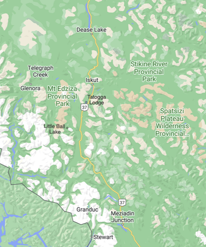
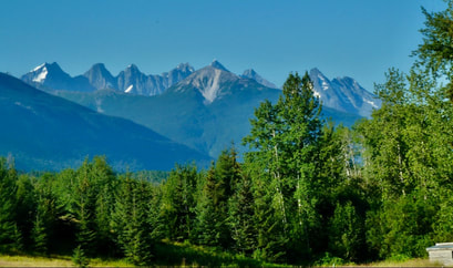
The drive north the following morning took us through a familiar landscape of towering hills and peaks shrouded in mist. The road was lined with swaths of yellow flowers and magenta fireweed (though, unfortunately cow parsnip appears to be rapidly displacing the fireweed). Tatogga Lodge, no longer open to the public, looked forlorn (last I heard it was housing men working at a nearby mine) and with Alpine Lakes Air no longer flying out of Tatogga Lake, we continued north to Dease Lake. The temperature plummeted to 7 °C and it began to rain. When we got to BC Yukon Air (currently the only option to fly into Edziza), we were told that the ceiling was too low to fly out to Little Ball Lake.
The drive north the following morning took us through a familiar landscape of towering hills and peaks shrouded in mist. The road was lined with swaths of yellow flowers and magenta fireweed (though, unfortunately cow parsnip appears to be rapidly displacing the fireweed). Tatogga Lodge, no longer open to the public, looked forlorn (last I heard it was housing men working at a nearby mine) and with Alpine Lakes Air no longer flying out of Tatogga Lake, we continued north to Dease Lake. The temperature plummeted to 7 °C and it began to rain. When we got to BC Yukon Air (currently the only option to fly into Edziza), we were told that the ceiling was too low to fly out to Little Ball Lake.
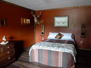 Our room at the Arctic Divide Lodge in Dease Lake.
Tomorrow, however, a bluebird day was forecast. The only motel in town was full, the campground was 15 km out of town, but we were fortunate to get a room at the Arctic Divide Lodge where we dried out the tent and hoped for a good night’s sleep.
Unfortunately, I did not get a good night’s sleep. In fact, I barely slept at all. The mattress was too hard for my liking and the outside light stayed on all night shining through the thin curtains. We got to BC Yukon Air at 7:30 am only to be told to come back at 9:30 am. A group of hunters had priority coming out of the backcountry. Given that we’d estimated the first day to be the longest distance-wise, I wasn’t happy with this delay, but took comfort in the fact that the days were long this far north.
Unfortunately, I did not get a good night’s sleep. In fact, I barely slept at all. The mattress was too hard for my liking and the outside light stayed on all night shining through the thin curtains. We got to BC Yukon Air at 7:30 am only to be told to come back at 9:30 am. A group of hunters had priority coming out of the backcountry. Given that we’d estimated the first day to be the longest distance-wise, I wasn’t happy with this delay, but took comfort in the fact that the days were long this far north.
DAY 1 17 km, 7.5 hrs
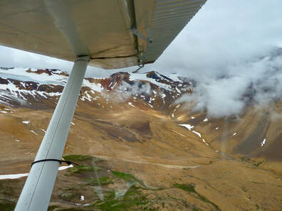
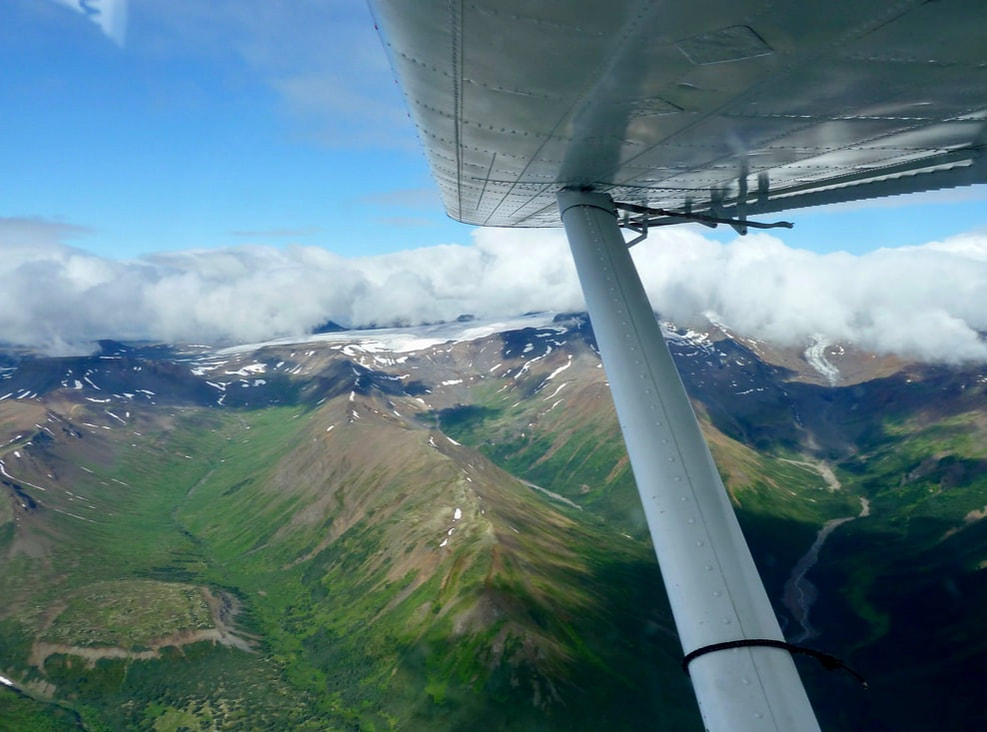
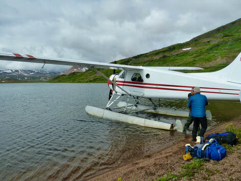
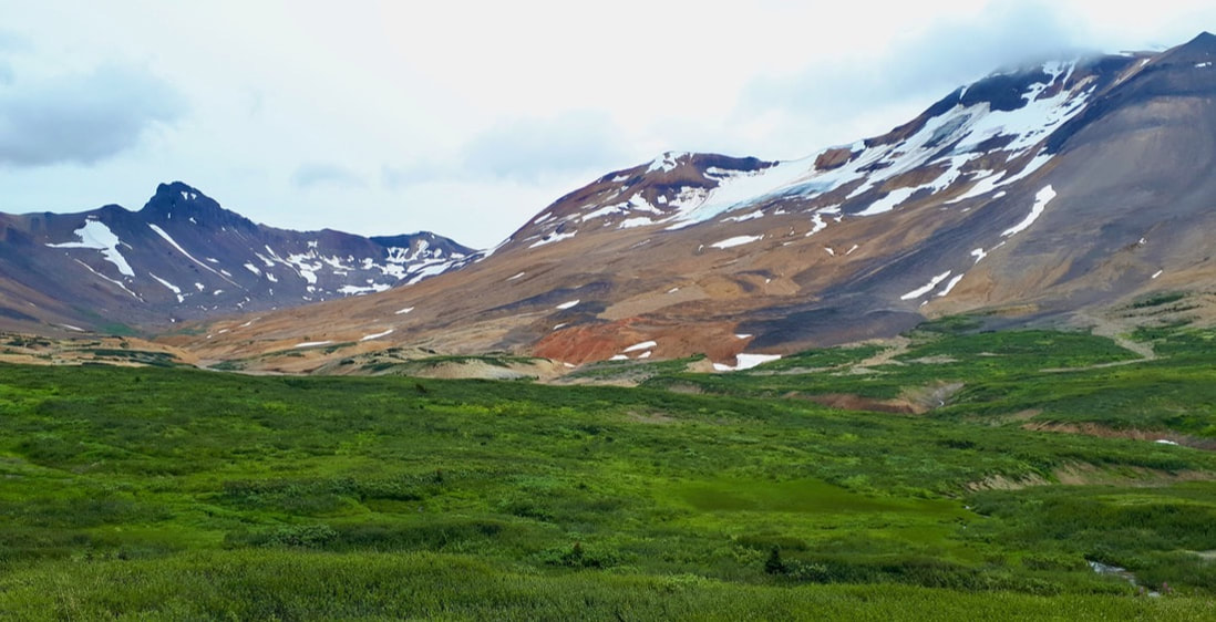
The clear blue-sky morning saw increasing cloud as the day wore on, but the luminescent orange peaks of the Spectrum Range and the massive glaciers of Mt. Edziza were still visible during the latter part of the 45-minute flight. Henning was ecstatic that we were flying in a Beaver built in 1949. I just hoped the passenger door wouldn’t fly open in mid-flight and had to calm myself during take-off (it didn’t help that I couldn’t get the earplugs to stay in my ears and had to hold them in place!). Once air-borne, as always, I was rivetted by the landscape below me: winding rivers, impenetrable forests, sweeping vistas of mountain meadows, aquamarine sparkling tarns, and lofty peaks. I wasn’t, however, prepared for the landing: the pilot banked the plane several times at what felt to me like a 90° angle!
The clear blue-sky morning saw increasing cloud as the day wore on, but the luminescent orange peaks of the Spectrum Range and the massive glaciers of Mt. Edziza were still visible during the latter part of the 45-minute flight. Henning was ecstatic that we were flying in a Beaver built in 1949. I just hoped the passenger door wouldn’t fly open in mid-flight and had to calm myself during take-off (it didn’t help that I couldn’t get the earplugs to stay in my ears and had to hold them in place!). Once air-borne, as always, I was rivetted by the landscape below me: winding rivers, impenetrable forests, sweeping vistas of mountain meadows, aquamarine sparkling tarns, and lofty peaks. I wasn’t, however, prepared for the landing: the pilot banked the plane several times at what felt to me like a 90° angle!
|
|
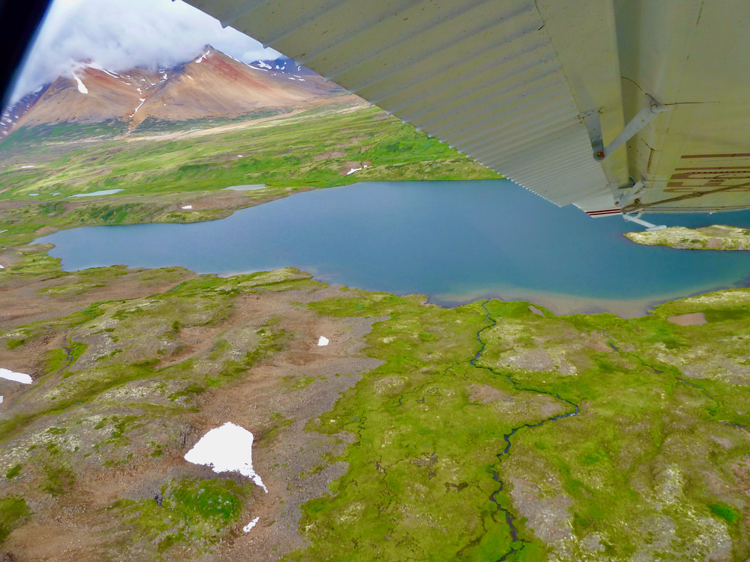
Landing at Little Ball Lake in Edziza Provincial Park.
Unloading our packs from the Beaver floatplane at Little Ball Lake.
|
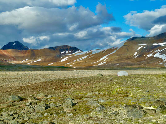
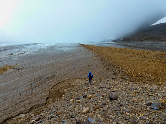
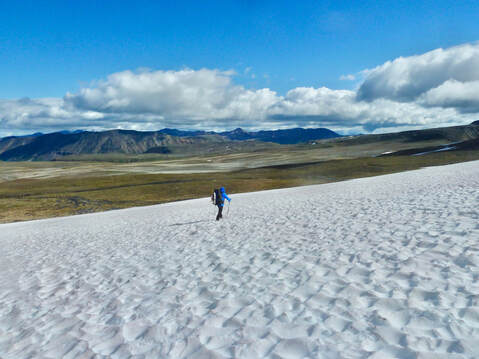
Walking around Little Ball Lake; Spectrum orange peaks backdrop.
|
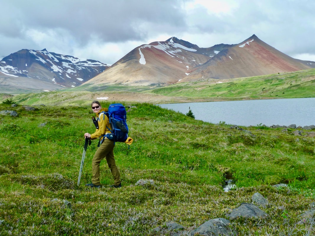
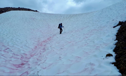
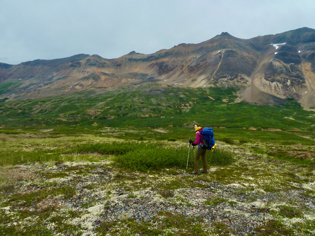
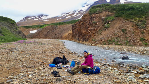
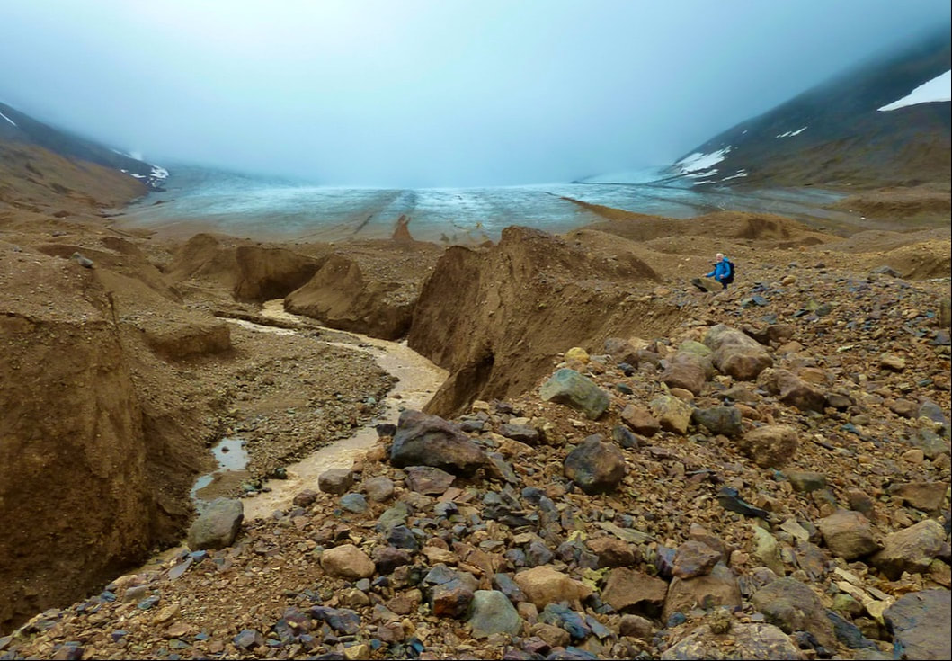
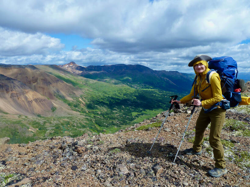
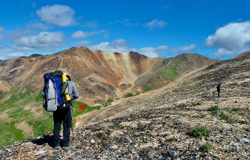
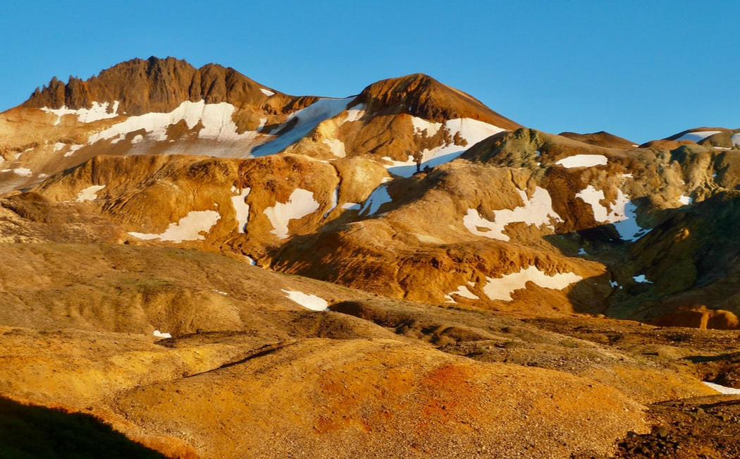
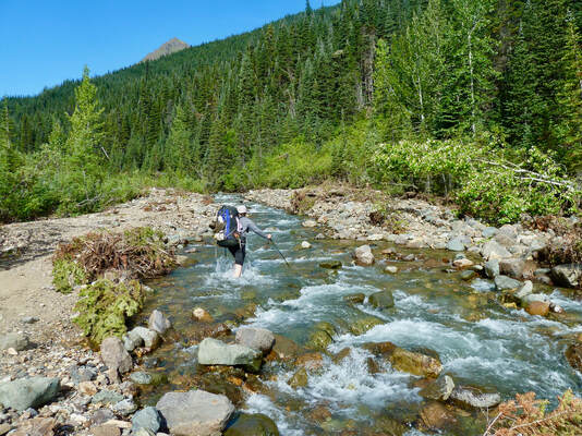
It was a little after 11 am by the time we started walking around Little Ball Lake. I was flooded with emotion – exhilaration that we were at last here and alone in the wilderness, but also worried should my back act up, my piriformis become too painful. I focused on staying in the moment. It was slow going for the first few hours due to uneven terrain and swamp, and an icy creek crossing (though we’ve perfected the speedy change of footwear to neoprene socks and holey shoes). We’d travelled less than 4 km and could still see Little Ball Lake in the distance. My pack felt incredibly heavy, and I didn’t think I could sustain our pace. I had to rest, and despite my fatigue and the fierce mosquitoes, I was enthralled once again by the radiant orange peaks and sweeping vistas of the Spectrum Range. I could see that Henning was worried about our slow progress. He opted to continue walking while I rested and then come back to carry my pack for me. After I’d snacked and rested, Henning was nowhere to be seen. I started walking in the direction he’d taken, and although we did meet up and I benefited from walking without a pack (the break I needed to re-energize), I concluded that we should not split up again.
I was enthralled by the radiant orange peaks and sweeping vistas of the Spectrum Range.
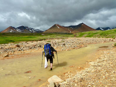
Fording an icy creek in neoprene socks and holey shoes.
|
Rest stop. Kounugu Mountain and Little Ball Lake in the distance.
|
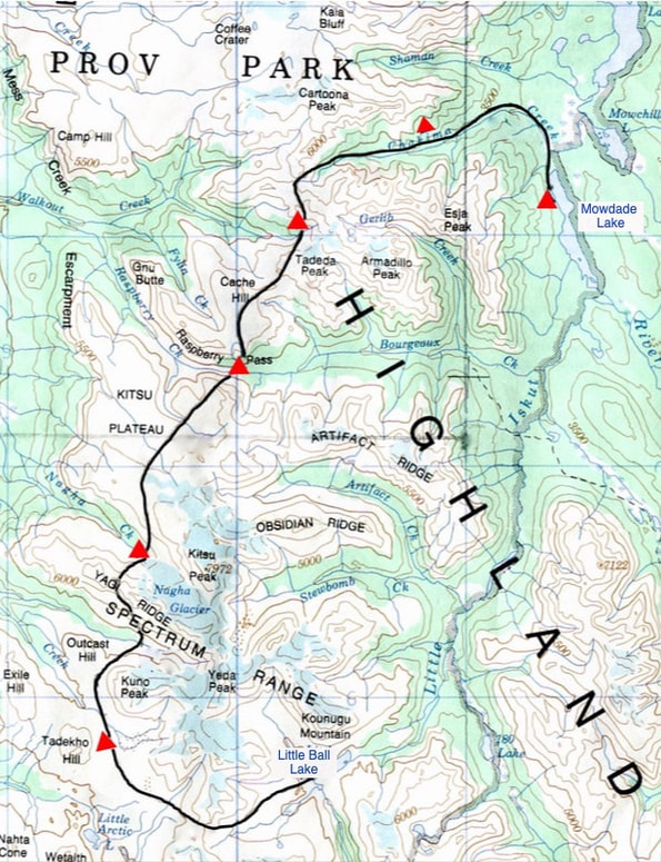
Our route starting at Little Ball Lake and ending at Mowdade Lake. Our campsites are shown in red.
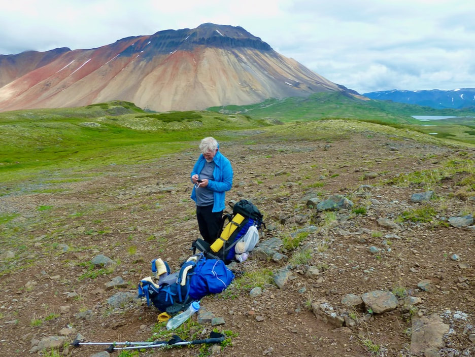
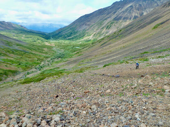
The ascent to the pass was strenuous and followed by a steep descent of a massive snow field even more challenging because of our heavy packs. I was relieved to get down to the valley bottom but when we rested, I felt the strain on my lower back. I found a large enough patch of moss to allow me to carry out the ‘cat-cow’ stretch and ‘child’s pose’, and from herein for the duration of our trek I faithfully performed these stretches daily to soothe my back. We had no more significant elevation gain for the next 5 km. We traversed numerous boulder fields and sank into glacial silt and still had to contend with mosquitoes, even though it was windy. This is not to say that there wasn’t any pleasant, easier walking – from time to time we welcomed walking on fields of tundra-like terrain and shale/dried up lake bottoms.
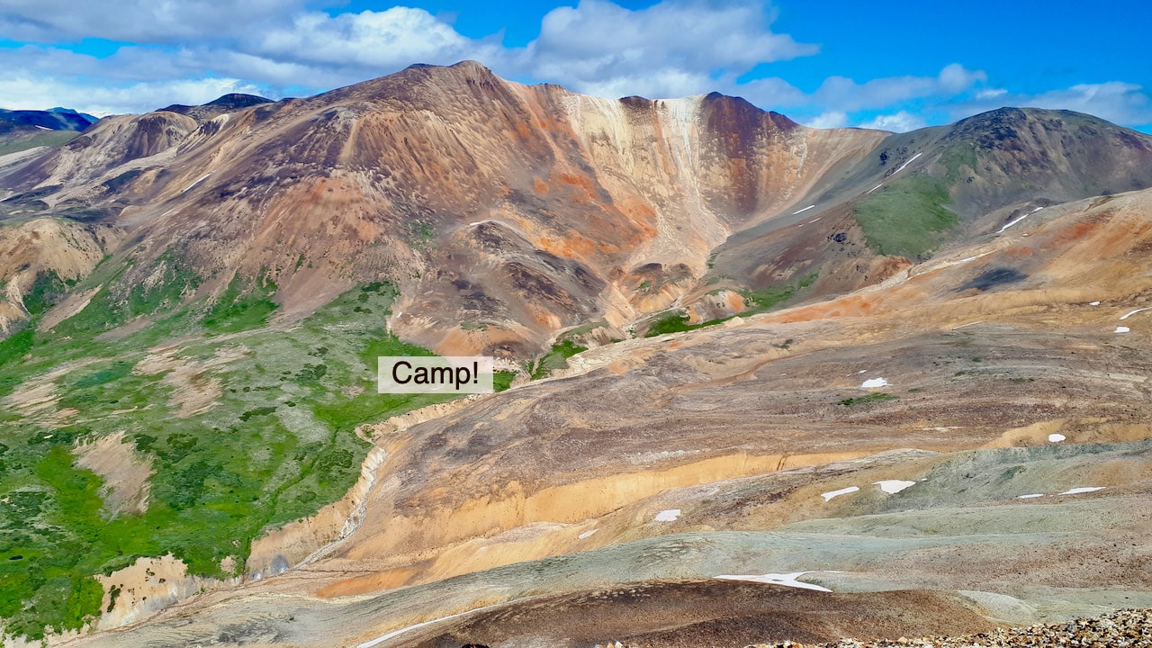
The last 1-2 km, however, seemed to go on and on. Running on empty (lack of sleep!), I caught up to Henning who had begun setting up camp positioned above a small lake. It was almost 7 pm.
Given my state of near exhaustion and the tough terrain, Henning wondered if he’d underestimated the route. I was convinced that a good night’s sleep would change everything.
The mosquitoes were so bad that we ate our freeze-dried meals and crawled straight into the tent. Entering/exiting the tent was a 2-person job to prevent mosquitoes from flooding in. The outer walls of the tent became plastered with mosquitoes in waiting!
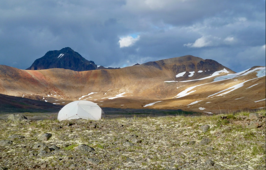
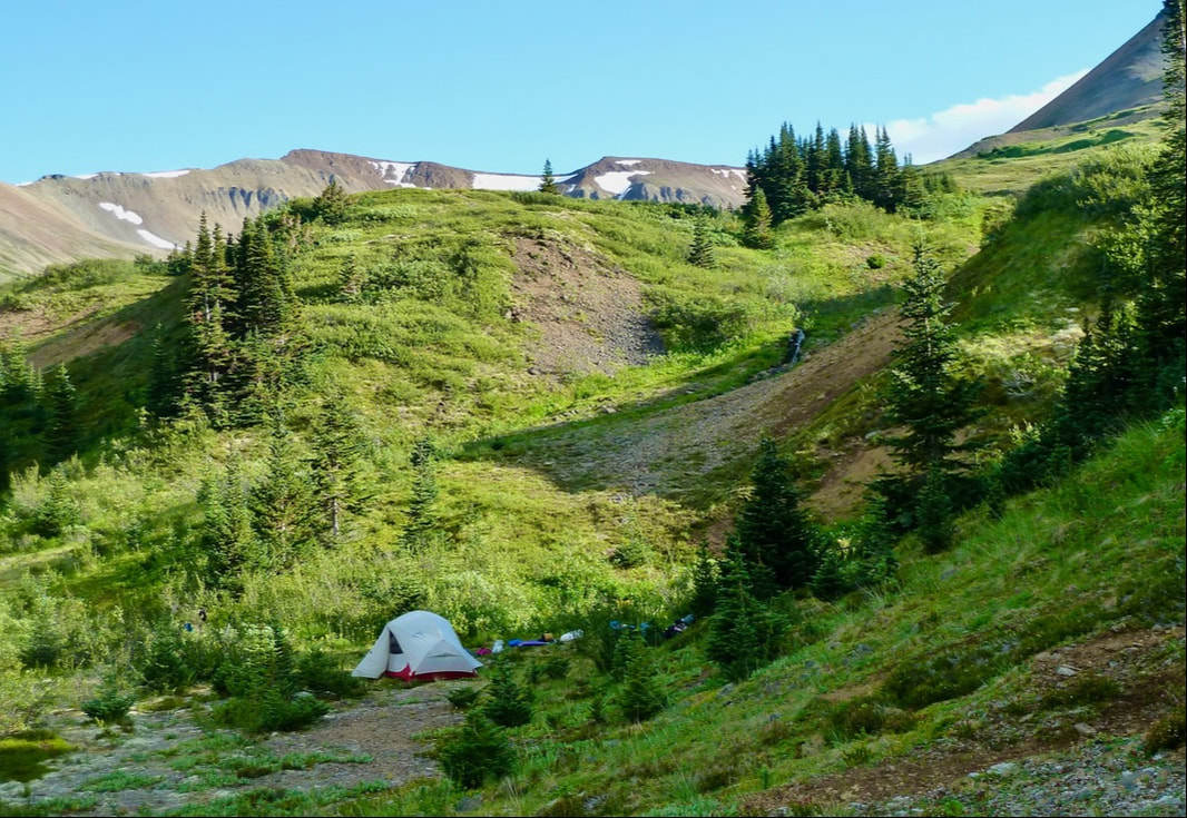
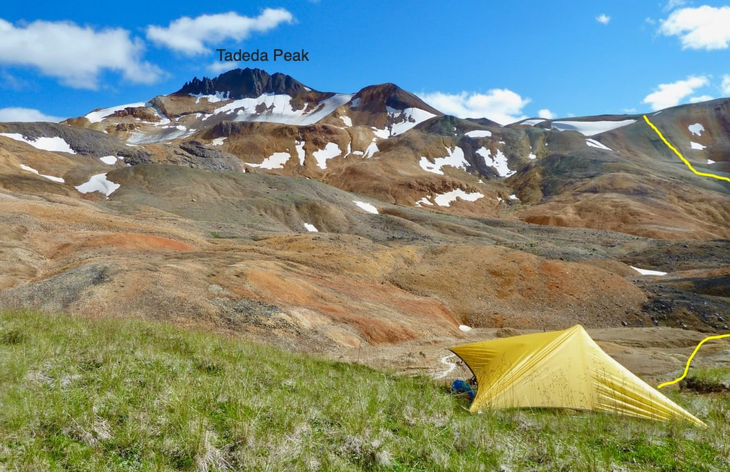
Camp 1, 17 km from Little Ball Lake, surrounded by orange peaks of the Spectrum Range.
DAY 2 14 km, 8.5 hrs (less than 2 km/hr)
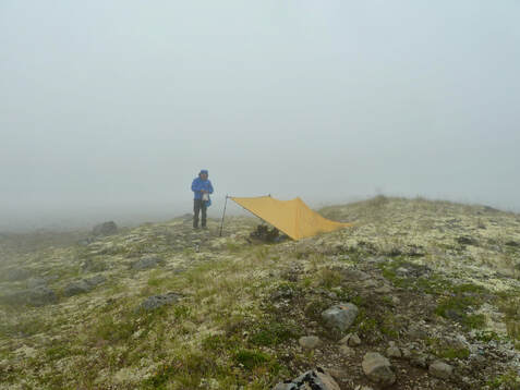
We awoke to low fog, so dense that the surrounding mountains had disappeared. It was cold – down to 3 °C during the night. We discussed walking in the fog. I was not in favour, but Henning questioned whether tomorrow might not be any better. When the sky looked like it was brightening, we packed up and left. It was already 10 am – at least an earlier start than yesterday! As we walked in the cold towards Outcast Hill, the fog lifted and clouds began to move in, but the mountain peaks were visible once again. We crossed Tadekho Creek and walked on gravel flats and through marsh. The going was pleasant, and I was in good spirits (amazing what a sound night’s sleep can do!). Soon after, we ascended to a large mountain meadow, followed by a descent to cross Tadekho Creek a second time. We lunched on the riverbed in preparation for the ascent of Yagi Ridge. Henning warned me that it was steep – the toughest section of our trek – but neither of us were prepared for the difficult terrain, nor the exertion needed to scale the extensive, steep, and very unstable scree slope.
Top left: Walking towards Outcast Hill as the fog lifted. Bottom right: Large mountain meadow that we needed to descend to cross Tadekho Creek and ascend Yagi Ridge seen in the distance.
.
Lunch on the riverbank of Tadekho Creek to fuel up for the ascent of Yagi Ridge.
Lunch on the riverbank of Tadekho Creek to fuel up for the ascent of Yagi Ridge.
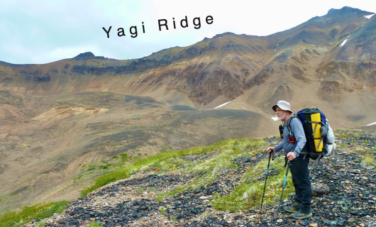
From this vantage point, crossing Yagi Ridge seemed a daunting undertaking.
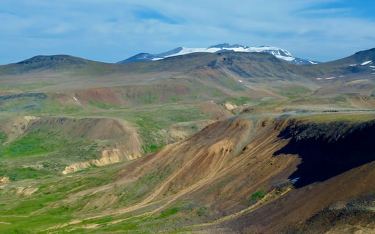
 Our camp on the Nagha riverbed. Nagha Glacier is barely visible in the distance.
Early on, I saw Henning up ahead descend into a gully with snow – apparently to determine if the terrain was easier walking (it was not). I saw him slip, then regain his balance. But in my mind, I watched him tumble down the gully! I was shaken but had to steel my mind and keep moving. Furthermore, I have a moderate fear of heights. And sometimes, large loose boulders started to slide. This was a terrifying combination! On more than one occasion, I froze. I had to refocus and continue climbing higher. When we thought we were nearing the top, and had little left in the tank, another slope appeared out of the gray fog and then another! But persist we did. We had no choice but to continue, to put one foot in front of the other, always watchful of unstable rocks. We called out to check on each other’s wellbeing – it was the only thing we could really do for each other.
By the time we reached the pass, it had begun raining and strong wind gusts threatened to blow us over. Henning had the wherewithal for us to stop and put on our rain gear. It was 3 °C. Luckily it didn’t start to snow! We were exhausted, but had to get down quickly, out of the wet and the cold wind. Just like the ascent it would be so easy to stumble, sprain an ankle or worse. Several times I thought we were down, but it was far to the valley bottom, and steep, and the wind was fierce and relentless. Thought I would get blown off the ridge!
At last, we reached the Nagha riverbed where we found a level spot to camp. We were apprehensive as to how we would cross the brown, raging river discharging full force out of the Nagha Glacier, but that was for tomorrow. Now we needed to erect the tarp, get into warm clothes, and make hot tea – ah, the joys of a shelter! Henning voiced that he was still cold (very unusual for him), so we set up the tent and he crawled into his sleeping bag. I prepared supper, but Henning ate very little (again so unlike him). Mac and cheese – hit the spot! I tidied up our camp and then joined Henning in the tent. We were warm and snug listening to the rain and the forceful wind gusting outside. I felt relief that we were safe, but sleep did not come easily. I replayed the day in my mind but was still unable to really process what we’d experienced. I was also worried about Henning, but hoped it was just overexertion – after all, he had the much heavier pack! Still, I checked in with Henning to make sure that I knew how to operate his inReach device should his condition worsen.
DAY 3 8 km, 8 °C high
We stayed in the tent until 7:45 am. I was relieved that Henning seemed improved but wondered if a rest day was needed to re-energize. And how were we to get to the other side of the torrential Nagha River? We heard boulders being rolling downstream by the river current. There was no question of crossing the river at our present location. Yet, neither of us
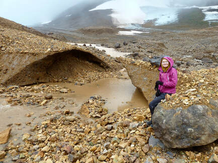 Sitting in front of large chunks of melting ice covered in rock.
wanted to consider going back down the treacherous terrain we’d come up yesterday. We decided to walk upstream to see if the river might become braided and therefore easier to cross. Things weren’t looking good, so I suggested we walk all the way to Nagha Glacier. I had this bizarre idea that maybe we could cross the glacier itself! We had nothing else to do with our day anyway.
We walked through extensive moraine consisting of steep ridges 6 or 7 m high. Everywhere rocks and boulders (up to 1 m in height) were in varying stages of breaking into slabs (resembling sliced bread) and of varying colours: pinks, greens, yellows. I found it fascinating!
We walked through extensive moraine consisting of steep ridges 6 or 7 m high. Everywhere rocks and boulders (up to 1 m in height) were in varying stages of breaking into slabs (resembling sliced bread) and of varying colours: pinks, greens, yellows. I found it fascinating!
Walking over extensive moraine consisting of steep ridges 6 or 7 m high on our way to Nagha Glacier.
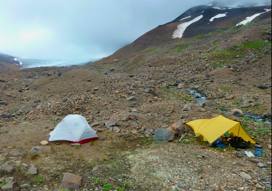
Upon reaching the toe of the glacier, we walked across ice with water running below it and at times sank into glacial silt, but the terrain seemed stable to us. We were hopeful that we could circumvent crossing Nagha Creek by walking across the glacier and only crossing a small tributary. We returned to camp and after lunch packed up and headed back to the Nagha Glacier. We were ecstatic when we made it to the other side but surprised by the swiftness of the small tributary we had to cross – imagine the full force of the main glacial river! We set up camp early in the day in a small gully out of the wind. Now we were well positioned to hike Kitsu Plateau to Raspberry Pass.
 Setting up camp in a small gully out of the wind. But fierce winds funnelled through during the night!
Magenta fireweed grew alongside clear hillside creeks that fed into the Nagha, and we came across a patch of vibrant lime-green water plants – the only splash of colour in this harsh, stark environment of rock and ice, fierce winds and cold. And yet there was a kind of beauty too in this barren, untouched landscape.
Unfortunately, we had a terrible night. The wind picked up in earnest, funneling though our gully and threatening to break the tent poles. We slept little and uneasily. Henning said that he was reluctant to get up and pee during the night for fear that the wind would blow away the tent with me in it!
Unfortunately, we had a terrible night. The wind picked up in earnest, funneling though our gully and threatening to break the tent poles. We slept little and uneasily. Henning said that he was reluctant to get up and pee during the night for fear that the wind would blow away the tent with me in it!
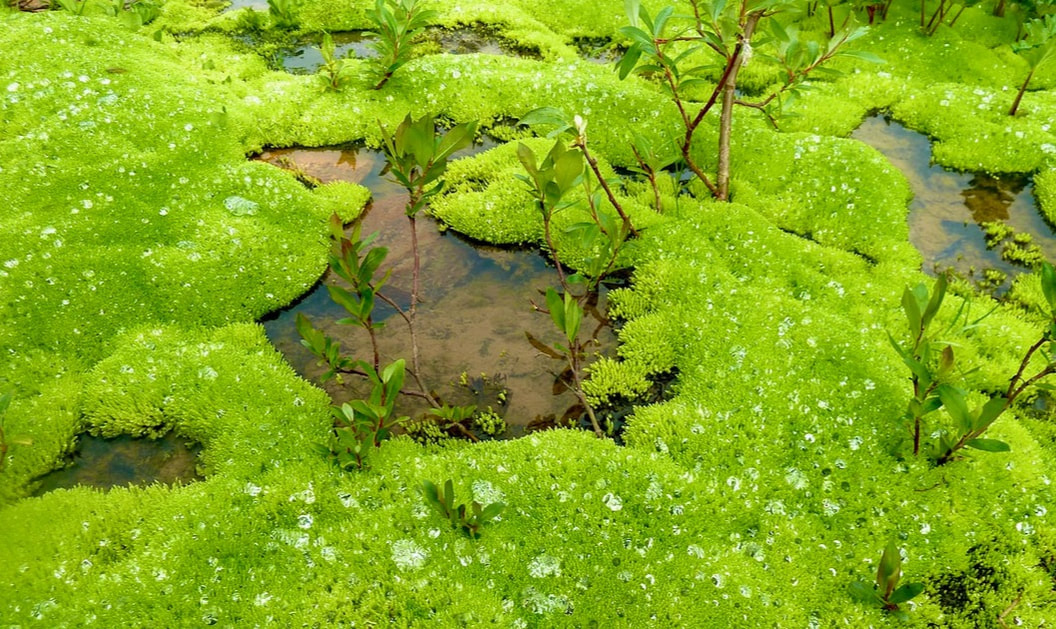
A delightful patch of vibrant lime-green water plants in an otherwise stark environment of rock and ice.
DAY 4 16.8 km, 8 hrs
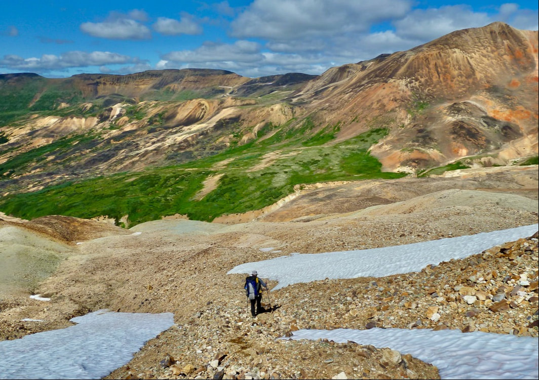
It was a cold morning (4 °C) and still windy, with partial clearing revealing volcanic snow-covered peaks. Our day began with a climb, heading up steep moraine and then onto a steep, again unstable scree slope. Not having chosen an optimal route we had to move laterally across the unstable scree. Henning was ahead and triggered a slide. A rock nailed him in his lower leg and pushed it out from under him. I watched in horror, for although he did regain his balance, for the second time, in my mind, I watched him topple down the mountainside. Again, I had to push away negative ‘what if’ thoughts and carry on. As we neared Kitsu Plateau we looked down at Nagha Glacier in its immensity and drank in the spectacular views which got even better as we attained the plateau.
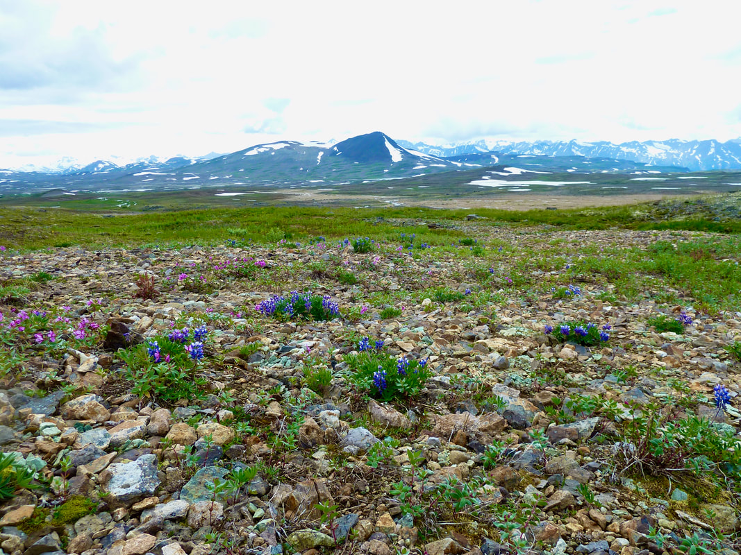
Here we encountered a series of boulder fields, snow fields and steep-sided creek gullies and ravines – rugged terrain to be sure, but we also traversed pleasant hummock fields and tundra-like terrain. The panoramic vistas were stunning.
How do you put into words these varied and grandiose landscapes we were traversing? How do you capture them in photographs? We’d encountered only the occasional footprints to know that others have been here. I felt so diminutive, as if we were the only two people on Earth.
How do you put into words these varied and grandiose landscapes we were traversing? How do you capture them in photographs? We’d encountered only the occasional footprints to know that others have been here. I felt so diminutive, as if we were the only two people on Earth.
Stunning panoramic views from Kitsu Plateau.
 Raspberry Pass at the base of this steep precipice.
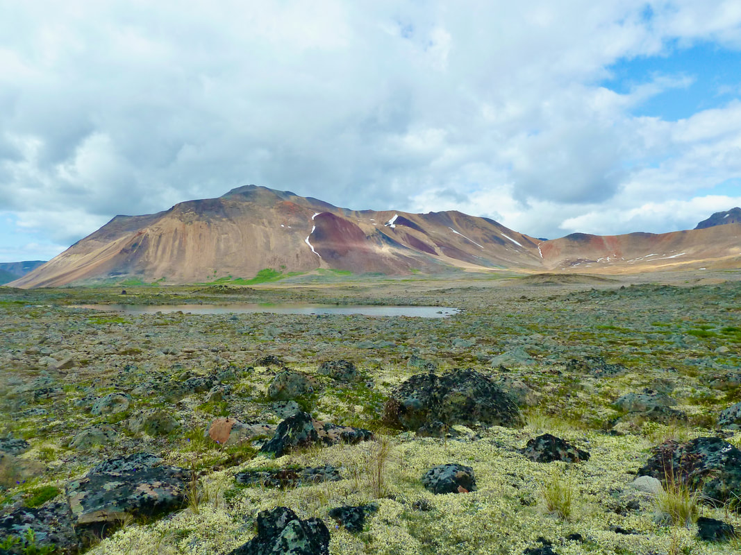
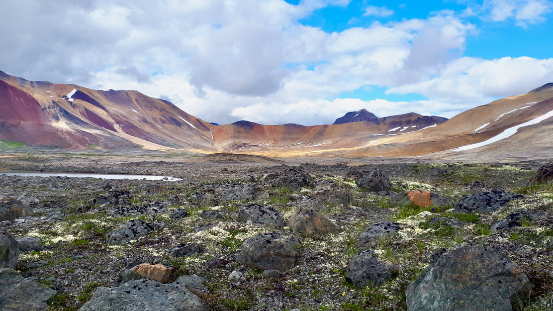
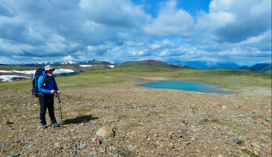
I spied a piece of jet black, smooth rock. Could this be obsidian? A natural glass formed by the rapid cooling of viscous lava and used by the Tahltan First Nations to create sharp-edged tools. As we progressed, more and more obsidian became interspersed among the rocky fields. Given that Obsidian Ridge lay to our east it was probably not surprising. Our limits were tested yet again. Kitsu Plateau stretched on endlessly. Our energy waned. Henning wanted to reach camp (supposedly just over the next hill), but I convinced him to stop to refuel. Fortunate that we did because we were far from Raspberry Pass. In fact, we walked to the edge of a very steep precipice. The wind was blowing like crazy, as we looked down at the dramatic sight before us and pondered how we were going to get down safely.
The wind was blowing like crazy standing at the edge of a steep precipice and pondering how to get down to Raspberry Pass safely.
 Our safe route descending into Raspberry Pass.
We eventually found a safe route that descended into the lush valley of Raspberry Pass. Ever increasing patches of blue sky appeared, and we were delighted to come across a path of sorts, perhaps a horse trail or wild animal trail. Surely it wasn’t far now to camp. We lost and regained the path periodically until it culminated in a kind of wildlife corridor – there were bear, wolf, and moose tracks, as well as fresh bear scat.
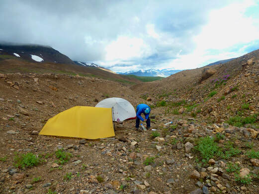
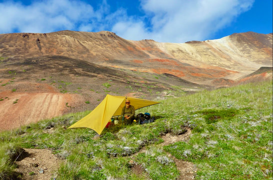
Further along we arrived at a series of three brilliantly turquoise lakes. I was certain this was the site of our camp, but according to Henning we still had 1.5 km to go! I wanted very much to stop and swim – the water looked so enticing though it was likely numbingly cold – but Henning convinced me to push on to unload our heavy packs for the day. Finally, after again losing and regaining rudimentary animal trails, and traipsing through marsh, we reached a stand of subalpine fir nestled among the mountains. A delightful creek ran nearby. Camp! We savoured the warmth and greenery – so much more hospitable than where we’d spent the previous night. Orange columbine and paintbrush, purple lupine, and yellow asters and buttercup were among the wildflowers that dotted the landscape. Raspberry Pass did not disappoint. (Ever since locating the name on a map, this place had beckoned to me.) Unfortunately, we had to contend with swarms of mosquitoes again, but these we gladly accepted in lieu of herculean wind gusts.
Further along we arrived at a series of three brilliantly turquoise lakes. I was certain this was the site of our camp, but according to Henning we still had 1.5 km to go! I wanted very much to stop and swim – the water looked so enticing though it was likely numbingly cold – but Henning convinced me to push on to unload our heavy packs for the day. Finally, after again losing and regaining rudimentary animal trails, and traipsing through marsh, we reached a stand of subalpine fir nestled among the mountains. A delightful creek ran nearby. Camp! We savoured the warmth and greenery – so much more hospitable than where we’d spent the previous night. Orange columbine and paintbrush, purple lupine, and yellow asters and buttercup were among the wildflowers that dotted the landscape. Raspberry Pass did not disappoint. (Ever since locating the name on a map, this place had beckoned to me.) Unfortunately, we had to contend with swarms of mosquitoes again, but these we gladly accepted in lieu of herculean wind gusts.
A snow bridge and the start of blue sky days.
|
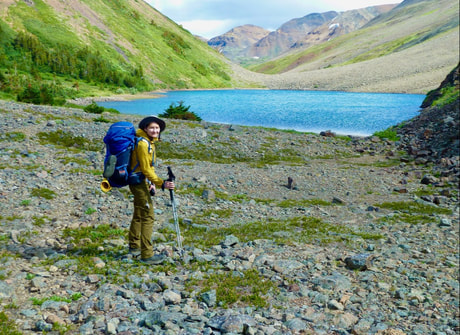
The first of three brilliantly turquoise lakes in Raspberry Pass.
|
Our camp in Raspberry Pass: savouring the warmth and greenery.
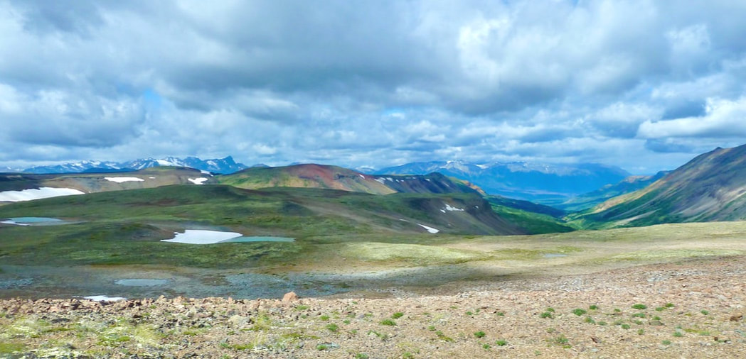
 Ascent from Raspberry Pass to a plateau with 360° views. Kitsu Plateau is in the far distance.
DAY 5 10.6 km, 6 hrs (< 2 km/hr AGAIN)
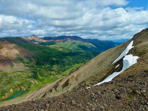
There was ice on the tent fly in the morning, but the sky was cloudless and deep blue. We started the day hiking uphill (as seemed to be the case each day). Unfortunately, the lower green slopes seen from below were not moss/heather but rather willow and stunted conifers. Bushwhacking was slow, and the mosquitoes, the already hot sun, and our cumbersome packs didn’t help matters. Fortunately, I regained my energy once we were at higher elevation where it was cooler. Here the walking became pleasant, on moss/lichen/heather, and we reached a plateau with 360° views. Looking back from where we’d come, it was hard to imagine we’d traversed the extensive Kitsu Plateau in a single day. We headed for the spectacular Tadeda Peak only to find ourselves at another precipice. From here we had to continuously pick and choose our route, changing course when we reached a cliff edge or steep ravine. At one point, having skirted an impressive, steep snow field that bore a small lake, Henning’s inReach showed 1 km to camp. That 1 km was to take us 2 hours!
There was ice on the tent fly in the morning, but the sky was cloudless and deep blue. We started the day hiking uphill (as seemed to be the case each day). Unfortunately, the lower green slopes seen from below were not moss/heather but rather willow and stunted conifers. Bushwhacking was slow, and the mosquitoes, the already hot sun, and our cumbersome packs didn’t help matters. Fortunately, I regained my energy once we were at higher elevation where it was cooler. Here the walking became pleasant, on moss/lichen/heather, and we reached a plateau with 360° views. Looking back from where we’d come, it was hard to imagine we’d traversed the extensive Kitsu Plateau in a single day. We headed for the spectacular Tadeda Peak only to find ourselves at another precipice. From here we had to continuously pick and choose our route, changing course when we reached a cliff edge or steep ravine. At one point, having skirted an impressive, steep snow field that bore a small lake, Henning’s inReach showed 1 km to camp. That 1 km was to take us 2 hours!
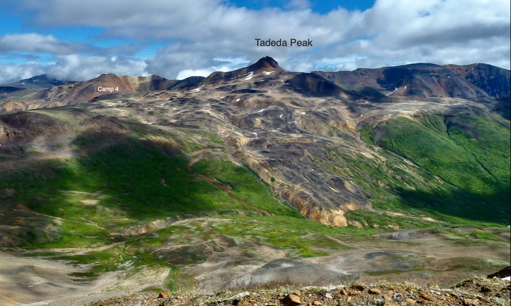
Heading for the spectacular Tadeda Peak, then descending into a steep-sided bowl for Camp 4.
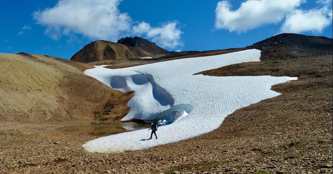
An impressive steep snowfield yielding a small lake. From here it was 1 km and 2 hours to camp!
We found ourselves at the top of a steep-sided bowl surrounded by brilliant orange peaks against a cobalt blue sky. A waypoint showed the camp to be on the other side of the creek that meandered along the bottom of the bowl. We needed to descend to that creek. It looked near impossible from my vantage point. But we started down a labyrinth of relatively steep moraine. Systematically we headed down one steep slope or ravine not knowing if that was a do-able path or whether we’d have to backtrack and find an alternative. There was also some loose rock, so I found it all very unnerving! When at long last we found ourselves at the base of the bowl, we chose to climb up the creek to access the campsite situated higher up. I hoped this route was barrier-free because I didn’t want to have to scale the steep sides of the creek.
A view to the steep-sided bowl we had to descend into to get to our camp (marked by the red 'X'). It took 2 hours!
It looked near impossible, but we had to descend into the bowl heading down steep slopes and ravines, some with loose rock - very unnerving!
We started down a labyrinth of relatively steep moraine and some loose rock, systematically heading down one steep slope or ravine not knowing if that was a
do-able path or whether we’d have to backtrack and find an alternative.
Our campsite was situated at 1678 m and surrounded by a breath-taking array of yellow to deep orange peaks. Although drained by the day’s effort (682 m elevation gain), we were captivated by the grandeur of the landscape. It was unparalleled.
Our campsite at 1678 m. The yellow line shows our approximate descent to the base of the bowl and up the creek to access the campsite.
|
|
In the evening glow the colours intensified – magical!
 Mt. Edziza in the distance.
DAY 6 9.6 km
We awoke to another beautiful cloudless morning and savoured our surroundings before packing up and climbing out of the bowl. At higher elevation we glimpsed Mt. Edziza and Cocoa and Coffee craters, and eventually intercepted the trail coming from the route to the north (Buckley Lake to Mowdade Lake) with which we were already familiar. I think that Henning was hugely relieved to be able to step down from route-finding duty. As we followed the trail along Chakima Creek to the horse camp, I was surprised by the absence of lush greens and yellows and wildflowers that we’d encountered in the valley in 2018. Different time of year? Different conditions?
We awoke to another beautiful cloudless morning and savoured our surroundings before packing up and climbing out of the bowl. At higher elevation we glimpsed Mt. Edziza and Cocoa and Coffee craters, and eventually intercepted the trail coming from the route to the north (Buckley Lake to Mowdade Lake) with which we were already familiar. I think that Henning was hugely relieved to be able to step down from route-finding duty. As we followed the trail along Chakima Creek to the horse camp, I was surprised by the absence of lush greens and yellows and wildflowers that we’d encountered in the valley in 2018. Different time of year? Different conditions?
Cairns appeared as route markers - Henning could step down from route-finding duty.
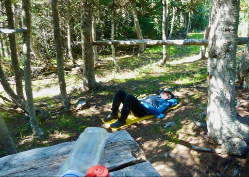 Relaxing at the horse camp - felt like we were on vacation!
The horse camp looked abandoned – no horse manure everywhere! (Perhaps Covid-19 had shut down the influx of international hunters.) We hung out and relaxed in the shade of the trees, enjoying a pleasant breeze. There was a table for setting the stove on to make tea. It felt like we were on vacation! We couldn’t find a level place to pitch the tent, so we had an early supper then packed up and hiked to a campsite 20 or 30 minutes away. It was a lovely clearing in the forest with orange mountain peaks in the distance. A breeze kept the mosquitoes at bay, and we heard the low roar of a distant waterfall. I felt peaceful and content, imagining what life had been like for pioneers in northern B.C. In the morning the air was still, and the mosquitoes returned in full force – my romantic notions of pioneer life didn’t look so rosy anymore.
Day 7 14.8 km, 7 hrs
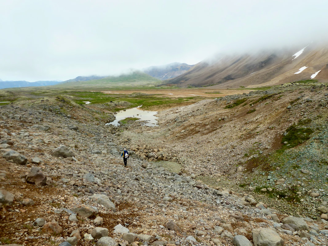
It was yet another sunny day. We continued to follow Chakima Creek on a pleasant trail that began with a creek crossing, some up and down, and mountain views. But then the trail worsened, and we were partly bushwhacking through willow scrub and tramping through wet marsh in the heat of the day. We had a lovely lunch on a creek bed and some pleasant walking in pine forest, but it was just so hot and muggy that my pack felt heavy, and I needed to stop every 30 minutes. The trail went on and on. Eventually we got to the low-lying beaver dam/pond area. It was muddy, humid, and bug-infested, but relatively dry – had the beavers moved out? Further along we crossed knee-deep water, but nowhere was the water waist-deep from late snow melt as we’d feared. I was ecstatic to get to Mowdade Lake. I raced down to the lake and stripped off my clothes – mistake! The mosquitoes descended on every inch of my body!
The next morning, after a lovely serene breakfast on the shores of Mowdade Lake, a different Beaver floatplane (built 1951) flew us back to Dease Lake. Since the burger Shack wasn’t open yet, we got hot BBQ chicken legs from Super A Foods and devoured them sitting in the jeep in the store parking lot. Later that evening at our Meziadin Lake campsite, I fried up burgers, onions, and mushrooms. That took care of our craving for fat, though an avocado would have been nice too!
The sunny days persisted for our drive home. We were fortunate to view the elusive Seven Sisters Peaks (often shrouded in cloud!) just north of Kitwanga on Highway 37.
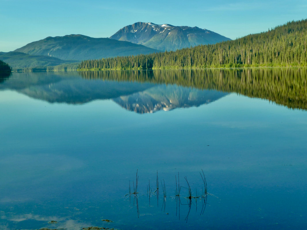
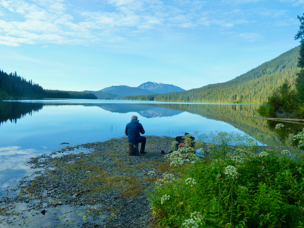
Our final morning enjoying the tranquility of Mowdade Lake.
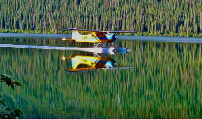
Our pick-up was a Canadian icon, the De Havilland Beaver bush-plane. This one built in 1951.
|
 The Seven Sisters viewed just north of Kitwanga. The Seven Sisters viewed just north of Kitwanga.
|
In the coming days we reflected on this third and most challenging of all three experiences in Edziza Provincial Park. Though we were pushed to our limits, the reward was colossal. And, though this was to be our final excursion into the park, we have begun discussing a fourth trip – perhaps starting and ending at Mowdade and allowing for a return to the incredible steep-sided bowl and a side-trip north to the lava fields that we’d previously traversed in foul weather. Such is the lure of this vast, wild, and mystical landscape!
