Return to Edziza: Hiking Buckley L. to Mowdade L.
August 5-11, 2018
Mt. Edziza Provincial Park captivated me the moment we soared over the Spectrum Range’s magnificent orange-red-yellow volcanic peaks. Our 2016 trek from Little Ball Lake to Arctic Lake was awe-inspiring with its sweeping vistas of alpine meadows, sparkling tarns and colourful volcanic rock in a remote region of northwestern B.C. Now, two years later, Henning and I were keen to return to this vast, wild and beautiful landscape. We planned taking 7 days to hike from Buckley Lake to Mowdade Lake.
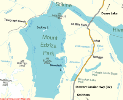 From Davenport Maps Ltd.
Upon our arrival at the rustic Tatogga Lodge we inquired about a drop-off at Buckley Lake with Alpine Lakes Air. We’d had to cancel our original booking. August being a busy time for fly-ins (hikers, hunters, fishermen), we jumped at the chance to fly out later in the day. We spent the rest of the afternoon organizing our gear (I wanted to keep down the weight as much as was safely possible), emailing family (we only had a personal locator beacon for emergencies, not the SPOT messenger beacon that allows for communication) and supping at the resort. Unfortunately the gourmet meals I’d so been looking forward to from our previous visit were a thing of the past. Tina was now in Smithers, and her husband, John, and son were running the show.
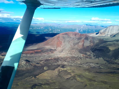
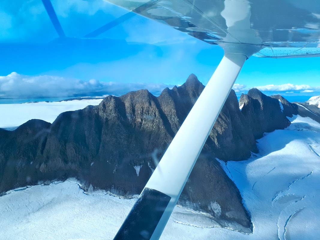
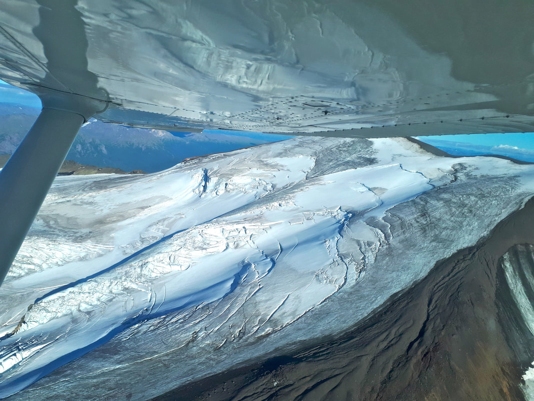
It was a lovely blue-sky evening for our flight. Yet, as usual, I was anxious during take-off, as we skimmed along the choppy lake surface, me alone in the back seat. My stomach lurched as the plane banked steeply but once we leveled off I felt spellbound. What a thrill to be airborne; to hold a bird’s eye view of the winding rivers, lime green marshes, verdant forests, aquamarine lakes and tarns and steep mountain peaks. The pilot announced we were taking the scenic route and flying over the top of Mt. Edziza, something he’d never done before and for which he needed to climb to 9000 ft! How lucky we were to view these magnificent glaciers close up!
|
|
Flying over Mt. Edziza en route to Buckley Lake
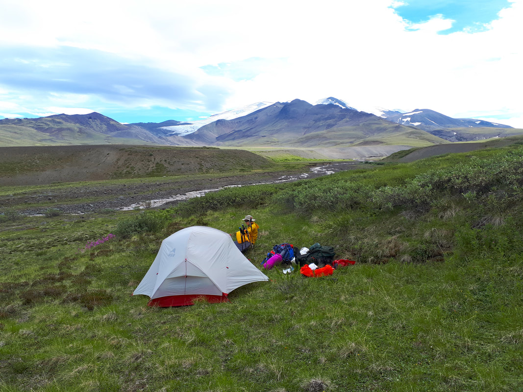
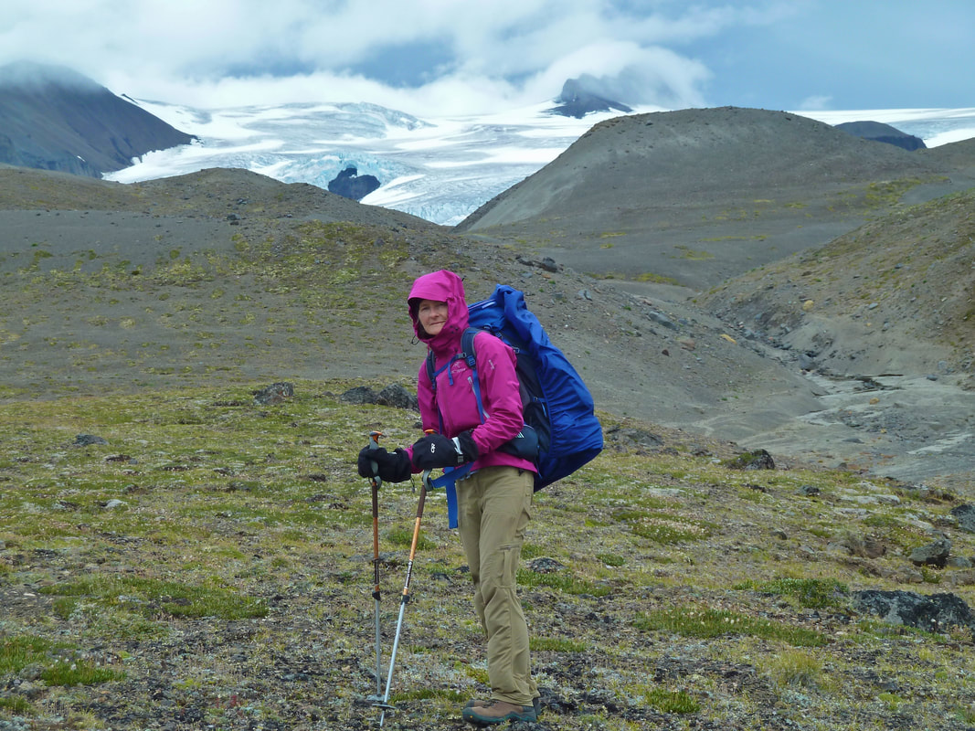
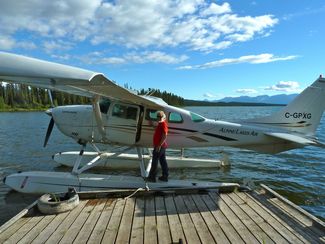 Drop-off at Buckley Lake
We also spotted smoke from the big forest fire near Telegraph Creek. Fortunately the fire was far enough from where we’d be hiking, but a change in wind direction could plague us with smoke on the trail. I hoped this would not be the case. At Buckley Lake horse camp (used by horseback hunting outfitters) we were all alone. This was it – alone in the wilderness with 75-80 km of rugged terrain ahead of us. I was filled with euphoria.
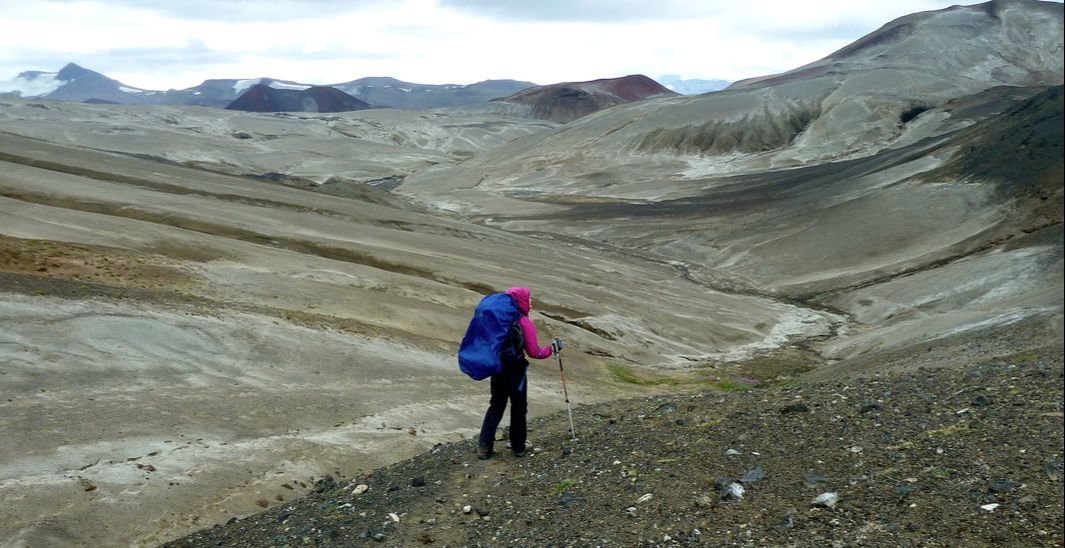
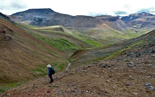
We retired early in order to get a timely start before the day heated up. As we emerged from the tent at 6 am mist was rising from the tranquil lake and a loon’s lingering call broke the silence. Mt. Edziza glowed pink on the horizon. We departed on a trail through a forest of pine and fir, richly carpeted in moss. It ran alongside Buckley Creek and had to be crossed balancing on a single log.
We retired early in order to get a timely start before the day heated up. As we emerged from the tent at 6 am mist was rising from the tranquil lake and a loon’s lingering call broke the silence. Mt. Edziza glowed pink on the horizon. We departed on a trail through a forest of pine and fir, richly carpeted in moss. It ran alongside Buckley Creek and had to be crossed balancing on a single log.
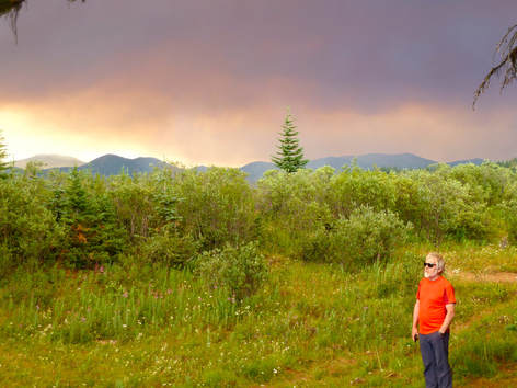
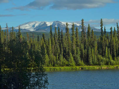 Mt. Edziza seen from Buckley Lake
The trail climbed gradually and the going was pleasant until the smell of smoke assaulted my nostrils. Panicky thoughts started to fester – how could anyone contact us if we were walking towards a forest fire – but the smell eventually abated and my thoughts turned elsewhere. The trail next moved through bog/swamp with some muddy sections. It being a very dry year, I could only imagine how tough the going would be in wetter years. We then emerged onto a plateau with Edziza visible but mostly concealed by willow, scrub birch and other early successional vegetation.
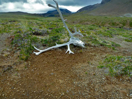
Willie Williams horse camp was attained after 8.5 km. It was strewn with moose antlers of varying sizes and degrees of weathering. Additionally, plastic containers, used batteries and other garbage lay scattered about – very upsetting! Despite it being a short day, we stuck with our plan to camp here because we couldn’t be sure how far we needed to go to reach a reliable source of water. We were only carrying enough for drinking (2.5 L between the two of us), not for cooking. We hoped this effort to cut down on the weight of our packs wouldn’t turn out to be problematic! Another group continued on past Willie Williams, but each person was carrying 6-8 L of water (14-18 lbs)! Another weight reducing (but primarily volume reducing) strategy we adopted, was to empty all but one of our freeze-dried meals into ziplocs and use the first meal pouch over and over again for all remaining meals.
Willie Williams horse camp was attained after 8.5 km. It was strewn with moose antlers of varying sizes and degrees of weathering. Additionally, plastic containers, used batteries and other garbage lay scattered about – very upsetting! Despite it being a short day, we stuck with our plan to camp here because we couldn’t be sure how far we needed to go to reach a reliable source of water. We were only carrying enough for drinking (2.5 L between the two of us), not for cooking. We hoped this effort to cut down on the weight of our packs wouldn’t turn out to be problematic! Another group continued on past Willie Williams, but each person was carrying 6-8 L of water (14-18 lbs)! Another weight reducing (but primarily volume reducing) strategy we adopted, was to empty all but one of our freeze-dried meals into ziplocs and use the first meal pouch over and over again for all remaining meals.
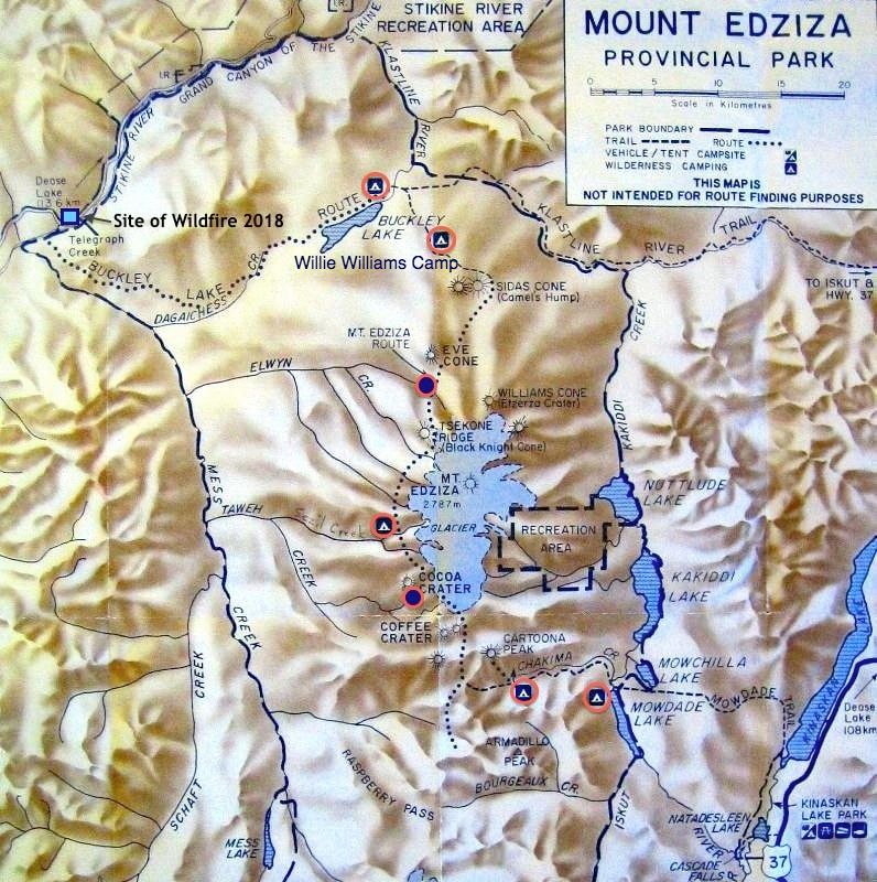
Our campsites are shown with red circles. Note the 2 sites in addition to those originally marked on the map. Also note the close proximity of Telegraph Creek, the site of the wildfire.
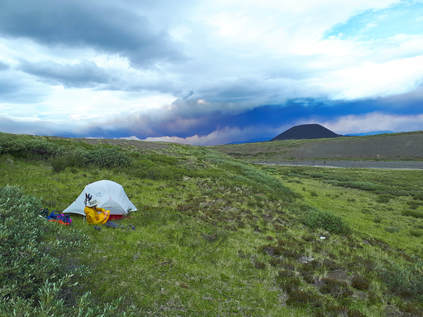
Late in the afternoon a band of orange wildfire smoke began to appear in the distance. It eventually enveloped the sun, transforming it into a big red ball, and dark purple smoke marched steadily across the sky. We could only watch and wait to see if we’d lose the sun altogether and be plunged into darkness.
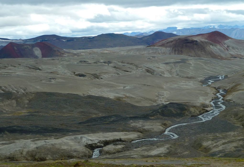
We awoke to partial cloud but were relieved to discover a smoke free horizon. The trail proceeded through a grassy plain that gave way to a field of gravel-sized lava with isolated clumps of vegetation: primary succession at work. Silas Cone, then Mt. Edziza, a lava field pouring out of its base and flanked by more symmetrical other-worldly cones, appeared in the distance.
We awoke to partial cloud but were relieved to discover a smoke free horizon. The trail proceeded through a grassy plain that gave way to a field of gravel-sized lava with isolated clumps of vegetation: primary succession at work. Silas Cone, then Mt. Edziza, a lava field pouring out of its base and flanked by more symmetrical other-worldly cones, appeared in the distance.
Silas Cone
|
Mt. Edziza
|
 Crossing Elwyn Creek
These steep cinder cones were formed by lava blown violently into the air from a single vent and broken into small particles that solidified and fell as cinder around the vent. They are apparently no more than 1300 years old and remain unaltered by erosion and devoid of vegetation. Eve Cone, massive, stunning and perfectly symmetrical came into view next. Rising 150 metres above the plateau, it was a formidable spectacle, especially as we got nearer and nearer. At this point we were walking in pumice sand and a fierce wind slammed into our chests – it was slow going and felt like we were walking in the desert. Unfortunately we were unable to locate a creek in the vicinity of Eve Cone where we’d planned to camp. We continued on another few km, traversing hummocky alpine meadow (the trail ends at Eve Cone) but still without success. We had no choice but to carry on to Elwyn Creek. We were relatively confident that it wouldn’t be dry, surmising the creek drains from Mt. Edziza’s glaciers. Nonetheless we were tremendously relieved to spot it, though chocolate brown in colour. We crossed the knee-deep creek in our neoprene socks and holey shoes, facing into the strong current. We were thankful that the neoprene socks kept our feet from losing feeling in the frigid water. Fortunately we found a tiny spring with clear, great tasting water adjacent to the creek. From this point forward, while remaining at high altitude, we no longer treated our drinking water.
Our camp was idyllic, nestled in a valley with views of Eve Cone, Edziza glaciers and Elwyn Creek. By late afternoon a menacing layer of wildfire smoke had materialized above Eve Cone producing a rather dramatic image. We’d had to contend with strong wind, but Henning’s expertise in tarp set-up allowed us to remain huddled under the tarp until 7:30 pm before the bitter cold drove us into the tent. We’d hiked 14.5 km in 5 hours on this day.
Views of Elwyn Creek and Edziza
|
View of Eve Cone
|
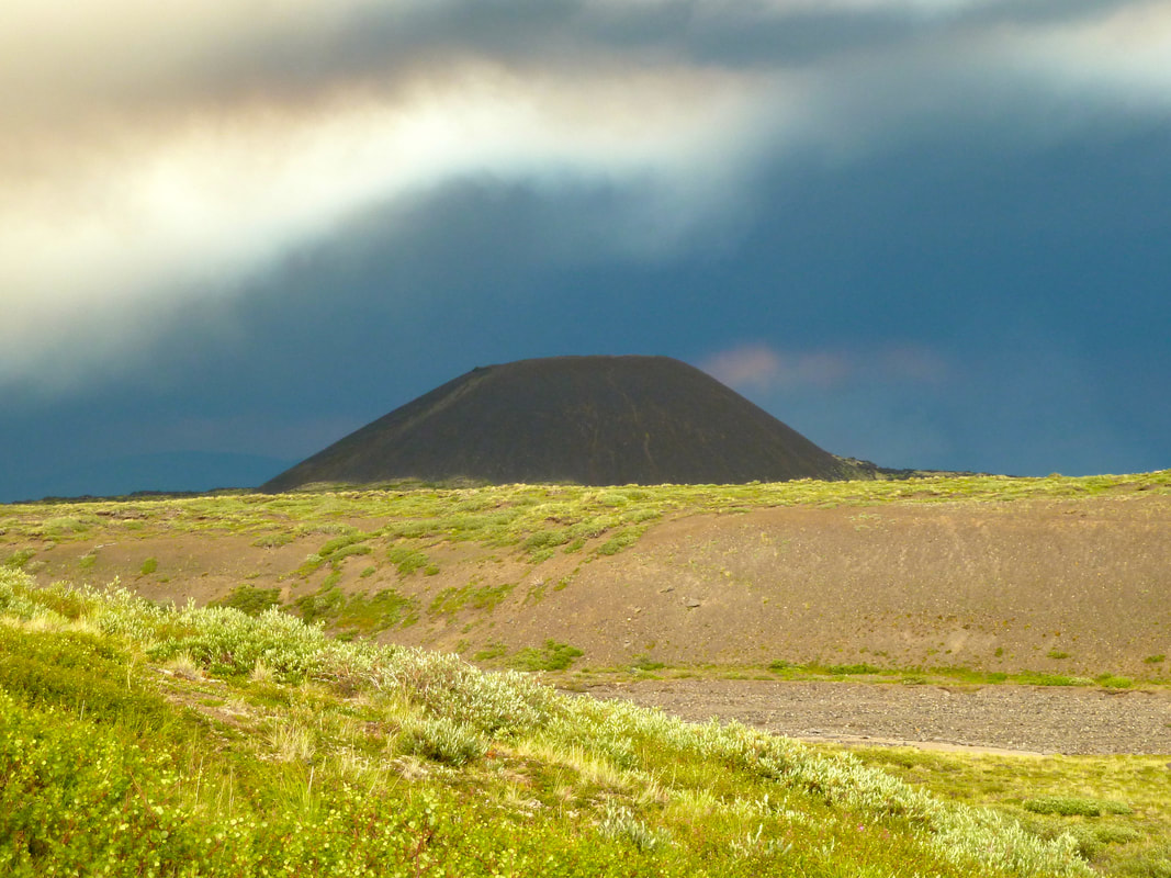
A layer of wildfire smoke appeared above Eve Cone
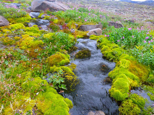
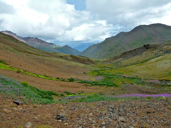
We remained in the tent for almost 12 hours, hoping rain and wind would abate, but it was not to be. Walking into the wind was initially tough, but I soon fell into a pleasant rhythm. Still, it was a relatively long and challenging day (6 hrs to go 14 km) with a lot of up and down, crossing steep sided creeks. There were at least four creek crossings, each time having to take off our hiking boots and donning the neoprene socks and holey shoes. And yet, we were rewarded with sweeping views in all directions as we navigated past the close-up, breathtaking Edziza glaciers. We camped in the vicinity of Taweh Creek, amidst little oases of lime green moss-like plants and vibrant pink, yellow and white flowers. It was the first evening that the sky was finally smoke free.
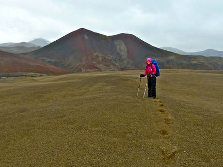
Peak of Edziza behind me
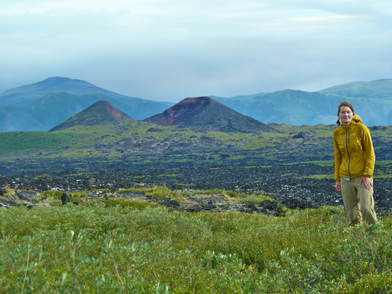
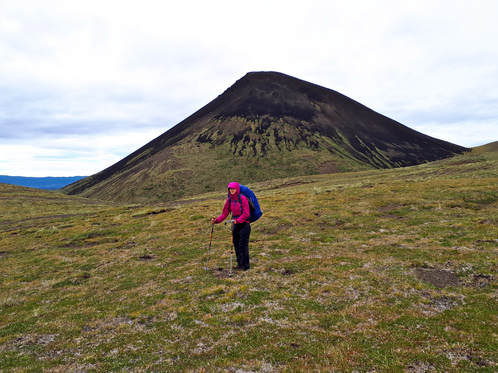 Black Knight Cone
Day 4 we awoke to light rain and an even lower ceiling. My first instinct was to stay in camp and hold out for better weather for crossing the upcoming high pass. But Henning quickly pointed out that the weather could deteriorate even further. OK, we needed to go! In the absence of a trail, cairns marked the way, but they were often so far apart that it was a challenge to locate them without binoculars. Yes, we’d left the binoculars behind to reduce the weight of our packs. Shortly after setting out we had to cross a fast moving creek. Reluctant to change into our creek fording socks/shoes so soon, Henning found his way across by jumping from slippery rock to rock. After encouragement I too made it across without mishap. Yet, the next creek, Taweh Creek, was considerably wider and faster, especially where a cairn indicated the safest crossing. After careful assessment we concluded it couldn’t be ‘jumped’, though a group of youngsters behind us did find a way.
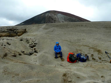
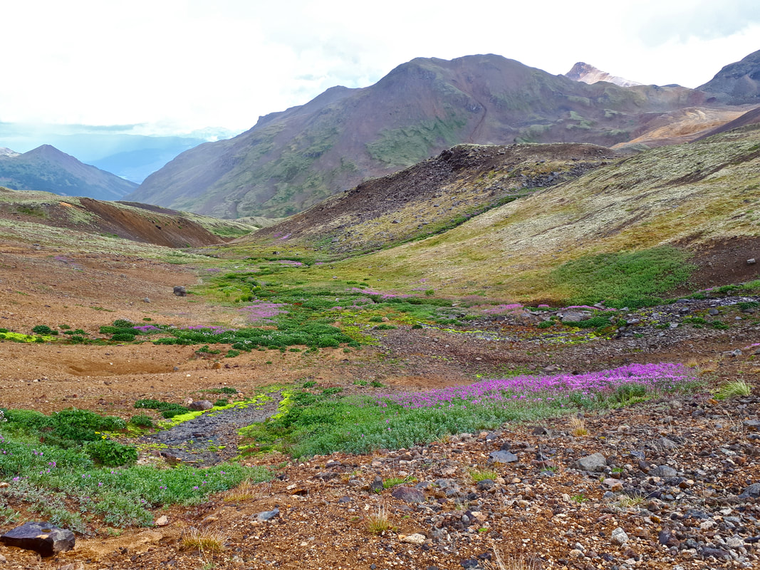
It was lovely walking in grassy alpine. Wildflowers bordering cascading creeks provided splashes of magenta, pink, purple and yellow. The climb to the pass was steep and culminated in a ‘desert’ of dunes formed from white, pink and black pumice rock that had eroded over time into sand-like grains. The aptly named Cocoa Crater loomed mysteriously before us. Unfortunately, a cold and harsh wind renewed its vigour. I was glad to be wearing my rain pants, wool hat and hood and warm gloves. We dropped down into the base of a dune to escape the wind and grab some lunch. It was not surprising that the group of youngsters had also found this natural shelter. After lunch a driving rain began in earnest, pelting our faces.
It was lovely walking in grassy alpine. Wildflowers bordering cascading creeks provided splashes of magenta, pink, purple and yellow. The climb to the pass was steep and culminated in a ‘desert’ of dunes formed from white, pink and black pumice rock that had eroded over time into sand-like grains. The aptly named Cocoa Crater loomed mysteriously before us. Unfortunately, a cold and harsh wind renewed its vigour. I was glad to be wearing my rain pants, wool hat and hood and warm gloves. We dropped down into the base of a dune to escape the wind and grab some lunch. It was not surprising that the group of youngsters had also found this natural shelter. After lunch a driving rain began in earnest, pelting our faces.
 Cocoa Crater Cocoa Crater
|
Lunch spot, escaping wind and rain
|
We pushed on until we stood at the top of a basin 100 m below us surrounded by spectacular volcanic cones and peaks as far as the eye could see. We descended into the basin along a narrow path and were delighted that the wind was diminished and the rain had stopped. Furthermore, a tiny creek (just a trickle really) ran through the centre of the basin. Unsure of where we’d next find water and shelter from the wind, and both a little low on energy, we set up camp in the basin at an elevation of approximately 1800m. We’d hiked only 10 km.
After teatime we hiked up a nearby slope where we were rewarded with an expansive landscape featuring rust-coloured Coffee Crater and a myriad of other volcanic peaks. We continued to a ridge where we glimpsed yet another of Edziza’s glaciers. We descended slalom-ing the soft hills of pumice! Back at camp the clouds began to break up and patches of blue sky appeared. The sun even broke through for a fleeting moment to bathe our basin in sunlight. We were hopeful that a change in the weather was on its way.
After teatime we hiked up a nearby slope where we were rewarded with an expansive landscape featuring rust-coloured Coffee Crater and a myriad of other volcanic peaks. We continued to a ridge where we glimpsed yet another of Edziza’s glaciers. We descended slalom-ing the soft hills of pumice! Back at camp the clouds began to break up and patches of blue sky appeared. The sun even broke through for a fleeting moment to bathe our basin in sunlight. We were hopeful that a change in the weather was on its way.
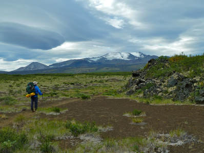
Descending into a basin 100 m below us. Coffee Crater is the reddish cone on the far left.
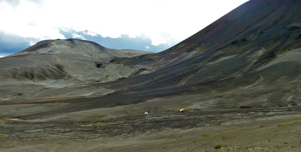
Camping in the basin: tent on left, tarp on right
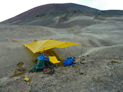
Terrifying gusts of wind materialized just after we settled into the tent. All my senses were heightened, listening to the wailing wind and fearing that any minute I would hear the tent poles snap and tent fabric rip. Pumice sand pelted the outside of the tent and blew through the tent mesh, sending me burying my head in my sleeping bag. After what seemed like a long time, Henning voiced for us to move the tent. He went out first scouting an alternative location. Then at 1:00 am with our headlamps on, during lulls in the wind, a little at a time, we carried the tent up a sand bank and positioned it in a sand gulley. At first it appeared sheltered, but soon too sand whipped against and into the tent. I was anxious that the sides of the gulley would cave in and bury us alive! I forced myself to focus on my breathing and managed to reduce my anxiety, but still sleep would not come. At first light, wind still howling, we plotted our escape. Somehow we managed to take down the tent without it blowing away. Breakfast was an energy bar on the go. I didn’t even attempt to put in my contact lenses. The plan was to keep moving until the bitter wind was a thing of the past. Unfortunately we hadn’t gone far before we had to cross another creek.
|
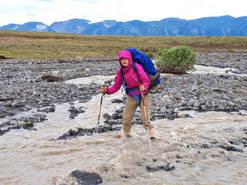
Creek we had to cross in the pouring rain after a sleepless night
|
 Ancient remnants of Tencho Glacier
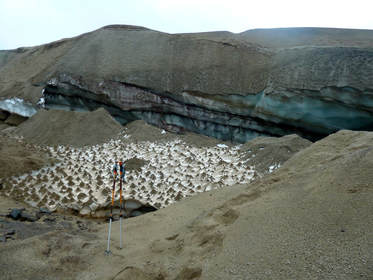
And by this time it had started to rain! So much for a positive change in the weather. It was a miserable affair changing into our creek fording socks/shoes with wet sand getting on everything. We pushed on in the hammering rain, climbing to another plateau of pumice sand. At one point we had to walk over the ancient remnants of Tencho Glacier. I hurried across uneasily fearing that the ice cave could collapse. Footprints were somewhat reassuring indicating that others had traveled this route. We encountered a few more creek crossings but were fortunate to be able to ‘jump’ these.
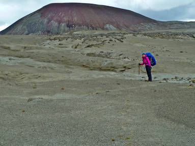
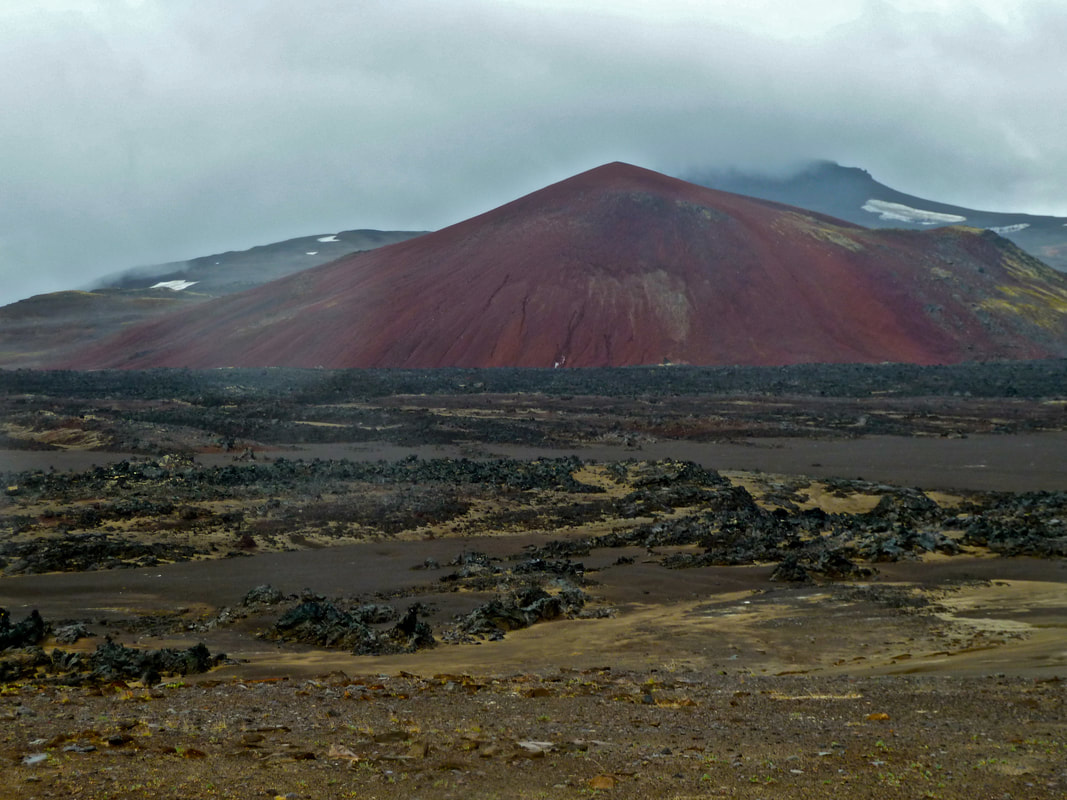
 Coffee Crater
The cairns directed us past stunning Coffee Crater and through fields of bizarre black and pink lava forms punctuated with more impressive volcanic cones. (The cairns were particularly difficult to locate in the lava fields causing us to spend a lot of time finding our way.) It was a surreal and vast landscape, but our heads were mostly down. We just kept moving, one foot in front of the other, sometimes climbing sometimes descending then climbing again, enduring the cold wind and rain.
After several hours, at the base of yet another steep climb, lack of sleep and fuel took their toll. I had to rest. We huddled together for warmth under the tarp Henning draped over us and our packs. We couldn’t rest long before the cold gnawed at our bones and we started moving again. Finally, we both agreed that we were running on empty. We had no choice but to stop on a flat exposed plateau for a quick bite to eat. It was difficult to access lunch from our packs without drenching everything in the pack. Our sleeping bags were safely stored in dry bags, but we hadn’t anticipated needing to pack clothing in dry bags since we had waterproof pack covers. Again we huddled under the tarp in an effort to keep out wind and rain. By this time my gloves were wet and my hands freezing. For the first time a sliver of fear crept into my thoughts. How far was it to the horse camp? (We were convinced we’d find shelter from the elements among the trees.) And would we make it there? I dismissed these thoughts and we pushed on doggedly, head down and resolute.
Fields of bizarre black lava forms and impressive volcanic cones. Note the rain spots on the camera lens indicative of the never-ending downpour.
We came to stand above a lush valley with meadows of wildflowers surrounded by remarkable orange and red-brown peaks. And yet, our wretchedness scarcely allowed us to take it all in. Down into the valley we descended, across the valley and to Chakima Pass. Our ascent of the pass was painstakingly slow. I placed one foot in front of the other, and used my poles to gain purchase and help pull me up the steep grade. At the top of the pass a substantial gust of wind almost blew me over! Upon our descent into the next valley (dominated by sub-alpine fir and wildflower meadows) Henning told me we still had 4 km to go. By now I was moving under sheer willpower. My shoulders ached, my piriformis muscles ached and my hips ached from where the waist belt dug in. The trail was extremely muddy and slippery, but we trudged straight through the muck.
When we finally arrived at the horse camp it was a shit hole, literally – piles of horse manure lay everywhere, as well as plastic bottles and other trash. But there was a massive tarp and a table and bench to get out of the rain. And there was no wind! We’d been on the move for 8.5 hours and covered 20 km. Supper was our first priority, followed by warming up and resting in the tent. What a wondrous thing it is to lie warm and dry in your sleeping bag listening to the rain pounding on the tent. I did not relish putting my wet pants, socks and shoes back on to emerge from the tent for tea and chocolate, but it had been too early to retire for the night.
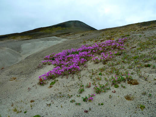
Miraculously, we awoke to a cloudless sky and orange peaks bathed in sunlight. With only about 12 km remaining to Mowdade Lake, we had an extra day before pick-up. We chose to spend it hiking back up the valley without heavy packs and sleep deprivation to better appreciate our surroundings. Although fog followed us up the valley and cloud materialized, sunny skies persisted all day. We had a relatively tranquil day, feasting our eyes on the meadows of vibrant pink and yellow flowers and bands of pea green low lying shrubs.
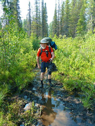 Neoprene socks and holey shoes the final kms to Mowdade L.
The final morning the ground vegetation was beautifully laced with frost. The tent fly was also covered in frost, but a leisure morning allowed for drying it (and the tent) out. A faint smell of smoke was in the air, and by the time we departed camp smoke was visibly moving up the valley and the sky was increasingly becoming hazy. It was a day of varied terrain as we followed Chakima Creek down the valley. Some up and down with views of the creek and orange peaks; some pleasant walking along alder, poplar and willow flats; some trudging through marsh/bog; some trails among enchanting forest covered in luxurious growth of moss and toadstools that you might expect to see fairies resting on.
About 4 km from the horse camp, I fell face forward after stepping on a slippery rock during a creek crossing. I grazed my forehead on a boulder and badly scraped up one knee and the shin of the other leg. I was really shaken up and afraid of not being able to continue on to Mowdade Lake. However, after bandaging my forehead, Henning didn’t allow me to linger long, getting me back up on my feet and walking. The BC Parks route description warns of three creek crossings that can be difficult in high water. Having been a dry summer (and low snow pack), we only encountered one crossing in which the water came to our thighs. Furthermore, the water was slow moving. The final kilometers to Mowdade were fraught with low lying areas filled with running water from the many branches of the braided Chakima Creek and with beaver dams/ponds. Once more our holey shoes and neoprene socks came in handy. Some sections were extremely slippery and muddy and we sank in almost to our knees. Again, I wonder what things would have been like if it hadn’t been such a dry year.
We were elated to arrive at Mowdade Lake some 12 km after leaving the horse camp. We washed in the lake and watched uneasily as wildfire smoke began to descend into the valley. Fortunately visibility was much improved in the morning. Mist rose from the still lake where two pairs of trumpeter swans broke the silence honking stridently. We walked the tent down to the small gravel beach to dry out, hung our wet socks and pants and lounged in the morning sun, awaiting pick up. Everything had long dried by noon so we had lunch, read and snoozed, but still no float plane. Since we hadn’t had a scheduled booking, we weren’t exactly sure when we’d be picked up. We ate our emergency freeze-dried meal and pondered setting up the tent again when I heard the Cessna. We raced to get our things together and ran the trail leading to the dock.
We’d scarcely taxied out to our take off position on the lake when we came to an unexpected stop. The pilot was as surprised as we were and informed us that he was getting out to take a look while leaving the engine running! He told me to pull on a specific lever if the plane started moving! We were grounded on an underwater mud bank so after the engine was turned off Henning got out too to help push us free. Our pilot flew us over the beautiful Cascade Falls, and from the air we saw smoke from the wildfires. Buckley Lake was now supposedly thick in smoke, so it seems that we were probably one of the last groups of hikers to get flown in. In fact, a group we’d met coming from the Spectrum Range en route to Buckley Lake, had been turned around by a helicopter crew that landed nearby. Good to know that despite the fact we didn’t have a device for communication, there would have been a way to get us out had we been threatened by wildfire.
Edziza Provincial Park had not disappointed once again. Although we did not enjoy the
spectacular weather of our Spectrum Range trip and were burdened by heavier loads
for the longer trek, the vast alpine plateaus and surreal landscape of bizarre volcanic
cones and lava fields and pumice ‘desert’ and dunes will be forever etched in my mind.