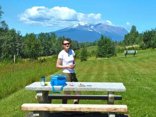
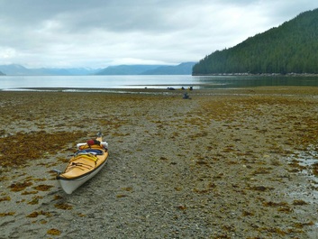
 My favourite picnic site just outside Smithers
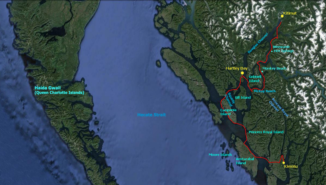
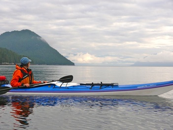
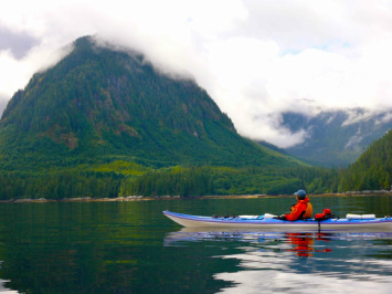
Did you know that humpback whales sound like elephants when they breathe? That sweet, coastal huckleberries are the perfect addition to pan-fried bannock? That tall, majestic, old growth cedar trees cling to the meager soil of rocky islets up and down the central and north B.C. coast? That white, tan, orange and pink sea anemones carpet large expanses of the intertidal and subtidal? These are just a few of the wonders I experienced on my recent kayak journey from Klemtu to Kitimat, paddling a total of 325 km in 16 days.
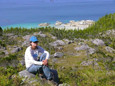
I spent my childhood in Kitimat, a small company town, where everyone had at least one parent working at Alcan (now Rio Tinto). It is surrounded by snow-capped mountains, lush rainforest and connected to the sea by Douglas Channel. Kitimat was a special place for me: my sisters and I fished the rivers with my dad (ice fishing at Kalum Lake in the winter), swam in Lake Else and the frigid ocean at Alcan Beach, hiked the surrounding trails – there wasn’t a weekend that I can remember that my family didn’t spend outdoors. It was here that I developed a deep connection with nature. My return to this region of B.C. by kayak, and as a marine biologist, granted me a very different perspective of the area, and allowed me to greater appreciate the rich and diverse terrestrial and marine life. I became enchanted by the rugged beauty of the north coast all over again, and reaffirmed for myself the importance of protecting this jewel.
July 16th, 2013 my partner, Henning, and I rose at 4:30 am to catch the 8- hour ferry from Prince Rupert to Klemtu. After packing some of our gear into our kayaks and the remainder into heavy-duty black garbage bags (great for carrying large amounts of gear on your back), we had a long walk with the kayaks (one at a time) to board the ferry. Unfortunately the M.V. Northern Expedition (new ferry that replaced the sunken Queen of the North) is not kayak friendly, lacking a trailer, nor could we afford the space kayak wheels would take up in our boats during the trip. We packed food for 21 days to allow for 5 weather/land days (days where conditions are too rough to paddle). Once seated on the ferry, the reality of the trip began to sink in. I couldn’t believe that, given a number of setbacks and complications, we were actually here! I had butterflies in my stomach, a combination of excitement and anxiety: were we ready for this big adventure?
We had driven up to Kitimat from the Sunshine Coast, and my sister, who still resides in Kitimat, drove us to Prince Rupert. The jeep would be waiting for us in Kitimat in 2-3 weeks, after paddling north from Klemtu. The 1400 km drive north is always beautiful, especially if blessed with good weather. Soon after Prince George there is an unmistakable stillness; you feel with all your senses that you have left urban life behind. The ranch lands of the Caribou give way to the lush pastures and forests of the Bulkley Valley. The Skeena River comes into view and the snow-capped Coastal Mountains reappear; a landscape that is so familiar to me. With each bend of the Skeena River I see my dad, fishing rod in hand.
Twenty-one logging trucks approached us in one hour just outside of Prince George. They were loaded with 20-30 cm diameter logs, evidence of the work of the pine beetle. Outside of Burns Lake, Smithers, Morricetown and Terrace I am heartened to have seen anti- Enbridge signs. Communities along the proposed oil pipeline recognize the grave threat to freshwater ecosystems.
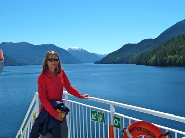 Scenic Princess Royal Channel from the ferry
The ferry took us through scenic Princess Royal Channel, lined on both sides by steep treed hills punctuated by spectacular waterfalls. There is evidence of recent clearcut logging on Princess Royal Island. I question how well the habitat of the spirit bear is being protected by the newly created Great Bear Rainforest, and how long it will be until the agreement is fully implemented. We try in vain to glimpse a spirit bear come to fish at one of the estuaries. The waters of the channel are emerald green and placid, in contrast to the turbulent and somewhat daunting waters of Wright Sound that we passed through earlier and will find ourselves paddling in about ten days time. We will not paddle through Princess Royal Channel; instead having chosen to paddle more exposed waters: Laredo Sound and Channel, Caamaño and Estevan Sounds (the outer coast of Campania Island), Otter Channel and across Squally Channel to Cridge Passage and into Wright Sound. From here our route leads up to Hartley Bay at the entrance to the Douglas Channel, then south again to the fjordlands of McKay Reach and Ursula Channel culminating in Devastation Channel and the Kitimat Arm of Douglas Channel.
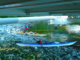 Difficult launch at Klemtu
Our launch at Klemtu was by far the most challenging I’ve experienced. In the full heat of the day (29 °C!) we had to carry kayaks and our 6 big bags of gear down a steep embankment to an uneven boulder field under the ferry dock. Somehow we managed to find relatively flat spots to load the boats, but we misjudged the time needed for loading and of the incoming tide. With our boats packed to maximum capacity, each piece has a place; each empty space, no matter how small, must get filled. Henning didn’t want to wait an hour or more for the tide to come in, so with the aid of our shortened pool noodles and logs on the beach, we half lifted, half rolled/pushed our fully loaded kayaks into the water. The pool noodles proved to be invaluable on this coast- with few sandy or gravel beaches, the noodles more than once saved the fiberglass coating on the hulls of our boats. Henning had also applied a plastic strip and duct tape to the kayak hulls to further protect them from the many rocky beaches often covered in mussel and barnacle growth.
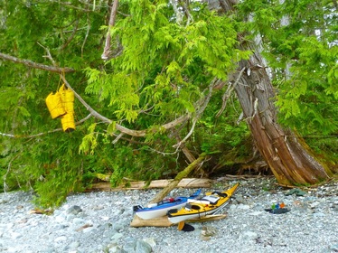 We didn't have to go far to find this branch for hanging our food
It was 5:30 pm, calm and still hot. The wet suits were packed away. Despite my exhaustion, I was elated to be on the water. We were met with strange eddies and inflow winds, but after about two hours of paddling a very picturesque gravel, clamshell beach (our campsite) came into view. We were both beat, but after a snack of dried fruit, we emptied the boats and set about to hang our food from a tree branch so that bears couldn’t get at it. Though we each had a bear proof canister (approximately 12 L) full of food, we also had 3 large, heavy dry bags full of food that needed to be hung. This task was one of our biggest daily challenges! Fortunately, the bags did get lighter over time. And so ended the first day of our epic journey.
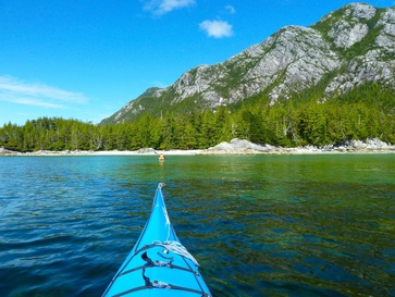
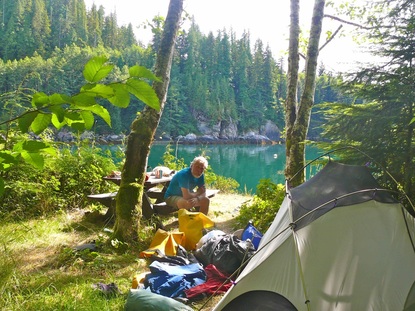
Most days we paddled an average of 10-12 nautical miles (18-22 km). We generally camped on gravel or clamshell beaches, in forest clearings or on grasses above the high tide level.
Most days we paddled an average of 10-12 nautical miles (18-22 km). We generally camped on gravel or clamshell beaches, in forest clearings or on grasses above the high tide level.
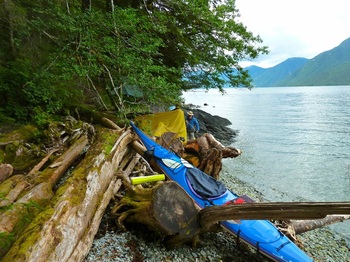 Not much room for camping on this beach
With much of the shoreline too steep to land on, and so many beaches inaccessible due to intertidal boulders and reefs, we were grateful to John Kimantas for providing GPS positions for campsites. Although relatively rough, each campsite was unique and possessed rugged beauty and charm. Few places to land on shore also meant that we had long hours in our boat, sometimes 3-4 hours before we could get out. So, no coffee or tea in the morning, and a quick exercise routine at the end of every paddle. I was adamant about regular exercise. In addition to the paddling, our daily tasks of packing and unpacking, carrying boats and hanging food, was physically demanding. I didn’t want any body parts seizing up, so far from help.
I couldn’t have foreseen an old injury rearing its ugly head. On day 11, camped in beautiful McKay Reach, more than 60 miles (100 km) away from Kitimat, my knee twisted and locked into place while I was using my foot to level gravel for our kitchen and seating area. I couldn’t put any weight on it. I screamed out and Henning came running to try to pop the knee back into place as he’s done so many times before. Not this time. I was tense.
I couldn’t have foreseen an old injury rearing its ugly head. On day 11, camped in beautiful McKay Reach, more than 60 miles (100 km) away from Kitimat, my knee twisted and locked into place while I was using my foot to level gravel for our kitchen and seating area. I couldn’t put any weight on it. I screamed out and Henning came running to try to pop the knee back into place as he’s done so many times before. Not this time. I was tense.
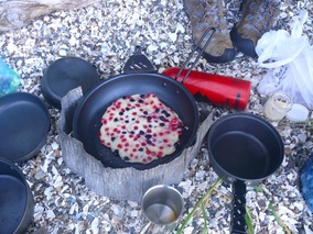 Sweet red huckleberry bannock - a real treat!
I suggested we have tea and bannock (with sweet red huckleberries I’d picked earlier). I tried to stay positive and not think of how I would make it up to the tent perched a rock scramble away in the forest clearing, or that this was the end of the trip with us having to call in the Coast Guard. Henning attempted another “fix”. Still no go. I could tell he was getting anxious, but I kept telling myself that I’d always managed before. It was several hours later that my knee finally popped back into place whilst I was seated and attempting to straighten my leg. Relief!
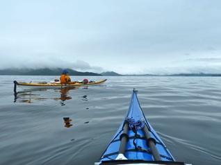
We faithfully listened to the marine weather forecast every morning, usually by 6:00 am (at 4:30 am the day of our 20 mile paddle), to allow us to get an early start and be off the water by afternoon should strong winds transpire. Fortunately for us, much of the trip we were blessed with relatively calm conditions (5-15 knot winds). Morning fog dissipated relatively quickly and did not halt our progress, even for channel crossings. We relied on both GPS and compass bearings.
We faithfully listened to the marine weather forecast every morning, usually by 6:00 am (at 4:30 am the day of our 20 mile paddle), to allow us to get an early start and be off the water by afternoon should strong winds transpire. Fortunately for us, much of the trip we were blessed with relatively calm conditions (5-15 knot winds). Morning fog dissipated relatively quickly and did not halt our progress, even for channel crossings. We relied on both GPS and compass bearings.
 The calm before the "storm" crossing Squally Channel
On day 8 we experienced some trepidation regarding the crossing of Squally Channel (the name alone should invoke caution). We’d left our pretty Cherry Islet camp in drizzle and light fog. The wind had howled during the night, but things seemed much calmer, though strong winds were forecast for Hecate Strait. (Since there is no marine forecast for the area we were in we had to surmise our own based on the Hecate Strait and the Douglas Channel forecasts.) We pulled out into Squally Channel to see scattered whitecaps. The waves were hitting us on beam (from the side); the most unstable and undesirable situation. I consulted my chart – no rest stops and a 3 mile (5.5 km) crossing. Squally Channel is known for fierce winds. And visibility was still limited. Both Henning and I agreed that conditions were marginal, and should they deteriorate we could be in trouble. We headed back but didn’t totally unpack our boats. Henning put up the tarp he’d just taken down; we got out of our wet clothes and warmed up with hot tea and the last of the pumpkin loaf. After a power nap we got out the binoculars to help us determine that the channel was less bumpy. I got into my wet, wet suit and we headed out onto the water for a second time. Miraculously, it was flat calm with improved visibility. However, not long after we’d committed to the crossing, the water became rippled. Waves began to build the further out we paddled. We were still far from land. The land behind us was already obscured in fog. I anxiously looked at Henning. We needed to keep going. With whitecaps increasing in number and height, my heart raced, fearing ever-worsening conditions. At last we were within about a mile of land. Henning, seeing the anxiety on my face, affirmed that we’d been in worse conditions and would be all right. And so it was. This day we were not to find ourselves in over our heads. However, it was a reminder to us of how quickly conditions on the water can change.
 The misery of loading kayaks on a clam bed and falling tide
It being the time of spring tides (highest and lowest tides of the year), we had to be extra vigilant about where we put the tent on the beach if no forested or grassy areas were available. The highest tides inevitably occur at 2 am when you are snug in your sleeping bag, lying awake praying that the tide won’t reach the tent or that the kayaks are safe, resting high enough on shore. The latter was the case when we lay safe in our tent in the woods on Campania Island and heard the waves of the incoming tide crashing onto shore with still two hours left until high tide. We couldn’t sleep until one of us got up to check on the boats.
Also, during the very low tides, some beaches, especially those with clam beds, have gentle slopes and extend a considerable distance, making campsite arrival and departure at low tide a misery. Even stopping for a rest break at such a beach had its toll, because the outgoing tide was fast to leave the fully loaded boats high and dry. We quickly devised a system using all four pool noodles: one of us pushed the kayak over the noodles, the other removed and repositioned the noodles in the kayak’s path.
On day 10 we arrived at the clam bed beach of Home Bay on Princess Royal Island at low tide. It was much too far to the prospective tent site to unload and carry all our gear, and the noodles did not roll, because of the many rocks covered in mussels. Solution? Henning secured a rock anchor to both boats that he dragged forward every so often to gradually float the boats further and further to shore with the incoming water. In the meantime I checked for a possible tent site. Though this was tedious and time-consuming, it was not nearly as onerous and frustrating as loading the kayaks the next morning with the falling tide. We wanted to time our departure so that we would have the current with us for paddling. Unfortunately, this meant carrying gear and kayaks in stages to the edge of the water only to find by the time all the gear was in one place, the water was already much further out. We felt that the tide was gaining the upper hand, until we found a trench with at least one foot of water where we could load the floating boats. We pulled the kayaks to open water just before they would have been beached!
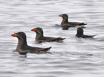 Rhinoceros Auklets
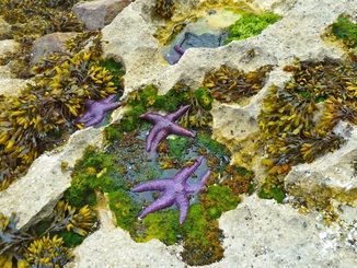
Although there was an obvious cost associated with kayaking during the spring tide, as a marine biologist, I wouldn’t have it any other way. With extreme low tides, there were many mornings I could delight in intertidal exploration, and often we paddled close to shore to view the amazing creatures of the intertidal and those below us in the subtidal.
Morning paddles were extremely meditative; the water was often glassy calm and the forest gave off its woodsy, organic aroma mixing with the smells of the ocean. The call of a loon or raven or the high-pitched screech of an eagle was common, as were the tiny Murrelets floating and diving alongside us. On occasion we marveled at the size of sea lions, the grace of porpoises and the curious faces of seals popping up. One evening a family of 6 river otters, including a baby riding high on its mother’s back, came to feed in the bay where we were camped. However, we noted that the wildlife is more easily frightened here in the north, so during the Campania Sound crossing we were particularly happy to get close enough to identify a group of seabirds as Rhinoceros Auklets. There must have been hundreds of individuals; not unusual given the nearby breeding colony of 40,000 pairs at the Moore Islands ecological reserve.
Morning paddles were extremely meditative; the water was often glassy calm and the forest gave off its woodsy, organic aroma mixing with the smells of the ocean. The call of a loon or raven or the high-pitched screech of an eagle was common, as were the tiny Murrelets floating and diving alongside us. On occasion we marveled at the size of sea lions, the grace of porpoises and the curious faces of seals popping up. One evening a family of 6 river otters, including a baby riding high on its mother’s back, came to feed in the bay where we were camped. However, we noted that the wildlife is more easily frightened here in the north, so during the Campania Sound crossing we were particularly happy to get close enough to identify a group of seabirds as Rhinoceros Auklets. There must have been hundreds of individuals; not unusual given the nearby breeding colony of 40,000 pairs at the Moore Islands ecological reserve.
After the first two days of hot weather, the next few days were overcast and cooler for paddling. We set up camp on one of the Sagar Islands on day 4 and proceeded to spend the afternoon fueling up: pan fried bannock and pumpkin loaf for teatime, a two portion freeze-dried meal for each of us and chocolate for dessert. We both felt unusually low on energy during the day’s 9.2 mile paddle. We concluded that our calorie intake had been insufficient after paddling 20 miles the previous day. This was a serious error we would not want to make again. One of the best moments after spending 7 hours in your boat is getting out of wet sandals with wrinkly feet and putting on socks and shoes! Leaving Aristazabal Island behind and re-crossing Laredo Channel, we encountered a number of fishing boats from King Pacific Lodge in Camaaño Sound. Though as kayakers we prefer to paddle in remote areas with little boat traffic, the lodge employs people in the community and contributes to ecotourism. This, unfortunately, is threatened by the inevitability of an oil spill from supertankers should the Enbridge proposal be approved.
Our Sagar Island is connected to a smaller islet at low tide, which we were eager to explore. I continue to be amazed by the tall and massive old growth cedars (500+ years old) that cling to the meager soil on these rocky islands. Lichen hangs in long strands all aglow in sunlight, and moss carpets the forest floor. My eyes feast on the many shades of vivid green. It is like something out of Emily Carr’s paintings, ergo the name Emily Carr Inlet. I can see how she was inspired. The bedrock is limestone, which is also evident in the intertidal: many bizarre shapes and sizes of tide pools have been carved from the soft stone. These pools sport mussels of gargantuan size and a colourful array of fascinating creatures.
On our 4 mile long crossing of Campania Sound the day was gray; you couldn’t tell where the sky ended and the water began. Numerous commercial fishing boats were in the Sound. We knew the salmon were plentiful because they were jumping non-stop in front of our boats, sometimes 1.5 meters into the air! As we paddled around to the outer coast of Campania Island we immediately heard the roar of surf – waves crashing over boomers (submerged rocks)- despite the calm conditions. With bigger swell and surf comes enhanced excitement, but the upside of calmer conditions is the chance to explore closer to shore; to paddle through rock gardens, one of my favourite activities. It requires keen focus and observational skills to avoid running into rocks or misjudging the timing of a wave.
 View from Campania Island in radiant morning sun
Campania Island in the sun is nothing short of a paradise, and was undoubtedly a highlight of our trip. The afternoon we arrived on one of the beautiful white sand beaches, the sun began to peak through the clouds turning the water aquamarine and setting Mount Pender aglow in the evening light. Unfortunately evening also brought a scourge of black flies, probably made worse by the lack of a breeze. The next morning we awoke to the sun once again breaking through cloud cover and illuminating small islets on the horizon. There were fresh wolf tracks in the sand. We’d slept in until 7:00 am (this was a planned land day to explore the area). It was low tide and the perfect time to go into the intertidal before breakfast. Gumboot chitons, sunflower seastars, giant mussels, poppy-red sponges and layers of kelp (primarily Costaria and Alaria) draped over boulders, were just a few of the fascinating organisms radiant in the morning light and making up this rich fabric of life.
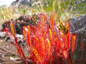 Sundew plants on Campania Island
After breakfast we bush-wacked through the forest only about 10 minutes before emerging into a bog with stunted, bonsai-like trees. Suddenly out of the corner of my eye I glimpsed clusters of tiny bright red, sparkling plants. On closer inspection, although only having seen them in pictures before, I declared them to be the carnivorous sundew plant. They were everywhere. We proceeded to climb up Mount Pender a short way for a spectacular view of the surroundings. By now it was bright sunshine and after lunch we paddled to a neighbouring beach to restock our dwindling freshwater supply at the creek. We walked up the creek a ways to make sure the water wasn’t brackish and, though the water was probably safe to drink, we filtered it. Despite the breeze, I took this opportunity to swim in the ocean. Ice cold, but the creek bed, bathtub deep, filled with the incoming tide and warmed to a very comfortable temperature. A small pool higher up served for rinsing off the saltwater and washing. What a refreshing and delightful feeling!
 Bog with stunted bonsai-like trees on Campania
As evening approached, Henning went fishing and I relaxed in the shade with my writing. Waves gently lapped onto shore, the only sound breaking the silence. The ocean wasn’t just blue: turquoise in the shallows gave over to emerald; further out dark blue changed into icy blue. I felt blissfully happy, and not for the first or the last time. I love being outdoors all day long, and I love the simplicity of outdoor life – of the focus on basic needs (hunger, warmth, staying dry and healthy), and the luxury for captivation by the beauty of nature.
Henning is not a fisherman. He doesn’t even have a fishing rod. He crafted himself a rod from a stick, and fully expected to come back empty-handed. However, within 15 minutes he was back with a rockfish of some sort, which we fried in butter with onions and salt and pepper. Yum! What a superb day!
Henning is not a fisherman. He doesn’t even have a fishing rod. He crafted himself a rod from a stick, and fully expected to come back empty-handed. However, within 15 minutes he was back with a rockfish of some sort, which we fried in butter with onions and salt and pepper. Yum! What a superb day!
On July 22 (day 7) the sun graced us for one more exquisite morning as we departed from our Campania camp. Paddling close to small islets, we drifted over expansive red sea urchin barrens. It dawned on me that we hadn’t seen any sea otters. Having been hunted to extinction on the B.C. coast, sea otters were reintroduced to northern Vancouver Island in the early 1970s and still remain on the endangered species list. Without any sea otters to keep red urchins in check, this spiny critter has been free to decimate kelp forests and create these massive urchin barrens we were observing. Kelp forests play a critical role as refuges for juvenile fish and many invertebrates. At one point we also spotted millions of tiny silver fish (2-5 cm long), schooling in the illuminated water column, prompting me to muse not once, but on other occasions as well, about the interconnectivity of life. Each link in the food chain is significant; for example, marine birds, larger fish and perhaps sea mammals including some whales may all represent links to these lower level, anchovy-like fish which, in turn, depend on high productivity of plankton.
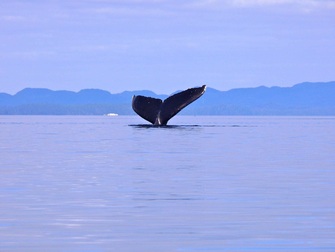
The sea in Estevan Sound was flat calm that morning. We had settled into a paddling rhythm, set for a 15 mile day, when both Henning and I heard what we deemed to be the sound of a whale breathing. We scanned the horizon when all of a sudden the huge black back of a humpback broke the surface of the water directly in front of us. I yelled and oohed and aahed as the massive fluke (tail) followed. We drifted for at least 10 minutes, eyes glued to the approaching creature which came within 20 m of us. Each time I see a whale I feel as if it’s the first time I am witnessing such an incredible spectacle. I am always left with a sense of awe and wonder. Later in the afternoon, whilst crossing Otter Channel into a southwest head wind, we stopped briefly to marvel at two more humpback whales. It was not long after setting up camp at Cherry Islet that the wind started to blow more fiercely, the sun disappeared and a light rainfall brought out the tarp.
After settling in for the night, from within our tent we heard strange elephant-like screeches. Whales? They sounded like they were right outside our tent! After a few minutes I couldn’t stand it any longer. I got dressed and clambered over rocks and logs to get a view over Squally Channel. Daylight was already fading. I looked far and wide, but couldn’t see any blow. Part way through the night we heard the strange breathing sounds again. Imagine being kept awake by whales spouting! While packing up in the rain in the morning we heard the whales again. This time we stopped what we were doing and ran across boulders to climb up to the headland for a better view. There they were! Three humungous, black shining bodies, coming ever closer, porpoising, fins in the air, giant flukes displayed. I was ecstatic and couldn’t stop uttering “Oh my God! Oh my God!” as they steadily moved past us in synchrony, less than 20 m away. A small porpoise was buzzing around in front of the whales, perhaps trying to grab an easy meal. Humpback whales can reach 15-16 m (50 ft.) in length, with the fluke measuring 1/3 of the body length, and weigh about 36,000 kg (79,000 lb.). Although this particular whale sighting was undoubtedly another of our highlights, we were still to see more humpback whales; two during the crossing of Squally Channel to Fin Island, several from our campsite at Curlew Bay and again whilst crossing Lewis Channel. I was astounded at the sheer numbers of humpbacks we’d seen (20-25 individuals), given their species at risk status in the North Pacific. I couldn’t help thinking of the devastating impact of the proposed Enbridge Project and the imminent LNG tanker traffic on the whale populations in this region. Hermann Meuter, cofounder of Cetacea Lab, a whale research station at the southern end of Gill Island where Whale Channel and Squally Channel meet, reported 185 resident humpbacks in 2010, up from 20-30 in 2002.
Our Curlew Bay camp was located on a clamshell beach on Fin Island connected to an islet by a shell bar. This afforded us great views onto two bays, one on either side of the clamshell bar. On July 24th we had a leisure morning with an estimated departure time of 11:00 am to time the Stewart Narrows for slack tide. As we drank our tea, whales surrounded us, though none actually entered the shallow bays. I wandered down to the intertidal to photograph sea cucumbers and green urchins when I heard a thunderous bang. Looking up I saw in the distance a vertical humpback, at least half of its body length up in the air. Wow! In the morning stillness the sound of the splash upon impact carried a long way. What a treat to observe this breaching behaviour. All baleen whales are known to breach and suggested reasons include social behaviour, to stun prey and to dislodge parasites from the skin.
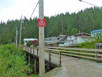 Boardwalk in Hartley Bay
We crossed Wright Sound under cloud cover and calm seas. What a transformation from just over a week ago when we passed here by ferry. Hartley Bay, an isolated community of about 180, lies at the northern extension of Wright Sound and the terminus of Douglas Channel. This is the only community we encountered on the trip, and we took full advantage of the hospitality of Claire Hill and his B & B. Salmon featured prominently in our meals, as it does for the residents of Hartley Bay. The community is unique in that boardwalks take the place of streets and ATVs and golf cars take the place of cars. Even the police car is an ATV!
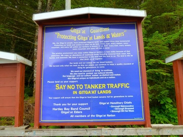
It isn’t hard to tell that these people of the Gitga’at Nation are vehemently opposed to oil tanker traffic on the B.C. Coast. There are No Tankers signs posted everywhere. Clearly, First Nations peoples dependent on the sea for their livelihood, have much to lose.
It isn’t hard to tell that these people of the Gitga’at Nation are vehemently opposed to oil tanker traffic on the B.C. Coast. There are No Tankers signs posted everywhere. Clearly, First Nations peoples dependent on the sea for their livelihood, have much to lose.
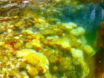
As we left Hartley Bay a day later, and I turned to look up Douglas Channel towards Kitimat, I envisioned giant super tankers speeding towards me. And I thought of the sinking of the Queen of the North, not far from here. In the vicinity, along the shore of Gribbell Island, a 5-6m intertidal zone boasted an incredibly rich flora and fauna that I could never have imagined. A wall-to-wall carpet of white, brown, red and pink anemones lay submerged in the clear water just below us. I could spend hours in my kayak, head down, mesmerized by the colours and shapes and graceful movements (e.g. of jellyfish and seaweeds) of the abundant and diverse sea life. What if oil were to spill in these waters and spread a thick coat over everything? In my head I heard the words of Art Sterritt, Director of Coastal First Nations, “We can’t allow this to happen…” in reference to an oil tanker spill wiping out all salmon, all ground fish and all the cultures of Coastal First Nations.
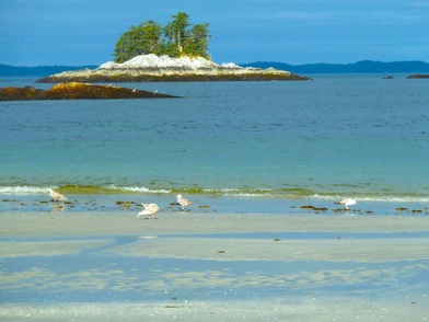
Looking up Douglas Channel
|
Wall-to-wall carpet of anemones
|
 Spectacular fjords of McKay Reach shrouded in fog
From Hartley Bay our journey took us south again, to the scenic fjords of McKay Reach. We paddled between steep forested mountains of Gribbell Island, home to the largest spirit bear population, on one side and steep forested mountains of Princess Royal Island on the other. As we headed north up Ursula and Devastation Channels, the sun and blue sky reappeared, showcasing mountains reflected in placid waters as smooth as a mirror. Here we battled the merciless horseflies, but also sighted a pod of killer whales moving down Verney Passage. In Ursula Channel we camped at idyllic Monkey Beach, the setting of Eden Robinson’s novel of the same name, not far from a Haisla cabin bearing signatures with the Robinson name. Interestingly, the Haisla have built an extensive network of basic cabins throughout their traditional territory that are available for public use. To our dismay a powerboat from Kitimat, blaring loud music, anchored in the bay that evening. It was a Saturday night. This was a reminder of our close proximity to Kitimat and, sadly, that our journey was fast coming to an end.
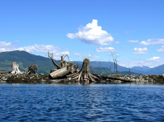 Greying stumps signal old growth forests of the past
I was keenly aware of a change in the forest – alder trees and devil’s club and blueberries making up a dense understory beneath fir and hemlock where red huckleberries and cedar had dominated further to the south. This vegetation is familiar to me from my childhood. As are the large, old growth cedar stumps greying as they lie on their sides and litter many of the beaches. The scene makes me think of a graveyard; a reminder of the demise of the old growth forest. As we get closer and closer to Kitimat, we see more and more clear-cuts from logging on these seemingly remote hillsides. It seems that no island, no shoreline is too remote to keep the logging companies at bay. Upon departure from Eagle Bay, our last campsite before arriving in Kitimat, we heard the sound of rushing water at the entrance to the bay. When we paddled closer to investigate, hundreds of salmon swam under or collided with our kayaks. We estimated there were thousands, most of them milling about in a pool at the base of a lovely waterfall. Unfortunately, moments later we also saw the log dump, in close proximity to the waterfall, and the recent clear-cut of the hillside above.
 Emerald green waters and a picnic table at Weewanie Hot Springs
Day 14 was a long (18.9 miles) tough day. We were paddling against the current, and hadn’t counted on outflow winds, at least not already at 7:00 am. Was our luck changing? We hugged the shore of Hawkesbury Island all the way to Kitsaway Island to escape the wind, but were still only paddling at 1.6-1.8 knots per hour (3 knots is considered average paddling speed). Our progress was painfully slow. Fortunately, after lunch we had the tide with us, and negligible wind for the crossing of Devastation Channel. But this made for hot paddling conditions. When we arrived at Weewanie Hot Springs I was so overheated that I plunged into the clear, emerald green water when I got out of my boat. Refreshing, though not nearly as cold as at Campania Island. The provincial park boasted a picnic table, composting toilet and little bathhouse overlooking the bay. And there wasn’t a soul to be seen. I was elated.
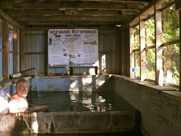 Soaking in the hot tub, with a view to the ocean
After supper, with the daytime temperature waning, we washed (outer tub), then soaked in the hot tub (inner tub) with a view onto the ocean. What bliss! In the late evening we watched the clouds acquire a deep orange hue over the water turned icy blue. I contemplated our nearness to Douglas Channel/Kitimat Arm. We were now only a day’s paddle from Kitimaat Village, Alcan Beach, Minnette Bay – all places from my childhood. The ensuing paddle to Eagle Bay was again hot and sunny, even in the late afternoon, with neither a cloud in the sky nor the slightest breeze. Views of the snow-covered peaks were phenomenal, but paddling in the heat was draining (I cooled myself by dipping my sunhat into the water and pouring it over me). We had run out of drinking water and arrived at the campsite in urgent need to rehydrate. Henning immediately set out for the waterfall with our water bags, but came back empty-handed. The waterfall was not accessible; it cascaded into a deep brackish pool. He tried the creek on the other side of the beach. It was dry. We both returned to the waterfall for another look. It was no good. I was sure the pool was over my head. Swimming to the waterfall wasn’t really an option because we would have to fill the water bags while treading water. It was going on 6:00 pm. Get into our kayaks and paddle to one of the creeks we’d passed? Look for the waterfall we’d heard at the entrance to the long bay? Or climb the steep slope adjacent to the waterfall in an effort to intercept the waterfall higher up? We were in dire straits! We finally opted for scrambling up the hillside. Remarkably, there seemed to be a hint of a trail (someone else that had run out of water?!), and, though a little scraped up by the underbrush, we were triumphant. The hillside flattened out and Henning volunteered to be the one to clamber down the rock wall of a small canyon decked in luxuriant growth of moss and ferns to access the swift moving water.
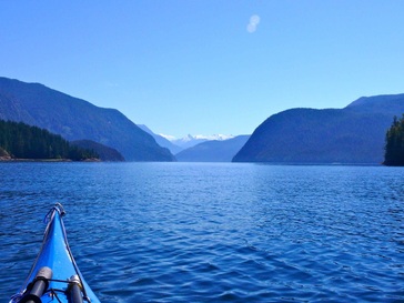 Stunning mountain views down Kildala Arm
Our final day on the water clear skies delivered stunning mountain views down Kildala Arm and Kitimat Arm. To my dismay a scar disrupted the beautiful landscape as the LNG processing plant and port construction site came into view. Judging by my chart it is located at Bish Creek where some 25 years ago I spent my summers as part of a team collecting chum salmon eggs for the Kitimat fish hatchery. I have been told there is to be a second LNG site. No to Enbridge, but LNG has the green light? Would the community of Kitimat embrace this new industry so wholeheartedly if they understood the health and environmental issues (contamination of huge amounts of ground water) of fracking? What of the noise levels of so many tankers passing daily through the channels that humpback whales are increasingly making their sanctuary in large numbers? Kitimat is an industry town, as are so many towns in the North. Understood. But might there not be a cleaner, more sustainable alternative to these polluting boom and bust industries? I’ve heard reports predict that it may already be too late for B.C to sell its fracked gas to China, given that many other countries are also engaged in fracking.
I have seen for myself the remarkable abundance of life on the central and north coasts. I have glimpsed on many occasion the interconnectedness of this web of life, and visited a First Nations community reliant on the bounty of the sea. I understand more than ever the need to stand strong to protect this coast against further unsustainable and environmentally destructive development. My kayak journey may be over, but my passion for this wild land of my childhood continues to run deep.
I have seen for myself the remarkable abundance of life on the central and north coasts. I have glimpsed on many occasion the interconnectedness of this web of life, and visited a First Nations community reliant on the bounty of the sea. I understand more than ever the need to stand strong to protect this coast against further unsustainable and environmentally destructive development. My kayak journey may be over, but my passion for this wild land of my childhood continues to run deep.
