A North Coast Paddle: Stephens and Porcher Islands
July 29 - August 8, 2019
Henning and I were at the Prince Rupert dock at 7:20 am, a full hour before the Hartley Bay ferry was to sail. It was busy — passengers were milling about with umpteen boxes of groceries and sundries — but not surprising since the ferry is the only access to the village of Hartley Bay. We were excited to embark on a 10-day kayak adventure to Campania Island to relive the beautiful scenery and wildlife encounters of a portion of our 16-day Klemtu to Kitimat paddle (see separate story and photos). But when we tried to check-in we were dumbfounded to learn that the ferry no longer takes kayaks and hasn’t done so for the last 3-4 years. Despite our countless enquiries, not one person had mentioned that kayaks are no longer permitted.
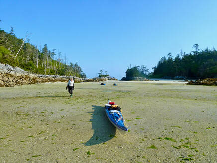
I was truly bummed. Was this the end of our long-awaited summer kayak trip? Henning, however, was not daunted and keen to come up with an alternate plan. We started talking about a trip departing from Port Edward. This hinged on the acquisition of charts, but more importantly we needed John Kimantas’ kayak book for the Northwest to locate suitable campsites. Since it was too early for much to be open, we went for coffee and tried to further strategize. We then learned that the only bookstore in town was permanently closed, there were no water taxis (to take us to Hartley Bay and proceed with our original paddle) and the information centre couldn’t be of any help. We were fast running out of options and feeling somewhat dejected when it occurred to me to check the public library — where we found John’s book! We photocopied the appropriate section, printed new tide tables and visited the marine sports store for new charts. By 1:45 pm we paddled out of Port Edward. It was a short one-hour paddle across choppy waters to Kitson Island where we landed on a sandy beach in the sun. I was elated and looking forward to this newly conceived adventure.
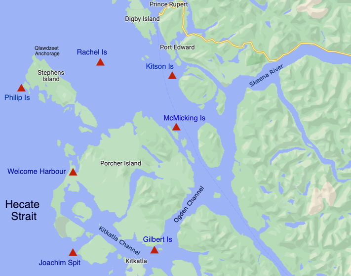
Our newly conceived paddle route from Port Edward around the northwest of Stephens Island and southern Porcher Island
and back to Port Edward. Our campsites are shown as red triangles, the first Kitson Island and the last McMicking Island.
and back to Port Edward. Our campsites are shown as red triangles, the first Kitson Island and the last McMicking Island.
Day 1
We awoke to rain. Fortunately, Henning had erected a tarp over our tent entrance and kitchen. Nonetheless, it was just 13 ℃ and it didn’t take long for me to feel the cold and damp seep into my bones. I put on my long underwear, wool hat, two fleeces, rain gear (basically all my warm clothing!), and after consuming hot tea and eggs I finally started to warm up. When Henning revealed that rain was in the forecast for today and tomorrow, I seriously questioned if I wanted to be doing this — fighting to keep warm day after day. Fortunately, the rain stopped by 11 am, so we diligently packed up and departed one and a half hours later.
We awoke to rain. Fortunately, Henning had erected a tarp over our tent entrance and kitchen. Nonetheless, it was just 13 ℃ and it didn’t take long for me to feel the cold and damp seep into my bones. I put on my long underwear, wool hat, two fleeces, rain gear (basically all my warm clothing!), and after consuming hot tea and eggs I finally started to warm up. When Henning revealed that rain was in the forecast for today and tomorrow, I seriously questioned if I wanted to be doing this — fighting to keep warm day after day. Fortunately, the rain stopped by 11 am, so we diligently packed up and departed one and a half hours later.
|
|
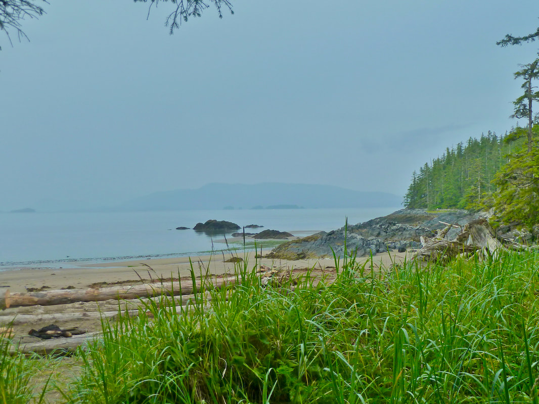
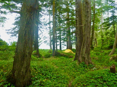
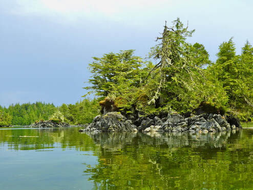
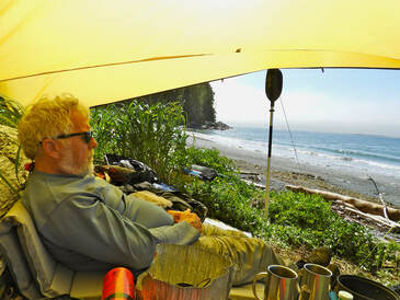
Kitson Island beach and our tent site in the forest.
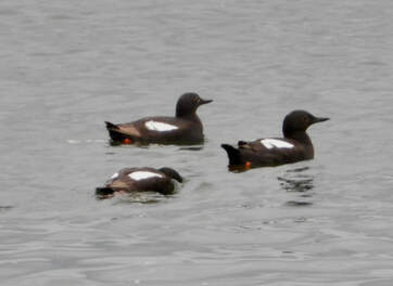 Pigeon guillemots
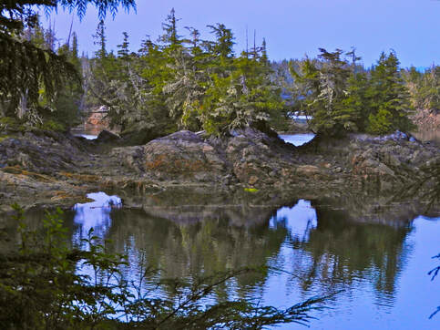
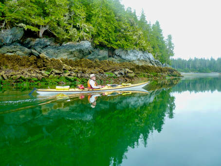
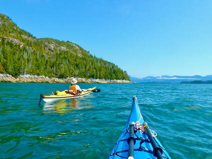
The sea was flat calm, and the sky began to lighten. I was back on my ‘high’. We encountered seals, rhinoceros auklets, loons and pigeon guillemots. A guillemot surfaced right in front of me — so close that I felt I could reach out and touch its silky brown head and neck. It was too rugged to stop at the scenic Greentop Islets one and half hours later, so we pushed on. Rachel Island still looked far away, but we settled into a steady paddling rhythm for the final two hours of the 9-mile crossing. The sky grew dark, but thankfully the rain held off until we landed on a beautiful white sand tombolo of one of the Rachel Islands.
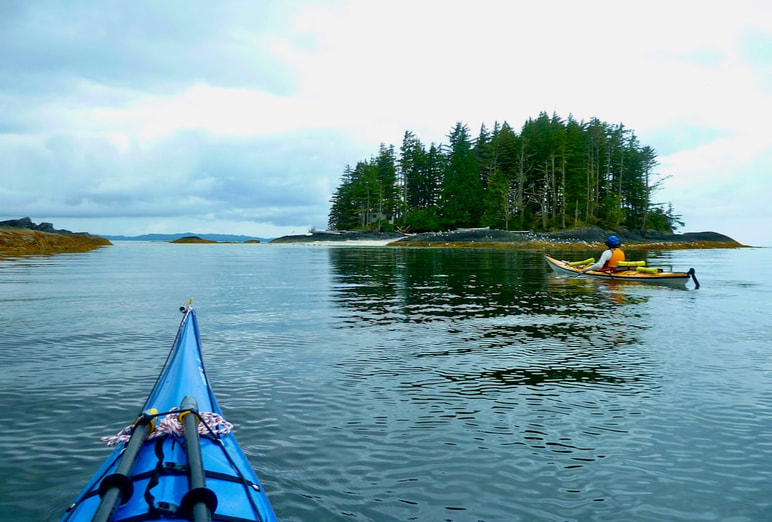
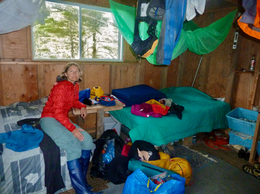
To our delight and good fortune we discovered a cabin perched on the bluff above the tombolo. The door was unlocked and a sign informed us that visitors were welcome. We spent the rest of the day warm and dry. And we listened to the rain pounding on the metal roof whilst looking out onto a field of seaweed covered rocks and distant islets silhouetted against the dense fog. Henning laboured to get the wood stove going — everything was so damp! Our wet gear hung from every available nail on the cabin beams. It was a real treat not to have to set up our wet tent in the rain or get out our cooking gear. The cabin was certainly well outfitted. We even had our own wooden bunks.
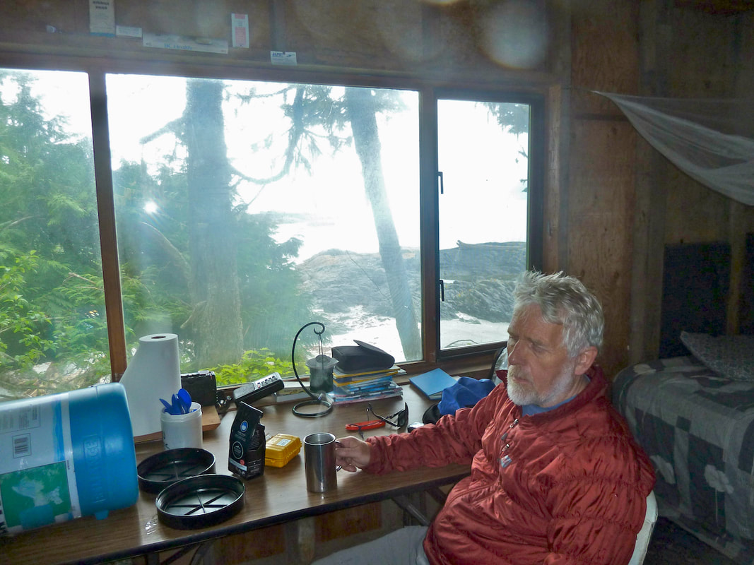
A well outfitted cabin on Rachel Island to shelter from the rain and dry our wet gear.
Day 2
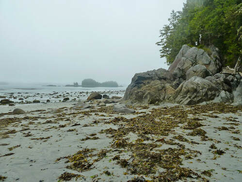
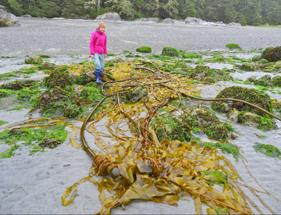
It rained steadily all night long. Not surprising that Prince Rupert is known as the rainbow capital of Canada. I emerged from the coziness of the cabin and headed out into the intertidal before breakfast. Just 20 minutes I told Henning. But that turned out to be more than an hour! A good low tide revealed red sea urchins (typically larger than the purple and green urchins and subtidal and thus not readily visible), feeding abalone (not common in the South due to over harvesting) and rich seaweed diversity. After a late breakfast, we agreed, reluctantly, to push on to Philip Island. So is the nature of sea kayaking — if the weather is favourable keep moving or risk getting storm bound.
It rained steadily all night long. Not surprising that Prince Rupert is known as the rainbow capital of Canada. I emerged from the coziness of the cabin and headed out into the intertidal before breakfast. Just 20 minutes I told Henning. But that turned out to be more than an hour! A good low tide revealed red sea urchins (typically larger than the purple and green urchins and subtidal and thus not readily visible), feeding abalone (not common in the South due to over harvesting) and rich seaweed diversity. After a late breakfast, we agreed, reluctantly, to push on to Philip Island. So is the nature of sea kayaking — if the weather is favourable keep moving or risk getting storm bound.
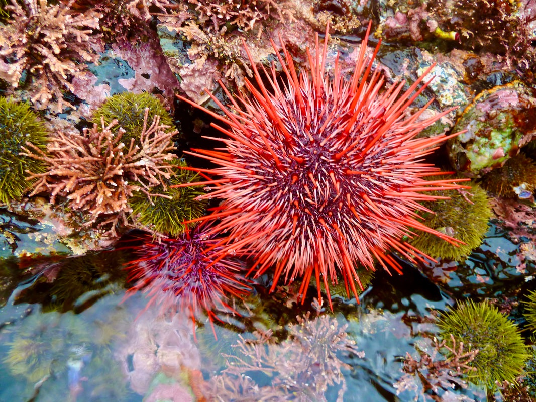
Red sea urchins visible during very low tide.
|
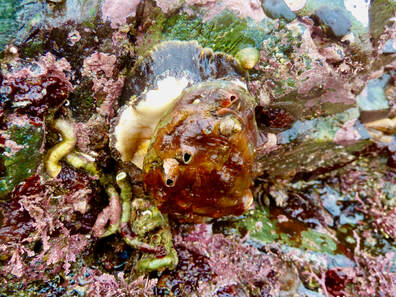
A feeding abalone. Note the fleshy 'foot' beneath the shell.
|
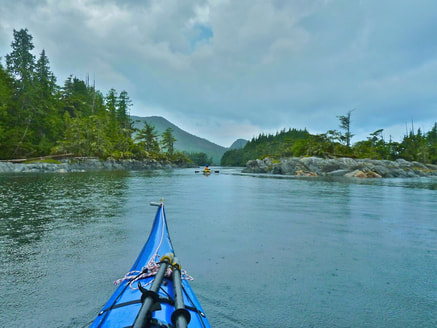 Paddling into Qlawdzeet Anchorage.
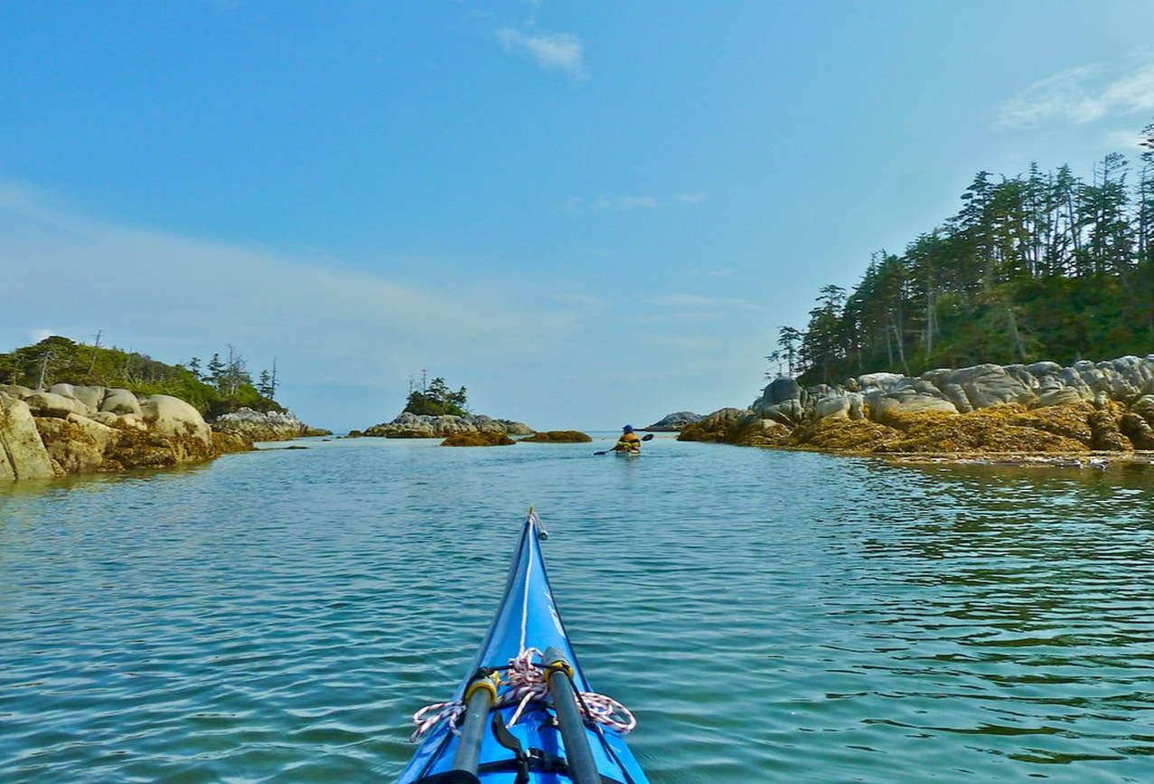
We had another long crossing — 8 miles to the Qlawdzeet Anchorage on Stephens Island. Fortunately, the rain had stopped, making packing up, as well as the crossing, more pleasant. As we paddled into the protected anchorage we were met by a serene world of rocky islets sparsely populated by gnarly trees laden with flowing old man’s beard. Large underwater rocks made navigation difficult. The boulders appeared suddenly, and I held my breath fearing that at any moment I would hear my boat scrape on rock. Large raindrops bounced off the still water, and when we stopped for lunch the rain began in earnest. I was quick to get on my wet suit (for body core warmth), rain pants, fleece and paddle jacket. As we headed out after lunch towards open water the sun peaked out from behind the fog. The sea glistened and in every direction there appeared to be clusters of islands lit up by the sun.
|
|
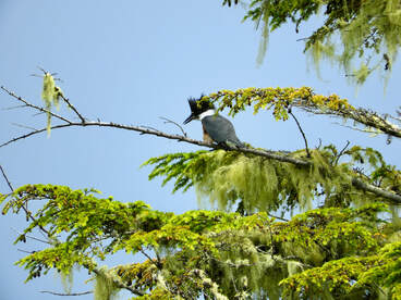
After lunch the sun peaked out from behind
the fog. A kingfisher perches on a lichen clad
tree.
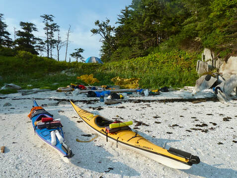
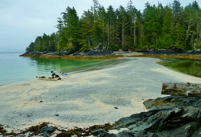
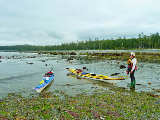
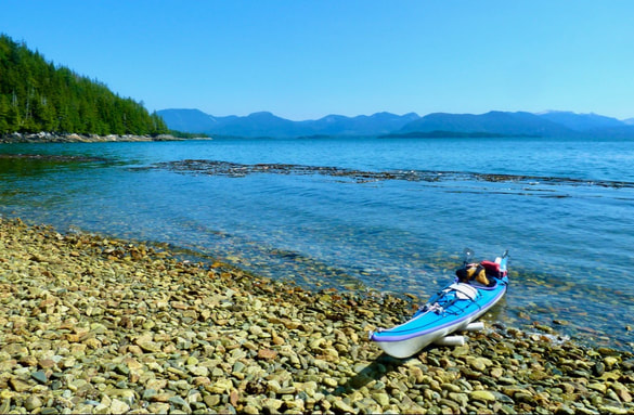
Though our GPS revealed close proximity to the campsite, it didn’t seem possible given the steep rocky shoreline of the outside northwest edge of Philip Island. But then, all of a sudden, after paddling through a narrow channel that disappears at low tide, we landed on a heavenly white sand beach which became even more extensive at low tide. By now the sky had cleared to showcase this stunning jewel in all its splendour. Although the aquamarine water beckoned, I was too tired to contemplate a swim. Our tent site was on a grassy hill above the beach with views to the ocean in both directions. We just needed to remove a few wild rose bushes with Henning’s saw.
Despite the steep shoreline of Philip Island, a white sand beach and our campsite were located nestled behind the closest rock on the left.
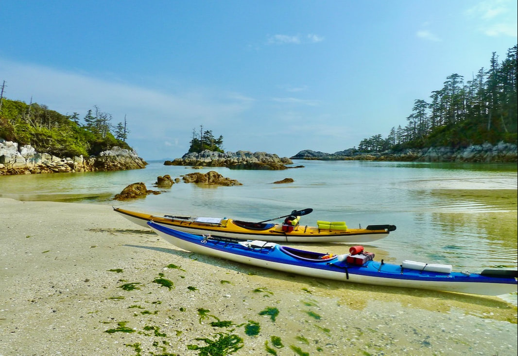
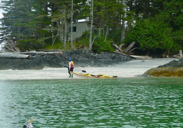
 A very low 0.1 m tide resulted in a long carry of our kayaks and gear.
Days 3 & 4
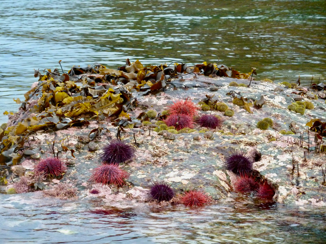
Again, we would have liked to stay another day, but 20-30 knot winds were forecast for later in the afternoon. There was also strong wind in the long range forecast. This prompted us to get up at 6:30 am. However, we didn’t manage to launch our kayaks until almost three hours later, in part due to the long carry (of our kayaks and gear) resulting from a very low tide (0.1 m). It was a spectacular blue sky morning and once on the water I felt sheer bliss. With a tidal range of 6-7 m (in contrast to the roughly 4 m tidal range of the South), there was so much to see during a low tide. A myriad of sea creatures and silken kelps clung to the rocky shores and islets we paddled past. The water sparkled in the sun, surged through channels and over boulders — yet the sea was velvety calm. This allowed us to explore the shoreline as well as observe the spouts and flukes of at least 5-6 humpback whales on the horizon. They were here, just offshore — perhaps feeding in bays of offshore islands.
Again, we would have liked to stay another day, but 20-30 knot winds were forecast for later in the afternoon. There was also strong wind in the long range forecast. This prompted us to get up at 6:30 am. However, we didn’t manage to launch our kayaks until almost three hours later, in part due to the long carry (of our kayaks and gear) resulting from a very low tide (0.1 m). It was a spectacular blue sky morning and once on the water I felt sheer bliss. With a tidal range of 6-7 m (in contrast to the roughly 4 m tidal range of the South), there was so much to see during a low tide. A myriad of sea creatures and silken kelps clung to the rocky shores and islets we paddled past. The water sparkled in the sun, surged through channels and over boulders — yet the sea was velvety calm. This allowed us to explore the shoreline as well as observe the spouts and flukes of at least 5-6 humpback whales on the horizon. They were here, just offshore — perhaps feeding in bays of offshore islands.
A cold northwest wind did develop in the afternoon, so we opted to forego the open ocean facing campsite for the shelter of Welcome Harbour. At first it didn’t look terribly appealing since it was high tide and the pebble beach was already in the shade. But we soon found the charming clearing in the forest where we could set up camp. Although I wasn’t overly warm I was determined to have a wash — Henning followed my example — that turned into a quick swim. And despite having paddled 15 miles, I made bannock with freshly picked huckleberries for our afternoon tea and coffee — yum!
We awoke to birds chirping and a serene morning glow. With strong winds in the forecast we decided to stay put.
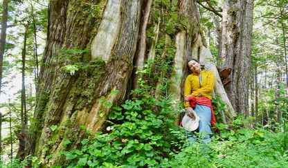
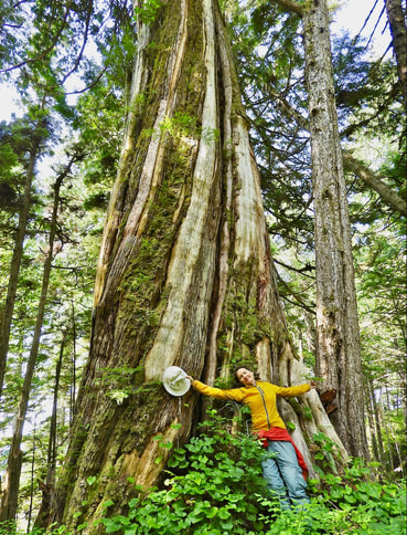
We hiked the trail across the peninsula through lovely ancient forest of giant cedar and spruce to a bay that faced the open ocean. Here we revelled in sun, wind and crashing surf. We were, however, surprised that the water offshore didn’t look particularly menacing.
|
|
Day 5
We were up at 6:15 am to avoid a long carry in mud and were on the water by 8 am. Due to the low tide, we had difficulty navigating the large number of boulders and barely found a clear path to open water. The day was cloudy and gray, the swell low with smooth undulating waves, and water surged over boulders and around islets generating a persistent roar — quintessential west coast paddling. When two porpoises surfaced off the stern of my boat I watched with wonder as they moved gracefully through the water.
After a few hours mesmerized by ocean swell, I needed to pee. We paddled close to shore, picking our way among the kelp draped boulders and rock gardens and trying to avoid unsuspecting submerged rock (boomers). At one point Henning was out in front. He’d seen the large boomer to the right, but then paddled straight into the direction I’d seen a wave break. I yelled but my warning seemed unwarranted, so I followed. But when I turned around I glimpsed a massive wave breaking right behind me. I paddled furiously, terrified the wave would launch me straight into Henning. I was reminded of our exhilarating paddles on the West coast of Vancouver Island: navigating waves breaking on reefs and rebounding from the shore and revelling in sea spray and the thrill of being propelled forward on a wave.
We passed numerous sandy beaches that were inaccessible at low tide due to the field of boulders guarding them. I was already contemplating how to pee whilst in my kayak when we spied a sandy beach on an islet. We ended up landing on a gravel/boulder bar that extended out from another islet. Seaweeds of all kinds surrounded me. It was a phycologist’s dream (a phycologist, like myself, studies algae). We paddled through Lessoniopsis beds! This kelp is commonly found in the very low intertidal and subtidal and thus I’d yet to observe it in nature, let alone from my kayak. After a late lunch we heard the barking and growling of a colony of sea lions resting on a small treeless islet. Fortunately, none ventured into the water to check us out! By the time we landed on a beach adjacent to Joachim Spit, we had paddled 15 miles.
The sun came out and I yearned for a swim, but Henning suggested we first locate a tent site. Given the 7 m high tide, camping on the upper part of the beach wasn’t an option. Also, the forest was too dense and the ground uneven. This called for some ingenuity and resourcefulness. We found a patch of ground at the edge of the forest that looked promising and began moving drift logs, cutting tree limbs and evening out the stones. I cut the metre long grasses to lay down over the stones and voila, we had a tent site above the high tide line. Now I could have my well earned swim. It had become breezy, but I followed through and was elated to feel so invigorated.
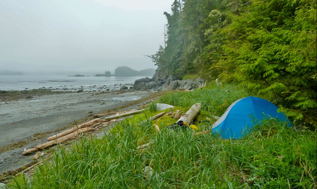
Our tent site above the high tide line at the edge of the forest near Joachim Spit.
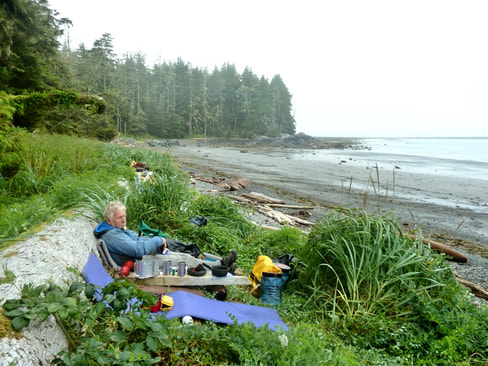 Our kitchen and lounging area near Joachim Spit.
Days 6 & 7
On day 6 we again chose not to paddle due to strong winds in the forecast. Our ‘kitchen’ and lounging area were located on the upper grassy part of the beach. We looked onto the lower seaweed strewn beach and the open ocean. The horizon was gray. You couldn’t tell where the sky ended and the sea began. Fog hung thick and heavy obscuring distant islets and islands, and it drifted in and out of nearby islets. Hypnotic waves rolled onto the beach. A pair of ravens croaked from their perch on a lichen clad tree. Earlier a deer had come bounding down the length of the beach, and not long after a lone wolf had appeared. As the morning fog slowly dissipated colour returned to our world: vivid blues and greens of the sea, yellow-brown and bright green seaweed covered rocks and the distant beaches and islets lit up golden in the sun. We pondered the fact we hadn’t seen a soul in the past week given our close proximity to Prince Rupert.
On day 6 we again chose not to paddle due to strong winds in the forecast. Our ‘kitchen’ and lounging area were located on the upper grassy part of the beach. We looked onto the lower seaweed strewn beach and the open ocean. The horizon was gray. You couldn’t tell where the sky ended and the sea began. Fog hung thick and heavy obscuring distant islets and islands, and it drifted in and out of nearby islets. Hypnotic waves rolled onto the beach. A pair of ravens croaked from their perch on a lichen clad tree. Earlier a deer had come bounding down the length of the beach, and not long after a lone wolf had appeared. As the morning fog slowly dissipated colour returned to our world: vivid blues and greens of the sea, yellow-brown and bright green seaweed covered rocks and the distant beaches and islets lit up golden in the sun. We pondered the fact we hadn’t seen a soul in the past week given our close proximity to Prince Rupert.
|
At low tide the beach was bound on either side by large boulders that were inundated with intertidal life for us to explore: clusters of giant barnacles, various anemones, chitons and snails, pink coralline algae and red, brown and green seaweeds of many shapes and sizes and textures. Later in the afternoon Henning erected a tarp to shade us from the intense sun. We watched the transformation of our beach as the incoming tide concealed the boulders on shore, the spit disappeared and waves tripled in height. A frenzy of whitecaps appeared in the distance. We were glad we didn’t have to land our kayaks now.
|
We awoke to total white-out and large droplets of moisture in the air. Fortunately, it was dry under our tarp and I kept warm wearing my long underwear. Strong winds were still in the forecast but expected to diminish to 10-15 knots the following morning. Though it appeared relatively calm in our bay, we had no way of knowing what it was like at Goschen Island or in Kitkatla Channel. We had two paddle options for the next day (provided the forecast did not change!), both of which required paddling through narrows with 4 knot currents that needed to be navigated at slack tide. For the Kitkatla option we also needed to account for tide movement (ebbing not flooding) and ensure that wind and current were not moving in opposite directions. We calculated four scenarios, the most favourable the paddle around Goschen Island after lunch during a high tide.
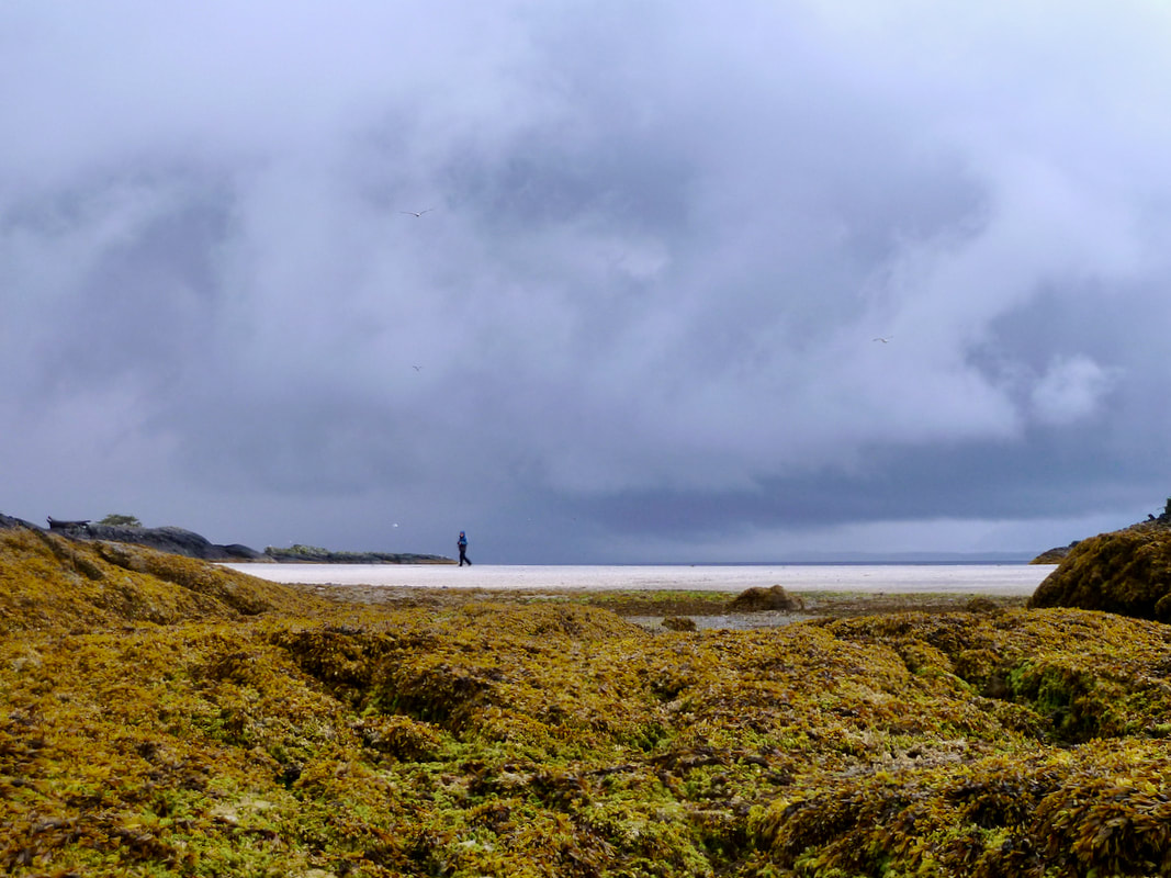
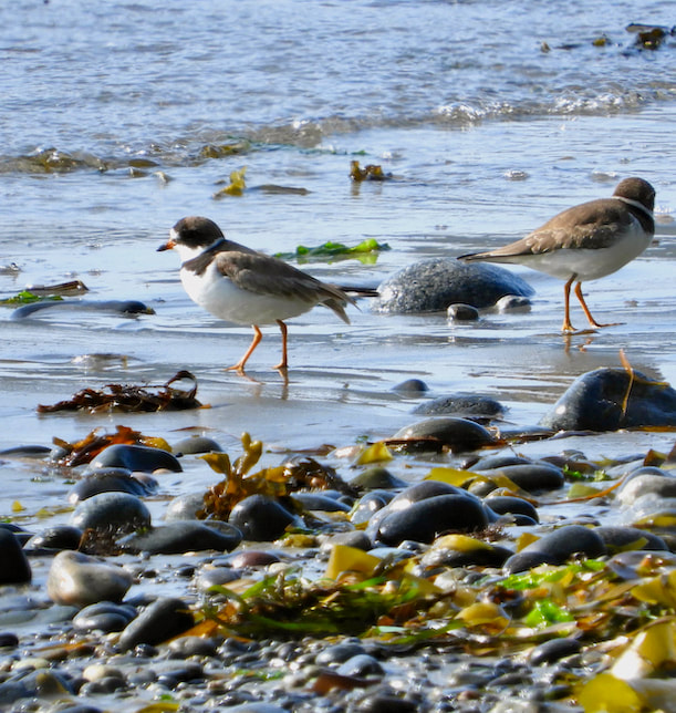
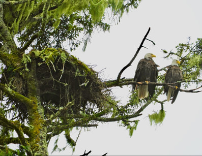
In the afternoon we embarked on a long beach walk. At low tide we were able to cross the spit to another beach where we were amazed by the amount of drift seaweed that had accumulated. We watched plovers and seagulls feeding on the beach, surf scoters paddling in the swell, a pair of eagles flying to their nearby nest — what a lovely way to pass the time! Henning was keen to move on, but for me these days were magical. The wild and rugged beauty of Joachim Spit had captured my heart.
|
The wild and rugged beauty of Joachim Spit had captured my heart
|
|
|
Day 8
Our well thought out plan for departure from Joachim Beach fell through at 9:30 pm when the marine forecast was updated and altered. Yet again, 15-25 knot winds were predicted for the afternoon. This changed everything. Paddling through Kitkatla Channel at high tide was now the best option since we’d be done paddling before noon. Nor would we encounter wind against current. I was somewhat bummed because I’d very much wanted to finish the final leg of the outer coast route. Furthermore, we’d have to get up at 4 am to get on the water by 5:45 am. I was not a fan, since we were already settled inside our tent for the night and thus hadn’t made any preparations for such an early departure. Sleep did not come easily and when it did it was very sporadic. Four o’clock came much too soon.
Not only was it still dark at 4 am but very wet and cold due to the fog, and the surf was crashing big dumping waves onto shore. I felt a nervous energy — how would we get off the beach? Would we make it to the narrowest point before the tide started to ebb and hinder our progress? I pushed away my misgivings and focused on getting packed up. I pulled on my wet suit and paddling jacket and secured everything to my kayak decking in anticipation of getting swamped when we punched through the surf. We brought the loaded boats to within the farthest reach of the waves, quickly hopped in and waited for a wave to set us afloat. Neither Henning nor I managed to get our sprayskirts on. Fortunately for me, I went out on a low wave series, but Henning got soaked! I was relieved that we’d got off the beach safely and was surprised how big the swell was just a little offshore. It was probably for the best that we were heading for the protection of Kitkatla Channel rather than the rugged outer coast.
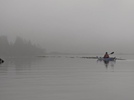
At 6 am it was no longer dark but still very foggy. Fortunately, we could make out the shoreline. It wasn’t long before we found ourselves paddling in a silent gray world that felt like the living had been put under a spell. The sea was flat calm. Occasionally an island loomed out of the fog, fuzzy edged. At one point the haunting calls of loons broke the silence and we stopped paddling to listen. An eagle or two perched on a tree top around almost every corner of the shoreline. A few fish jumped. Further along, past the village of Kitkatla, the sun broke through the fog briefly illuminating the Nereocystis (bull kelp) beds and enchanting little islets. We watched in amazement as the smooth black bodies of four porpoises moved gracefully through the still water in front of us. We heard each breath — magical.
Our well thought out plan for departure from Joachim Beach fell through at 9:30 pm when the marine forecast was updated and altered. Yet again, 15-25 knot winds were predicted for the afternoon. This changed everything. Paddling through Kitkatla Channel at high tide was now the best option since we’d be done paddling before noon. Nor would we encounter wind against current. I was somewhat bummed because I’d very much wanted to finish the final leg of the outer coast route. Furthermore, we’d have to get up at 4 am to get on the water by 5:45 am. I was not a fan, since we were already settled inside our tent for the night and thus hadn’t made any preparations for such an early departure. Sleep did not come easily and when it did it was very sporadic. Four o’clock came much too soon.
Not only was it still dark at 4 am but very wet and cold due to the fog, and the surf was crashing big dumping waves onto shore. I felt a nervous energy — how would we get off the beach? Would we make it to the narrowest point before the tide started to ebb and hinder our progress? I pushed away my misgivings and focused on getting packed up. I pulled on my wet suit and paddling jacket and secured everything to my kayak decking in anticipation of getting swamped when we punched through the surf. We brought the loaded boats to within the farthest reach of the waves, quickly hopped in and waited for a wave to set us afloat. Neither Henning nor I managed to get our sprayskirts on. Fortunately for me, I went out on a low wave series, but Henning got soaked! I was relieved that we’d got off the beach safely and was surprised how big the swell was just a little offshore. It was probably for the best that we were heading for the protection of Kitkatla Channel rather than the rugged outer coast.
At 6 am it was no longer dark but still very foggy. Fortunately, we could make out the shoreline. It wasn’t long before we found ourselves paddling in a silent gray world that felt like the living had been put under a spell. The sea was flat calm. Occasionally an island loomed out of the fog, fuzzy edged. At one point the haunting calls of loons broke the silence and we stopped paddling to listen. An eagle or two perched on a tree top around almost every corner of the shoreline. A few fish jumped. Further along, past the village of Kitkatla, the sun broke through the fog briefly illuminating the Nereocystis (bull kelp) beds and enchanting little islets. We watched in amazement as the smooth black bodies of four porpoises moved gracefully through the still water in front of us. We heard each breath — magical.
We set up camp on Gilbert Island among towering ancient cedars and spruce and abundant red huckleberry. The quiet was immediately evident — no surf, just gently lapping water. The fog burned off in the early afternoon to reveal a cobalt blue sky and picturesque bay. The water though inviting was icy cold as was the North west wind. Fortunately, we had the evening sun on our beach. It filtered through the trees to our secluded wooded camp.
 Paddling in Ogden Channel with a moderate wind at our back.
Day 9
We awoke to the stillness of the forest. Only the intermittent call of a loon or raven interrupted the silence. Fog hung over our tranquil bay though not as dense as at Joachim Beach. We had a leisurely morning and departed at 10 am for the long paddle up Ogden Channel to Mcmicking Island. We began at a slow pace, hugging the shore to stay out of the ebbing current. After 3 miles we ducked into a little bay for a snack and decided to continue to stop and snack every 3 miles. Not long after, we experienced a moderate wind at our back to help us along. The wind began to intensify, and given how frigid the water was at Gilbert Island, we decided to put on our wetsuit (drysuit for Henning). Henning also thought it likely it could get even windier. That didn’t sit well with me. I felt that if the waves from behind got any bigger l would move past my comfort zone. When the waves did appear to get bigger we agreed to head for a much closer beach even though this meant taking the waves from the side. Fortunately, there was no surf on the beach and we could land safely, refuel and put on our suits.
We awoke to the stillness of the forest. Only the intermittent call of a loon or raven interrupted the silence. Fog hung over our tranquil bay though not as dense as at Joachim Beach. We had a leisurely morning and departed at 10 am for the long paddle up Ogden Channel to Mcmicking Island. We began at a slow pace, hugging the shore to stay out of the ebbing current. After 3 miles we ducked into a little bay for a snack and decided to continue to stop and snack every 3 miles. Not long after, we experienced a moderate wind at our back to help us along. The wind began to intensify, and given how frigid the water was at Gilbert Island, we decided to put on our wetsuit (drysuit for Henning). Henning also thought it likely it could get even windier. That didn’t sit well with me. I felt that if the waves from behind got any bigger l would move past my comfort zone. When the waves did appear to get bigger we agreed to head for a much closer beach even though this meant taking the waves from the side. Fortunately, there was no surf on the beach and we could land safely, refuel and put on our suits.
 Despite the wind intensifying from behind, there was no surf on this beach, allowing us to land safely.
Further along we rounded a point where we were met with strange currents and a frenzy of whitecaps. Henning yelled for us to stay close to shore. This was no easy feat since we had to be careful not to run into submerged rocks! After passing the entrance to Oona River (leading to an old Scandinavian settlement), the wind lessened considerably and we considered taking off our wetsuits. But then suddenly the wind materialized from the front. It was a very cold north wind! We hugged the shore yet again, paddling into the fierce wind for the next 7 miles. We maintained our pace and continued to take breaks to snack and stretch.
|
It was after 5 pm when we finally arrived at camp. We’d paddled 17.2 miles. The camp was another enchanting forested site. Thick mats of moss carpeted the forest floor and fallen trees. It also hung from the bare branches of massive upright giants, resembling giant cue tips.
Day 10 We had a calm sea for our paddle back to Port Edward. Unfortunately, the charts we’d purchased were incomplete with regard to this section. For this reason we almost ran aground on extensive sand bars that are a result of the Skeena River discharging sediment as it empties into the ocean. Furthermore, puzzling currents (also related to the mouth of the Skeena?) made for slow progress the last few miles: we paddled 5 knots one moment, the next only 1.5 knots. 
This map illustrates the discharge of sediment as the Skeena River empties into the ocean.
|
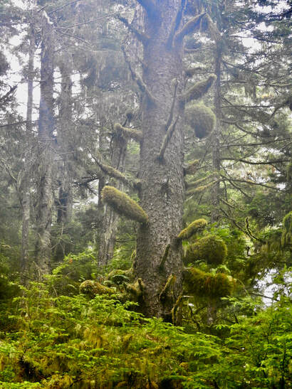 Moss clung to the bare branches of ancients, resembling giant cue tips. Moss clung to the bare branches of ancients, resembling giant cue tips.
|
We arrived at Port Edward grateful for having had the opportunity to explore more of the marine environment of northern BC. It wasn’t the paddle trip we’d envisioned, but the scenery and wildlife didn’t disappoint. As a child growing up in Kitimat I’d visited Prince Rupert countless times, yet never accessed these remote islands and beaches. Still, I felt their familiarity deeply and was captivated by the rugged beauty of the North yet again.
