Exploring the North, 2018
I took a 6-month sabbatical from teaching in 2018 so that Henning and I could drive North to explore parts of northern B.C., the Yukon, Alaska and the N.W.T., and travel to Costa Rica. We were to head North mid-July and return mid-October. Unfortunately, things didn’t go as planned. Our departure was delayed by 2 weeks due to the untimely death of my dear aunt, Renate, (Tante Nati), and the wetter and colder than usual summer/fall in the North drove us back home prematurely. I also injured myself early in the trip during a creek crossing in Mt. Edziza Provincial Park which limited further hiking opportunities. And yet, on the bright side, our 11,000+ km round-trip allowed us to experience novel landscapes including the spectacular wilderness of Tatshenshini-Alsek Provincial Park and Nahanni National Park.
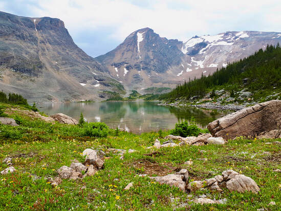
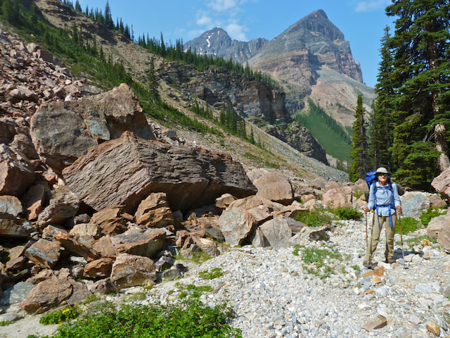
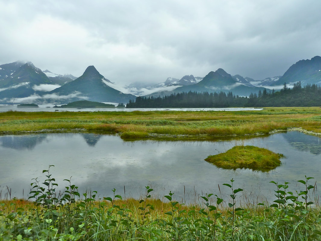
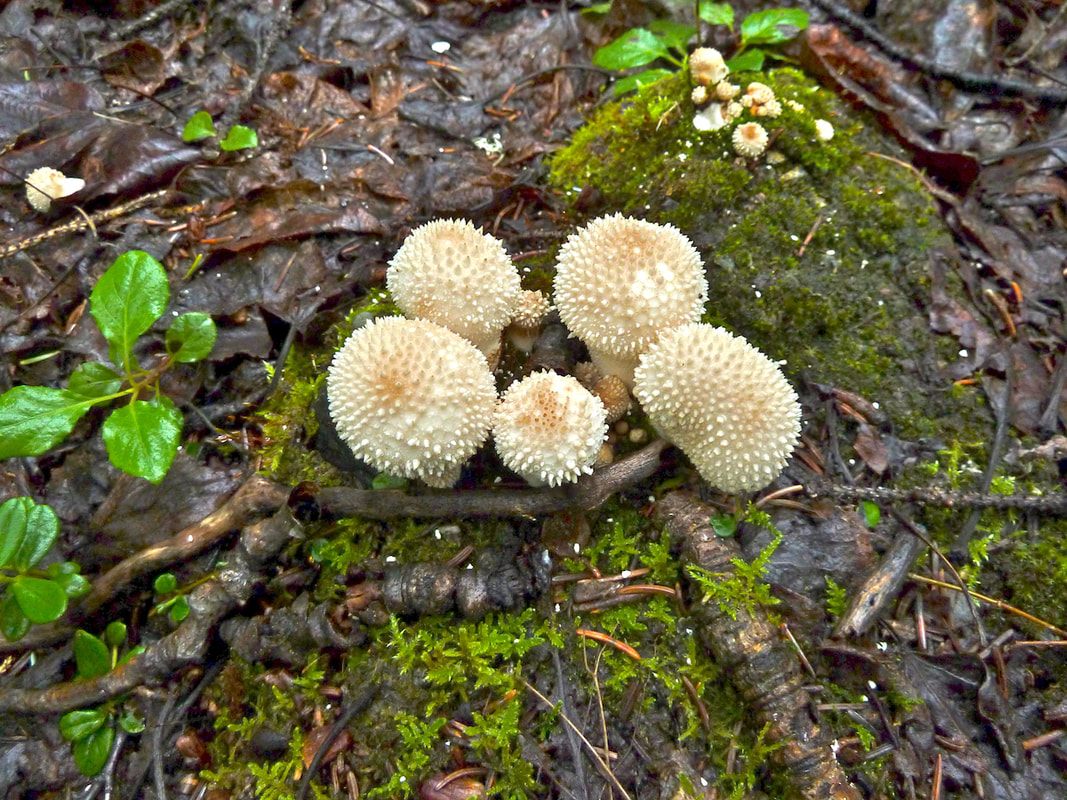
On July 28 we drove into Mt. Robson Park for a trial hike to test our pack loads for our week-long Mt. Edziza trek. Since the popular multi-day trails were already fully booked, we chose the less used Mt. Fitzwilliam trail. The mosquitoes were bothersome enroute and at our destination – in our eyes, nose, mouth, in my tea, in my contact lens case – yet we had a beautiful alpine lake and stunning mountain peaks to ourselves.
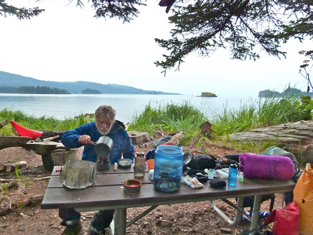
After the hike we drove north to Tatogga Lake Resort, the jumping off point for our 7-day trek (August 4-11) in Mt. Edziza Provincial Park. We hiked vast alpine plateaus and a surreal landscape of volcanic cones, lava fields and pumice dunes (see separate Hiking Buckley Lake to Mowdade Lake write-up under Backpacking Trips).
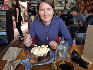
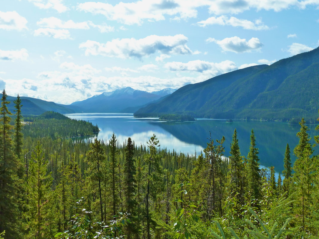
We then continued north through Dease Lake where we were assaulted by thick wildfire smoke that seemed to follow us to the beautiful aquamarine Boya Lake. We chose to head for Whitehorse the next morning, where we escaped the wildfires but drove through a severe rainstorm with the temperature plummeting from 15° to 7° C in a matter of minutes. The following morning when Henning got out of the tent our thermometer read 0° C (it was the middle of August)! We treated ourselves to a dinner in Whitehorse at the legendary Klondike Rib and Salmon. We shared the sourdough bread pudding with ice-cream and caramel sauce for dessert – it was so big that we couldn’t finish it, imagine!
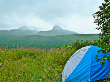
August 16 we left Whitehorse for the Tatshenshini-Alsek Provincial Park (contiguous with Kluane National Park) with plans to do several hikes in the area. The scenery transitioned from subalpine hills to steep rocky fortresses, some snow-covered. That evening we camped at Million Dollar Falls, south of Haines Junction. We sat in the vestibule of our tent, sheltered from the cold wind and looked out at a wall of magenta fireweed standing before a meandering creek. The sun was high in the mountains and the murmur from the creek soothing. I thought to myself “Life is good.” It was a starry night and a frigid one. When we emerged from the tent in the morning it was again only 0° C.
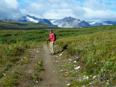
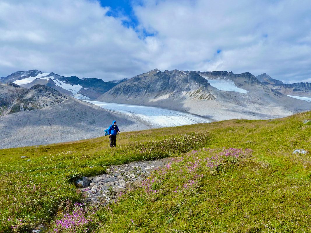
Part of me thought it was crazy to embark on a hike in such cold weather, but by the time we reached the Samuel Glacier trailhead the sun had begun to appear from behind the clouds and the temperature had risen to 6° C. We hiked an old road in the subalpine with 360° panoramic views of snow-covered peaks. The trail ended at a plateau with toes of glaciers creeping down steep towering peaks. Spectacular! Unfortunately my left shin had begun to ache on the way in. I’d ignored it as much as I could, but upon our return, and 7 hours of hiking, I was limping and in pain with a swollen leg. I hadn’t expected that my fall on our Edziza hike would still plague me over a week later – after all I’d walked on it for several hours to the trail end. And so, sadly, our hiking in the Tatshenshini ended.
Part of me thought it was crazy to embark on a hike in such cold weather, but by the time we reached the Samuel Glacier trailhead the sun had begun to appear from behind the clouds and the temperature had risen to 6° C. We hiked an old road in the subalpine with 360° panoramic views of snow-covered peaks. The trail ended at a plateau with toes of glaciers creeping down steep towering peaks. Spectacular! Unfortunately my left shin had begun to ache on the way in. I’d ignored it as much as I could, but upon our return, and 7 hours of hiking, I was limping and in pain with a swollen leg. I hadn’t expected that my fall on our Edziza hike would still plague me over a week later – after all I’d walked on it for several hours to the trail end. And so, sadly, our hiking in the Tatshenshini ended.
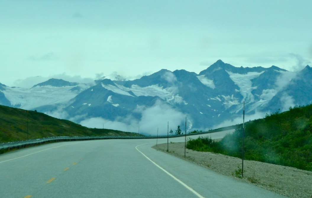
Since I wasn’t in any condition to hike, we drove south the next day and crossed the Canada/U.S. border into Haines, Alaska. The scenery from the highway was stunning. At 1000m elevation we were surrounded by alpine meadows and steep glacier-covered mountains. Despite the cloudy day, this was positively the most scenic drive I’ve experienced and there was hardly any traffic – a little-travelled jewel for those appreciating unspoiled natural beauty. However, I was unable to watch the road after witnessing numerous kamikaze ground squirrels standing erect at the edge of the highway only to race across the road upon the approach of a car. We also spotted two squirrels in the middle of the highway with a squashed comrade. Fortunately, Henning did not hit a single animal and discovered that by using his horn he could frighten them off.
|
|
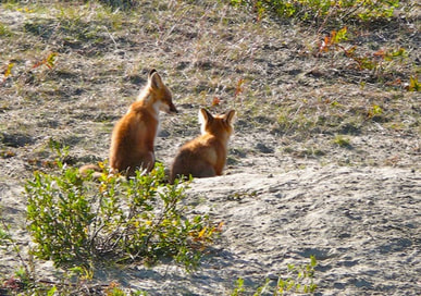
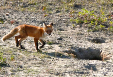
A family of red foxes along the roadside
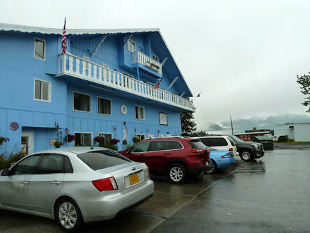 $130 US motel in Valdez, Alaska.
August 20 we pulled into Valdez, Alaska in the pouring rain. Low cloud and fog obscured the mountain peaks. Henning didn’t have to try too hard to convince me to check into a motel; the KOA Campground looked positively depressing in the rain. We were shocked to pay $130 US for the tiniest, dingiest (but clean!) room I’ve ever stayed in and $30 US for halibut and chips served in a ramshackle building that was freezing. One restaurant had advertised that guns were permitted if concealed and used appropriately! The mechanic Henning called was still asleep at 8:30 am and asked that he buy his own oil and oil filter for the oil change. This was not a refined, coastal tourist town like Tofino, B.C. Everything screamed out ‘frontier town’. And yet we discovered a great coffee house/organic food market to spend a rainy afternoon.
It was too wet and cold for us to contemplate any hiking or marine tours. So, we left Valdez after spending only a single day, and drove to a campground 25 miles out of town. The clouds moved quickly offering glimpses of pyramid-shaped peaks, but the rain began again, luckily not until our tent was up. We were the only tenters. I was happy to be outdoors again, and, based on the weather forecast, optimistic for a scenic drive and some hiking on the Kenai Peninsula. In the morning everything was socked in with low cloud, but periodically sun broke through the cloud and a few peaks emerged, so we waited for the clearing that just didn’t come. We left anyway, still hopeful. But any hint of clearing up was quick lived and much of the beautiful scenery remained obscured as it had on our drive in.
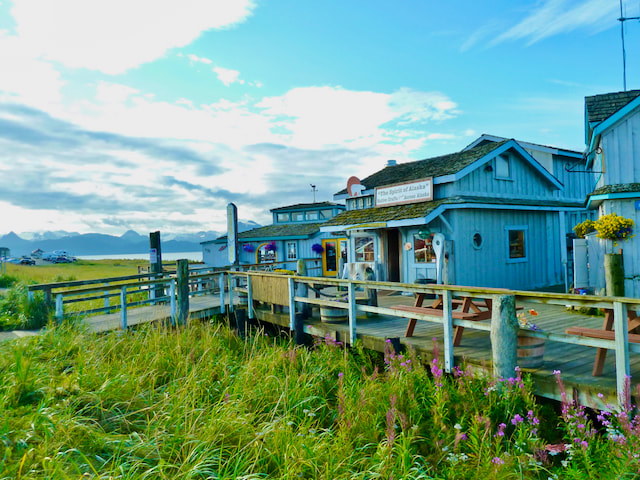
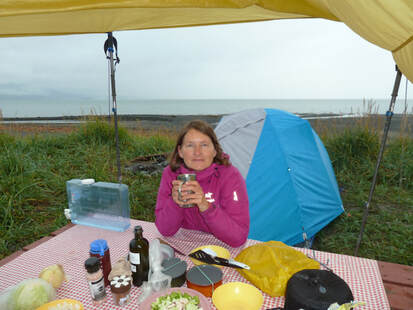 Camping on Homer Spit.
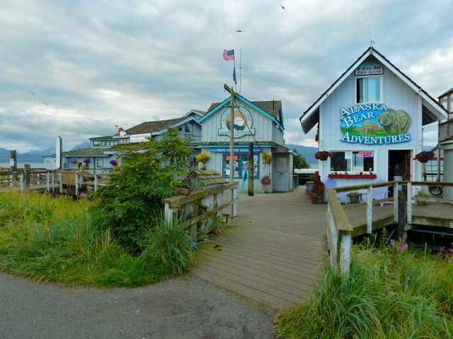
The rainy weather followed us to Homer, Alaska. We camped on Homer Spit in the drizzle at the edge of a sand/cobble beach. It was a lovely evening – smell of seaweed, a calm grey sea, snow-capped peaks mysteriously appearing and disappearing in the distance – but with nightfall it became a busy place. Vehicles headed to the bars further along, dogs barked, light from the lighthouse shone on our tent. We got little sleep. We were also annoyed by the dog poo on the beach (we’d almost set up our tent next to dog poo!), outside shops and on the street. Additionally, we noticed a lot of old vehicles and machinery rusting in yards and alongside the road – we concluded that Alaska is still a ‘frontier state’.
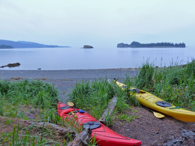
We rejoiced as the skies cleared the next morning and proceeded to rent kayaks for an overnight trip. The sun brought strong winds and choppy water, so our options were limited, and we were forced to perform a surf landing on a rocky beach. Fortunately, the kayaks were plastic! But we weren’t very satisfied with the gear (my skirt didn’t fit properly!), and to our astonishment we weren’t provided any safety equipment (no paddle float or tow rope). The kayaking wasn’t anything special compared to our past B.C. west coast trips, but the diversion from being on the road was welcome.
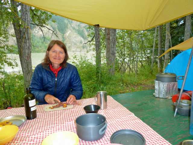
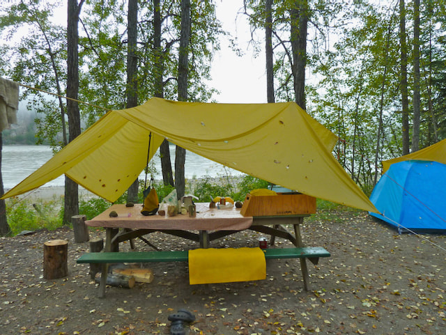
The wet weather returned, and though Henning was a creative genius with putting up tarp shelters, we were becoming more and more disillusioned with tenting in the cold rain (daytime temperatures averaged 11°-14° C) in Alaska. Nor did we have any desire to seek out hiking opportunities though my shin was no longer painful or swollen. Yet, just as we were feeling a little fed up with Alaska, we chanced upon a warm and eclectic café in the old townsite of Kenai City. Delicious ‘real’ hot chocolate with ‘real’ whipped cream and a super fudgy brownie. Yum!
The wet weather returned, and though Henning was a creative genius with putting up tarp shelters, we were becoming more and more disillusioned with tenting in the cold rain (daytime temperatures averaged 11°-14° C) in Alaska. Nor did we have any desire to seek out hiking opportunities though my shin was no longer painful or swollen. Yet, just as we were feeling a little fed up with Alaska, we chanced upon a warm and eclectic café in the old townsite of Kenai City. Delicious ‘real’ hot chocolate with ‘real’ whipped cream and a super fudgy brownie. Yum!
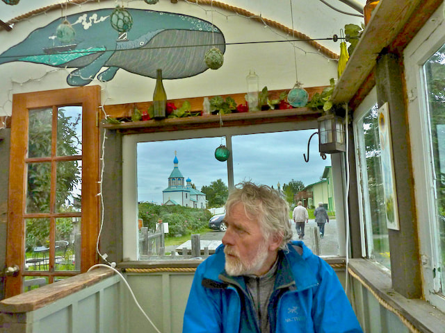
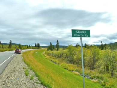
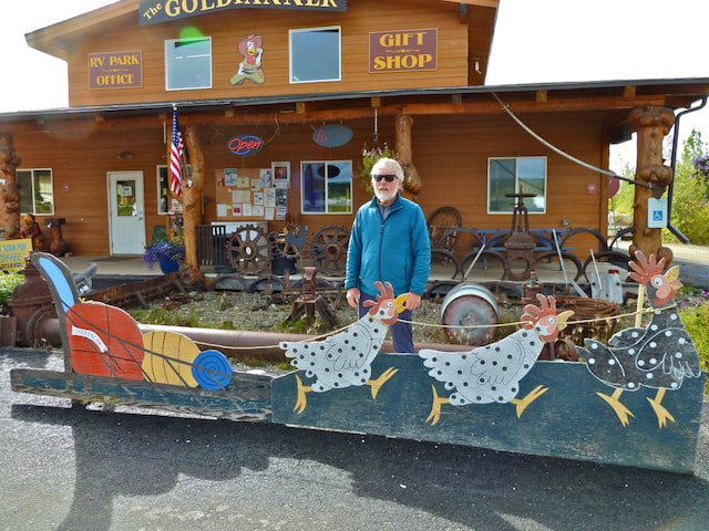
We continued northeast on the Alaska Highway. Heavy rain intermittently tapered off to allow glimpses of soaring mountains and expansive glaciers and icefields – I was convinced I viewed the Wrangell Mountain Range. North of Tok the mountains receded and rolling hills covered in dense stands of spruce became visible for miles in all directions. On August 27, after stopping in the hamlet of Chicken for ice-cream, we headed for the U.S./Canada border (which is only open from May-September) on the Top of the World Highway. It felt good to be back in Canada!
|
|
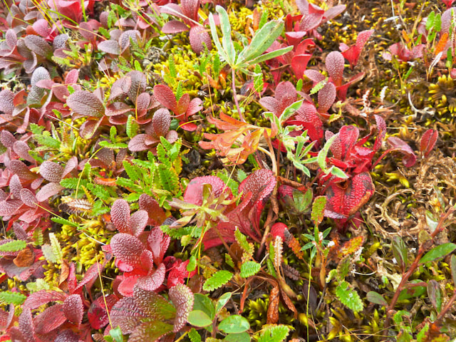
Cloud and sun were a welcome change and allowed us to appreciate the panoramic vista of rolling hills stretching out before us at an elevation over 1200 m. The hills were carpeted with red, yellow and green low-lying shrubs and dotted with spruce trees; the road twisted its way across the mountain ridges.
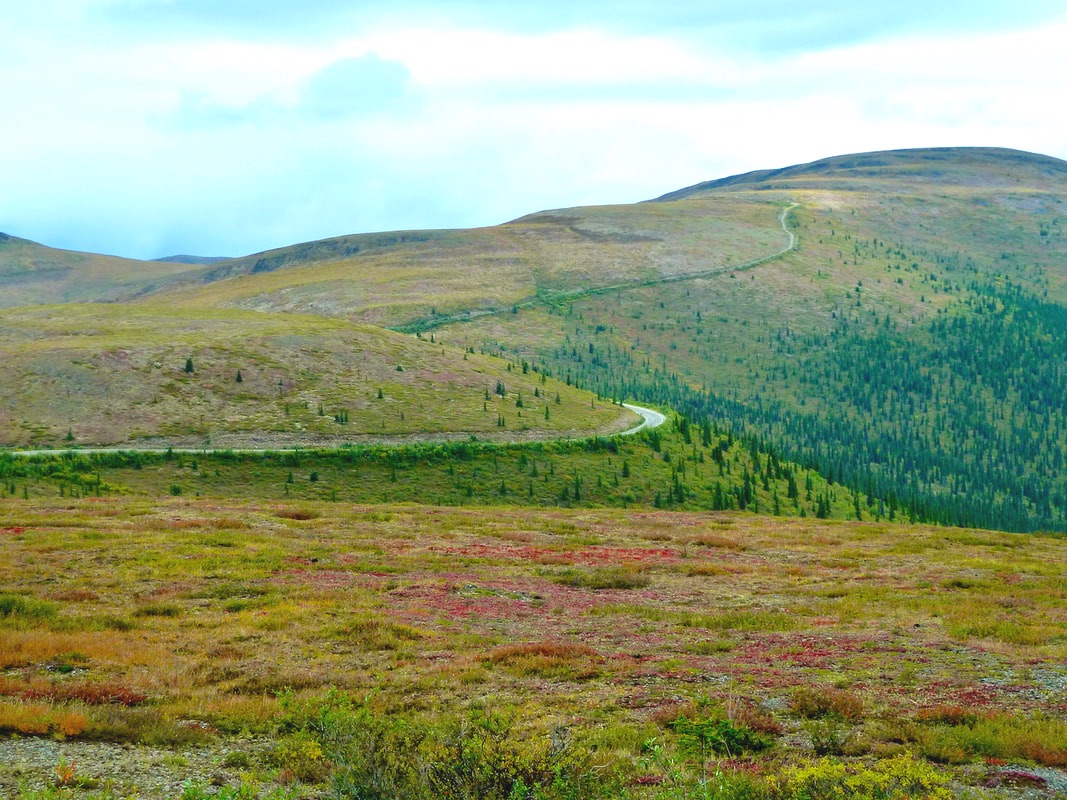
Top of the World Highway
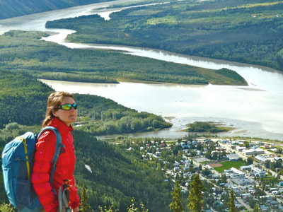
We camped at the Yukon River Campground, just outside Dawson City. I was elated that it was sunny! We hung out our wet things to dry mindful of the evening forecast for rain. Having erected a tarp over the picnic table, we were dry and cozy during the evening downpour that put out everyone’s campfire. The next day a ferry took us across the Yukon River to Dawson where we hiked the Midnight Dome Trail in the sun. The very steep sections were a welcome work-out, and at the top we were met with spectacular views of Dawson and the valley. We had a lovely dinner at Klondike Kate’s – elk and moose sausages – sitting under wool blankets out in the open. With clouds and showers forecast for the Dawson vicinity, we reluctantly packed up the next morning and left our delightful river-side campsite. We drove to the Wolf Creek Campground outside of Whitehorse, where we eagerly started planning to hike the Chilkoot Trail. I was flying high with anticipation – a favourable weather forecast meant we could still hike this highly scenic trail at the end of the season before it closed.
Camping at the Yukon River Campground, just outside Dawson City.
 Midnight Dome Trail and view of Dawson City.
However, the very next day this anticipation was tempered. I awoke with a sore throat, and following a day hike in the vicinity, my left shin became aggravated (it was now three weeks since I’d injured it). I worried that my leg was not fully healed and could worsen on the 50 km hike. But I was not prepared to give up. Henning suggested we hike the first day of the Chilkoot and if need be, turn around. OK, good. We could keep moving forward with our plans. We purchased our freeze-dried food and prepared our packs for heading to Skagway, the start of the trail.
By morning my sore throat had worsened, but still eager to do the hike, we drove to Skagway on September 1 and checked into a motel to let me rest for a day or two. I was hopeful that just maybe this wouldn’t develop into a bad cold. There was fresh snow on the mountains around Whitehorse and splashes of red and yellow appeared in the hills heading south. In the vicinity of Skagway, a thick fog obscured the tall mountain peaks. Given Labour Day weekend, we were lucky to secure a motel room – a tiny box of a room, but warm. After a hot shower I climbed into bed where I stayed all day. My cold moved into my chest and my head; my body ached all over. Henning brought back Take-out, but the bun of my $18 U.S. chicken burger was burnt and the fries inedible. Luckily, we still had some food from camping!
By morning my sore throat had worsened, but still eager to do the hike, we drove to Skagway on September 1 and checked into a motel to let me rest for a day or two. I was hopeful that just maybe this wouldn’t develop into a bad cold. There was fresh snow on the mountains around Whitehorse and splashes of red and yellow appeared in the hills heading south. In the vicinity of Skagway, a thick fog obscured the tall mountain peaks. Given Labour Day weekend, we were lucky to secure a motel room – a tiny box of a room, but warm. After a hot shower I climbed into bed where I stayed all day. My cold moved into my chest and my head; my body ached all over. Henning brought back Take-out, but the bun of my $18 U.S. chicken burger was burnt and the fries inedible. Luckily, we still had some food from camping!
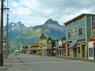 Skagway, Alaska
In the morning it was clear that I was not well enough for us to leave the next day to hike the 50 km Chilkoot trail, especially given overnight temperatures dipping below 0° C. I was heartbroken. Was this how our road trip would end? Henning suggested that once I was feeling better, we drive to Fort Nelson to enquire about flights into the Nahanni, N.W.T. But I didn’t want to stay in this tiny shoebox for another day. And so, we left Skagway on a cold brilliantly sunny morning. We got the last motel room in Watson Lake since the motels were full of evacuees from neighbouring towns that had fled wildfires.
In the morning it was clear that I was not well enough for us to leave the next day to hike the 50 km Chilkoot trail, especially given overnight temperatures dipping below 0° C. I was heartbroken. Was this how our road trip would end? Henning suggested that once I was feeling better, we drive to Fort Nelson to enquire about flights into the Nahanni, N.W.T. But I didn’t want to stay in this tiny shoebox for another day. And so, we left Skagway on a cold brilliantly sunny morning. We got the last motel room in Watson Lake since the motels were full of evacuees from neighbouring towns that had fled wildfires.
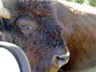
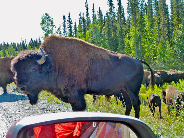
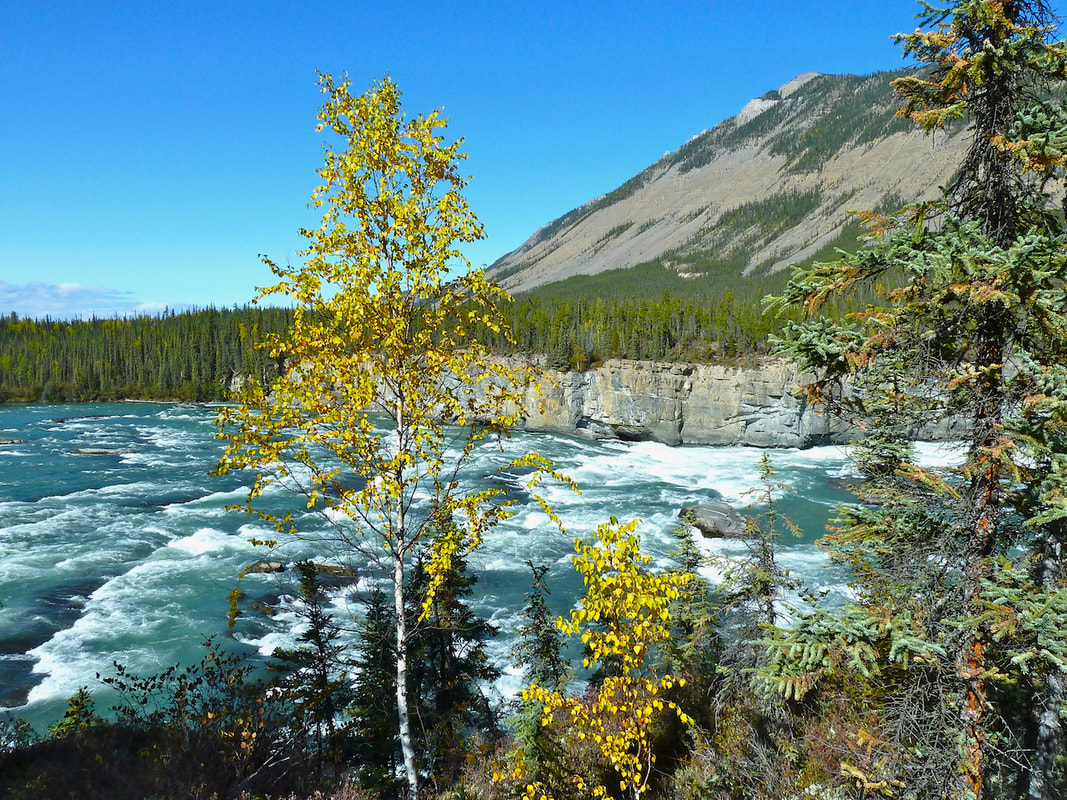
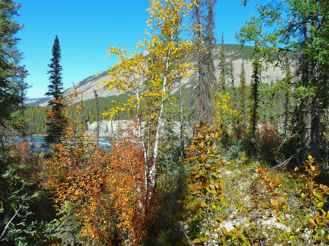
On September 3 we awoke to another cloudless blue sky and sun in the forecast. My cold was still hanging on, but I could relax in the car and enjoy the drive next to the grey-green Liard River and alongside hills of mixed forest interspersed with patches of vivid yellow. There was almost no traffic. We were delighted to come across a herd of 50+ bison. Something triggered a small stampede which caused some of these huge beasts to approach the jeep – a little nerve-wracking!
|
|
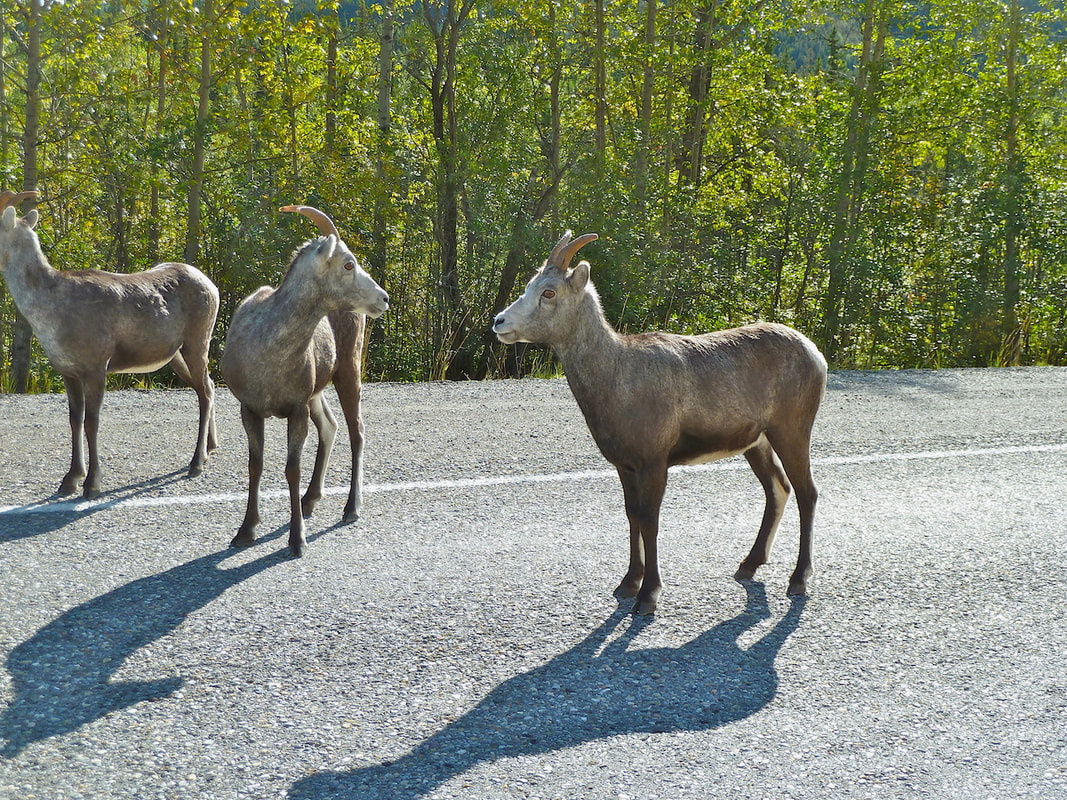
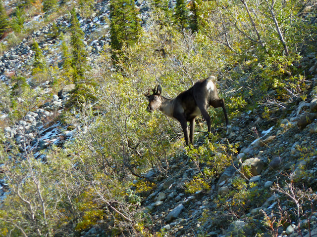
The stretch of the highway through the Northern Rocky Mountains and along the aquamarine Muncho Lake was incredibly scenic. Fresh snow on the hills, peaks and alongside the highway sparkled, creeks shimmered, and we encountered stone sheep, reindeer and caribou. Beyond the Rocky Mountains an expansive plateau of dark green table-top mountains yielded to the flat ranching country near Fort Nelson. We booked into a cheap, old kitchenette where we could make ourselves a good, cooked dinner and breakfast. We were also thrilled to be able to secure a flight into Nahanni National Park in a few days’ time.
Muncho Lake
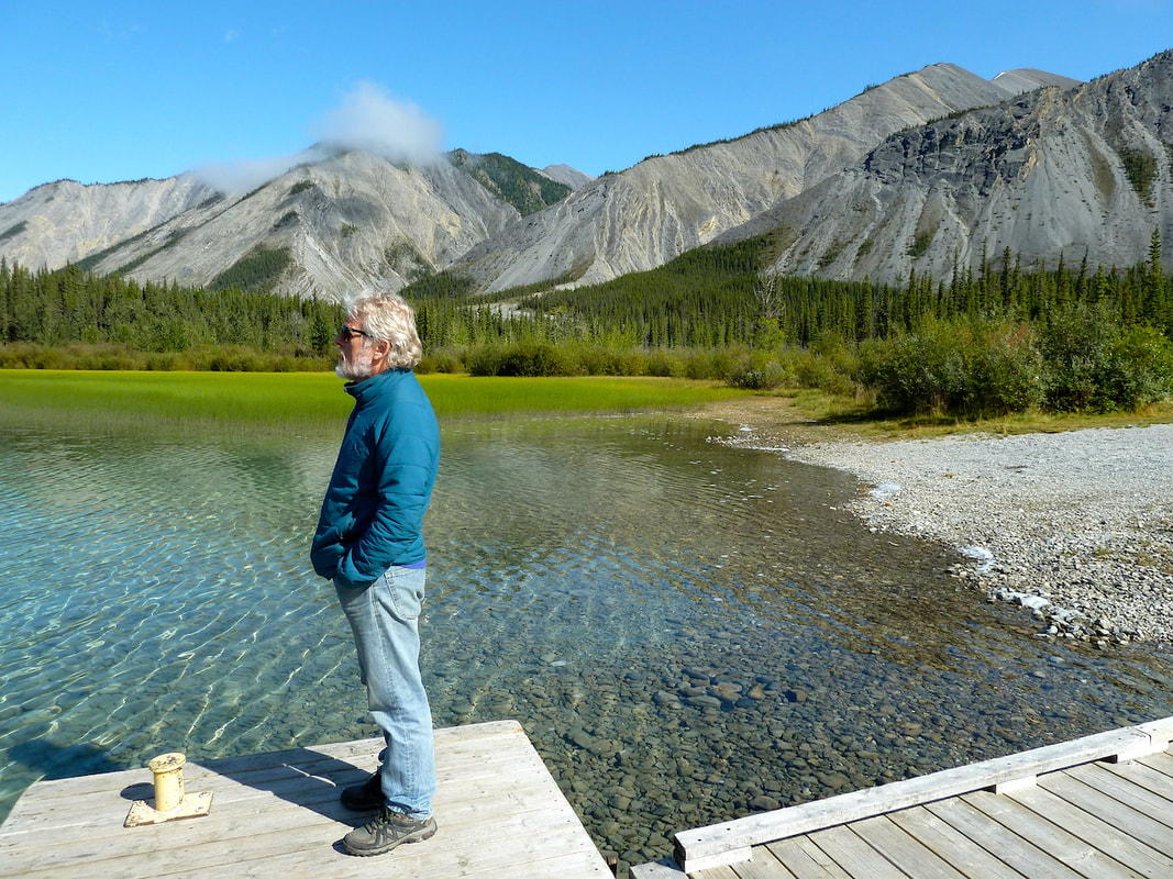
Leaving Fort Nelson, and heading north on the Liard Highway, towards the Northwest Territories, there were few vehicles and no RVs. The gravel road was in good shape, though we had to stop several times for bison to cross. Birch and poplar, golden in the sun, intermixed with spruce; the distant Mackenzie Mountains were briefly visible. There were only two other campers, both in RVs, at our riverside territorial campsite. It was a very cold starry night, and I was rewarded by the sight of the Northern Lights when I had to get up to relieve myself – my enthusiasm, however, didn’t tempt Henning out of the tent! When we got up in the morning the thermometer read - 4° C and frost covered almost every surface. Given my ongoing cold and the need to keep warm, I appreciated Henning warming up the jeep for me to breakfast in.
View from our riverside territorial campsite, NWT, south of Ft. Simpson.
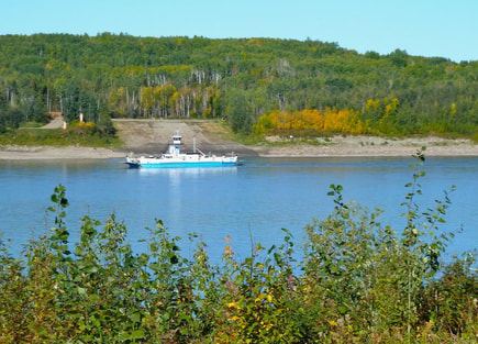 The ferry across the Liard River, 20km from Ft. Simpson.
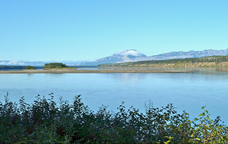
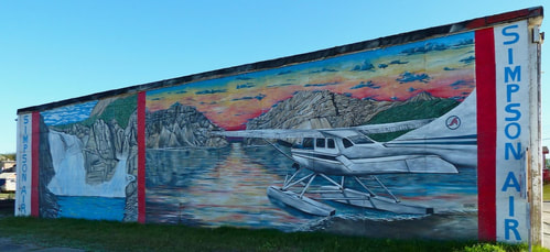
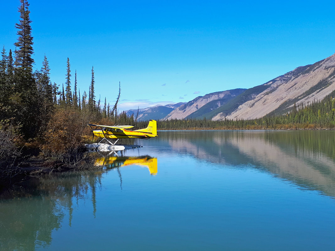
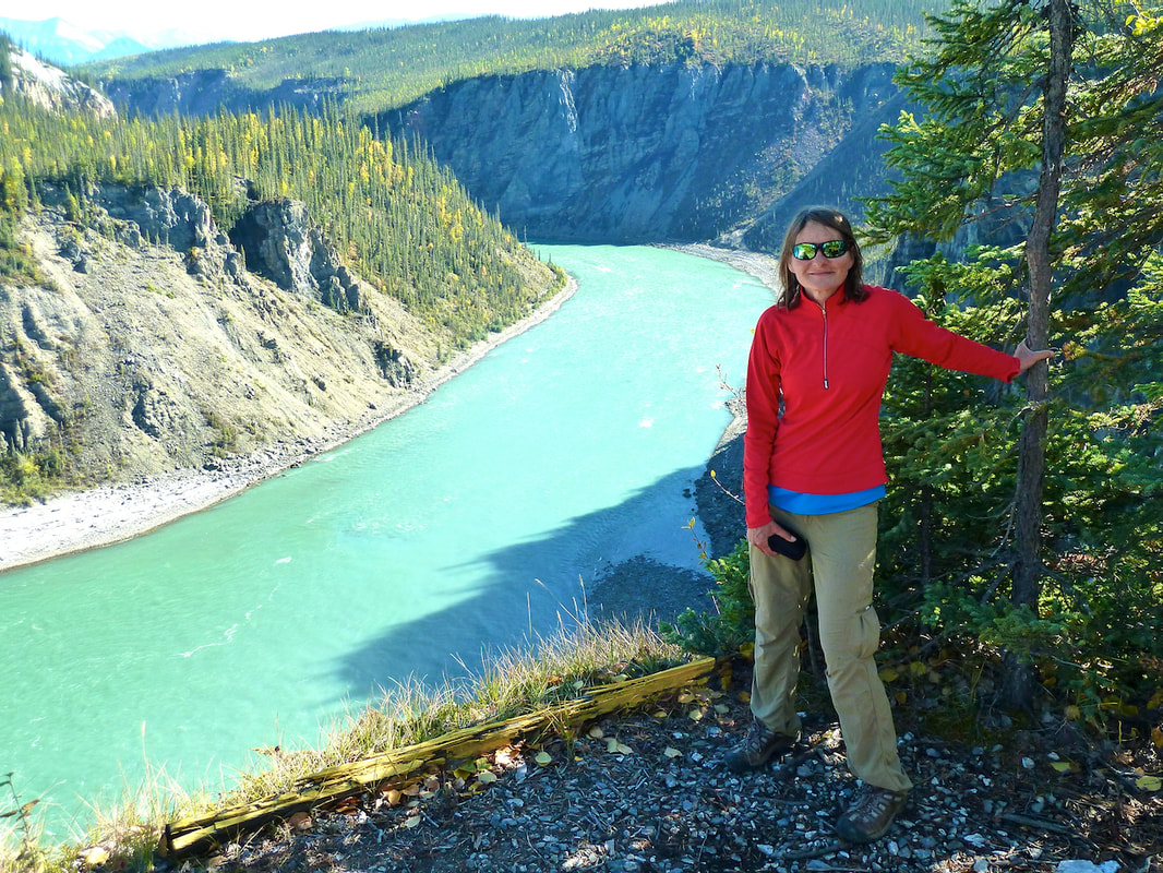
The landscape during our drive to Fort Simpson wasn’t particularly notable – vast poplar, birch and spruce stands. I was surprised there was no tundra, but then we were still a considerable distance from the Arctic Circle. About 20km from town, a short ferry ride took us across the Liard River. At the Simpson Air office, we learned that the flight we’d reserved into the Nahanni was no longer available. While on the road and out-of-cell range, we’d been unable to confirm the flight, so our seats had apparently been given to others. We were not happy, having made the long drive! However, we were offered a private flight in a smaller plane, at a small discount. The weather forecast was still good, so we readily accepted – when might we have such an opportunity again! Still not having shaken my cold, I went to bed early, bundling myself up with an extra sleeping bag inside our smaller tent which we pitched inside our bigger tent for extra warmth. Clearly, we hadn’t considered being equipped for sub-zero temperatures!
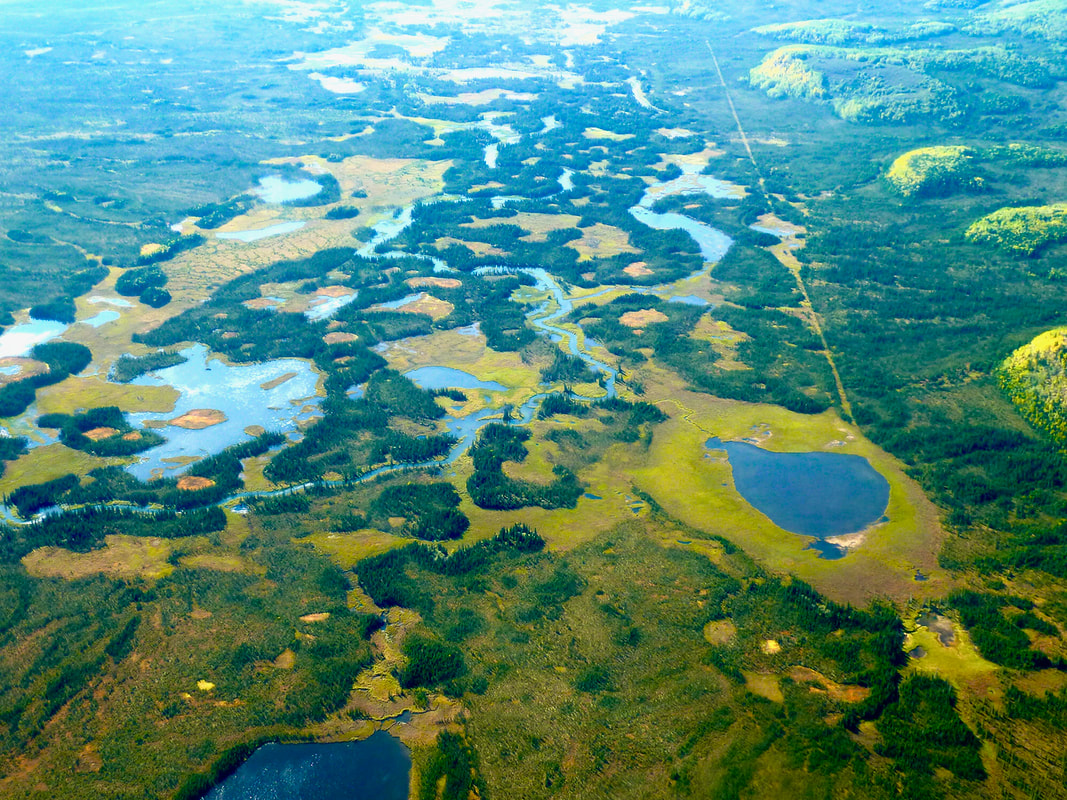
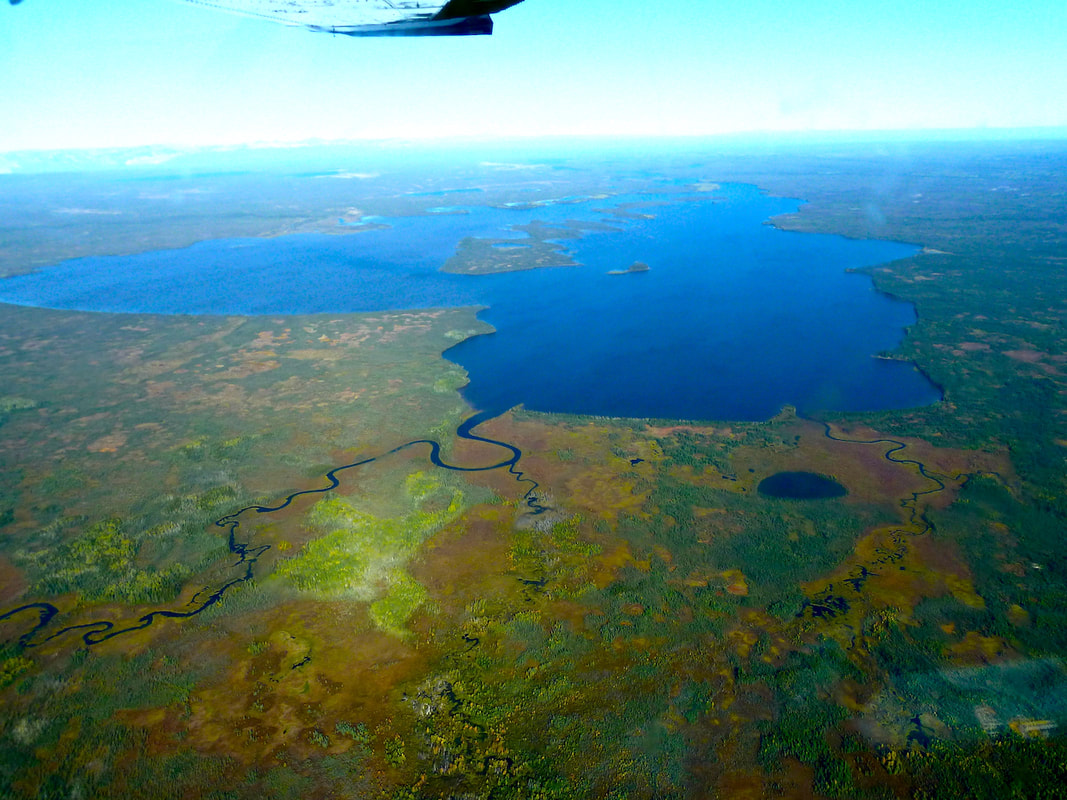
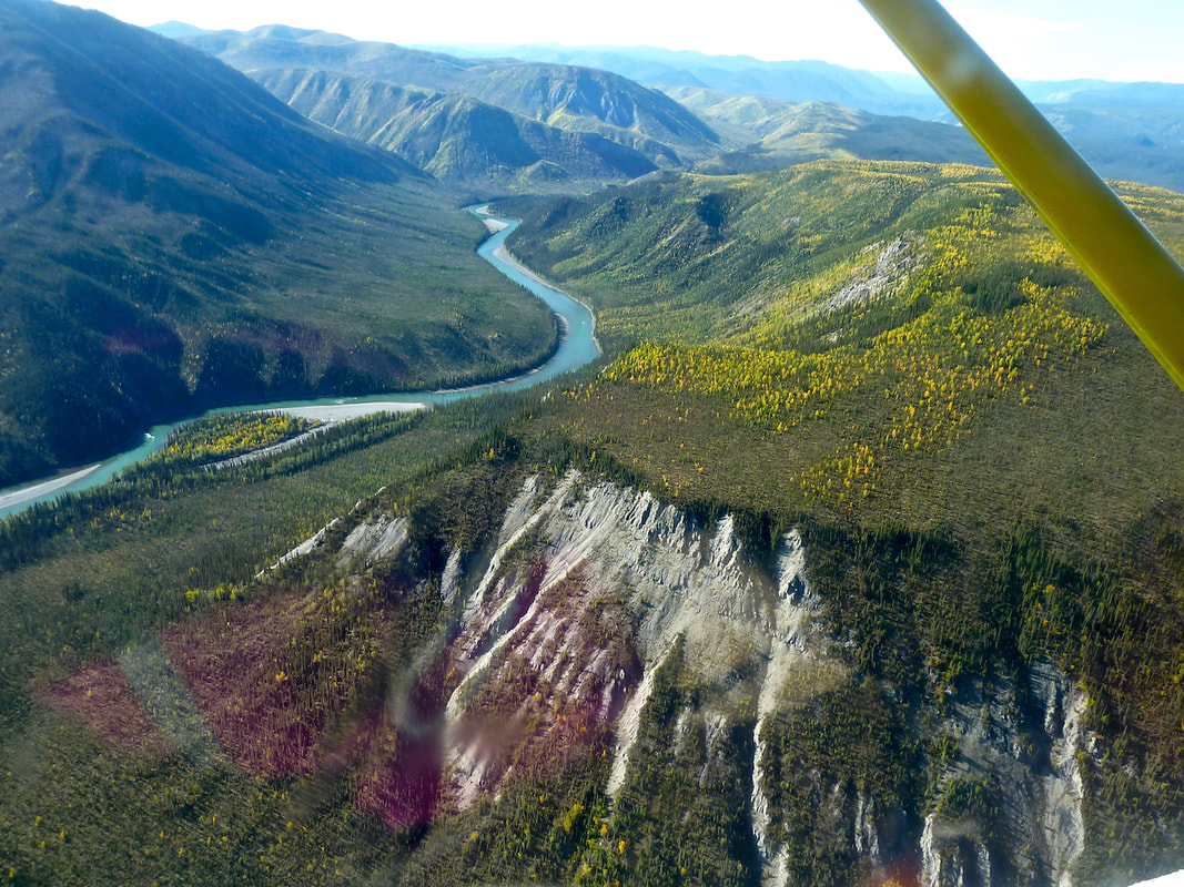
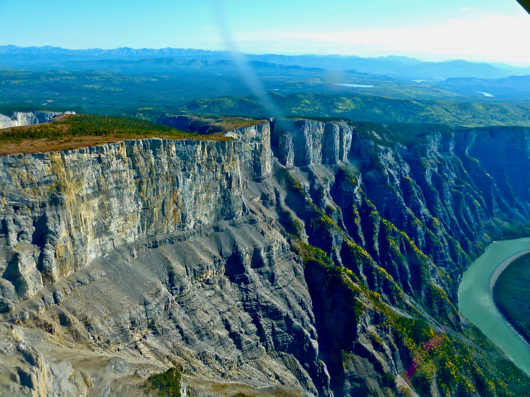
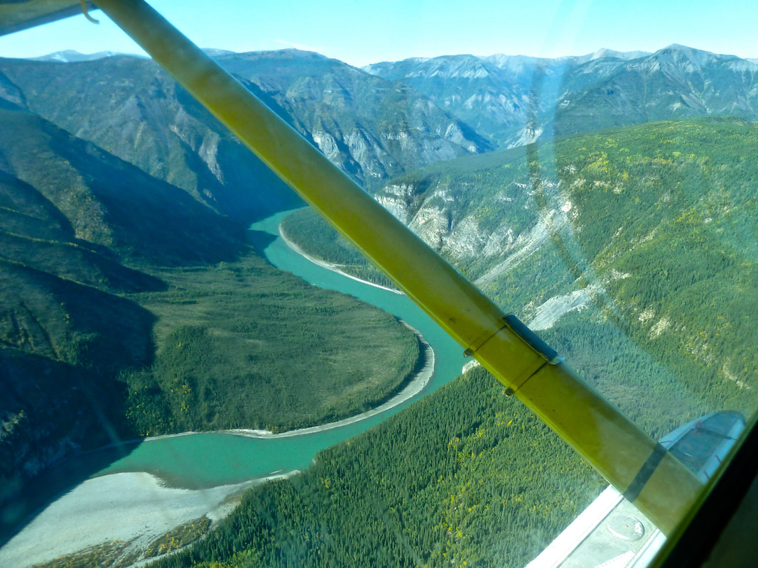
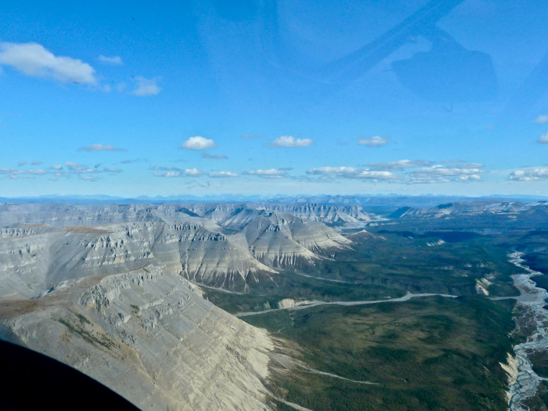
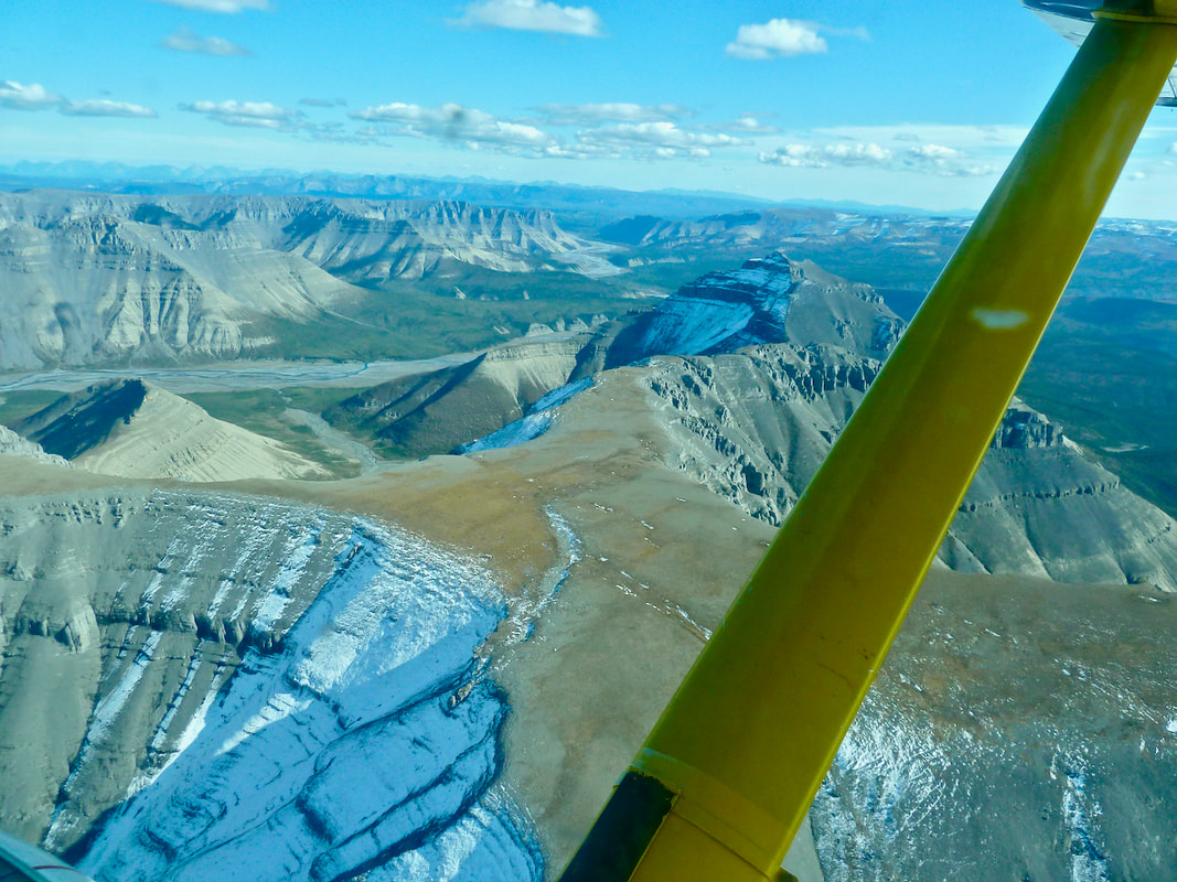
Sitting in the little Cessna 185, I wondered if this was a mistake – the plane was old, the seats in bad shape and I was apprehensive about my ears during take-off (though I’d taken a decongestant). Yet, once airborne, I was immediately thrilled by the stunning views!
Sitting in the little Cessna 185, I wondered if this was a mistake – the plane was old, the seats in bad shape and I was apprehensive about my ears during take-off (though I’d taken a decongestant). Yet, once airborne, I was immediately thrilled by the stunning views!
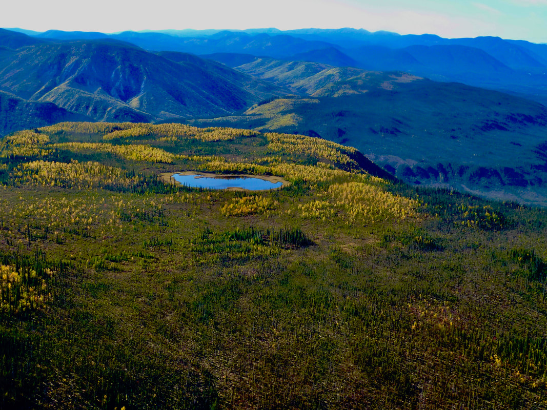
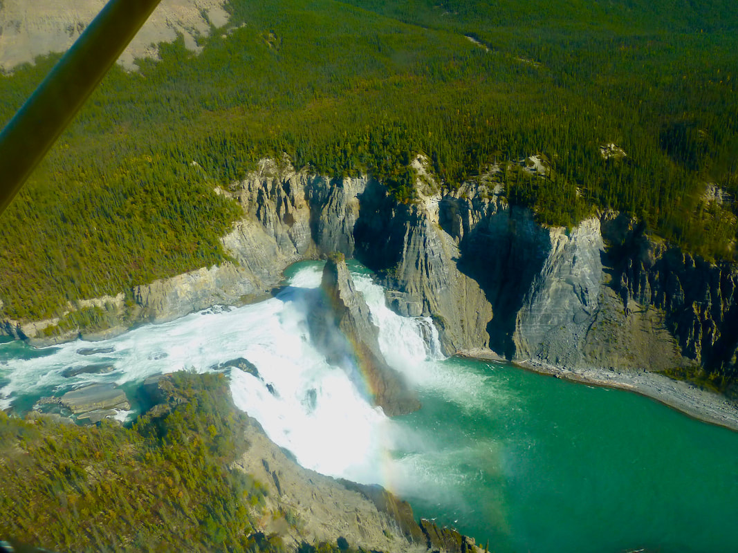
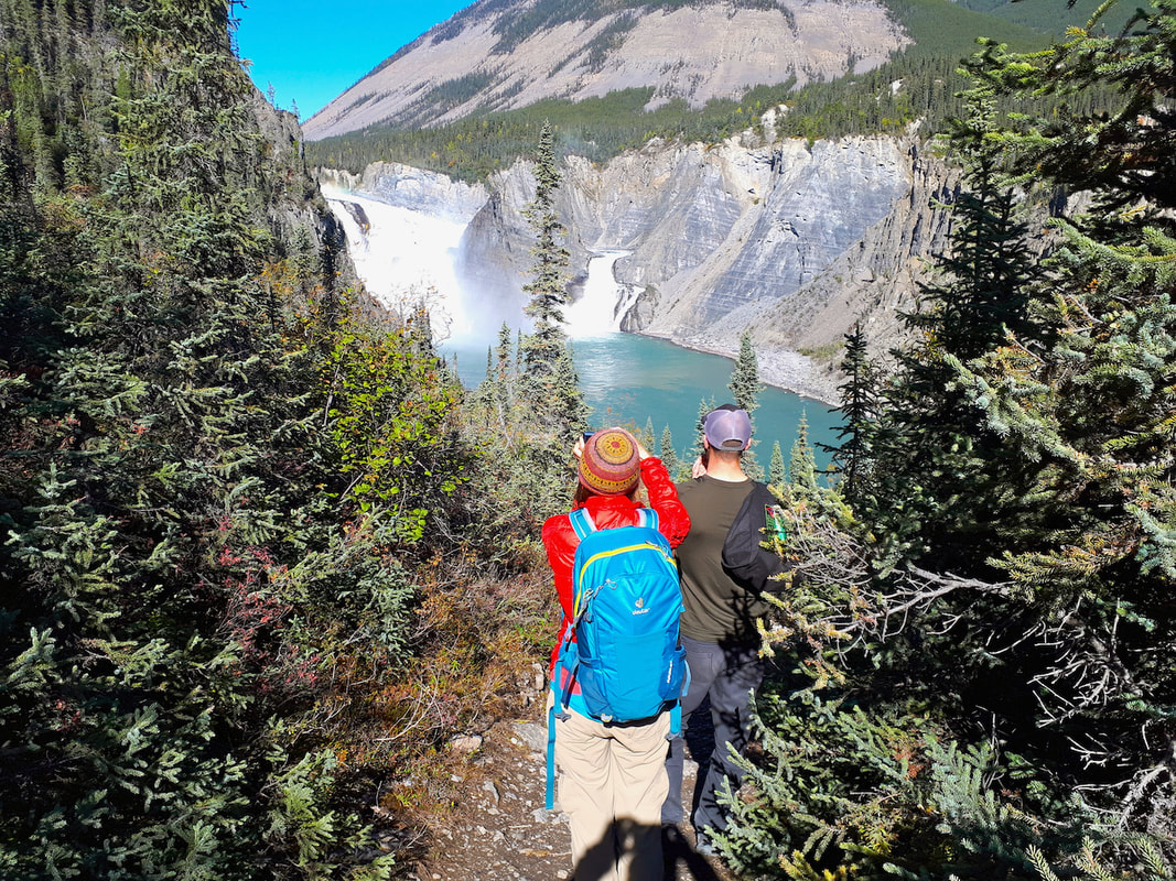
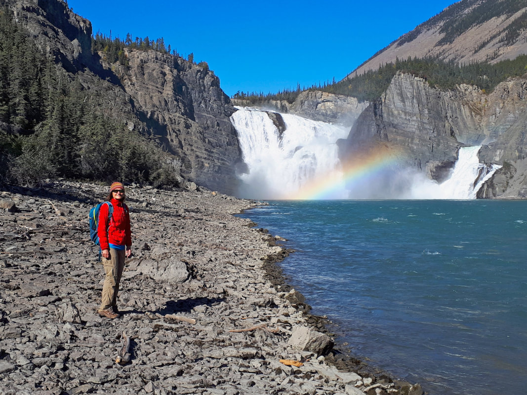
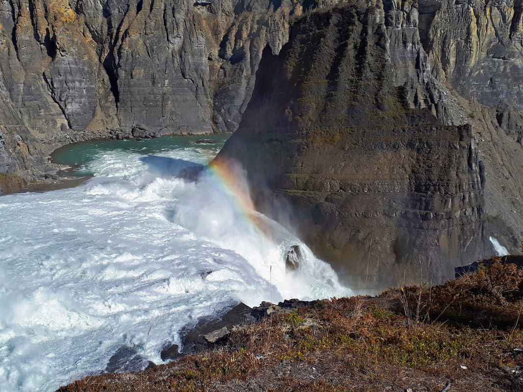
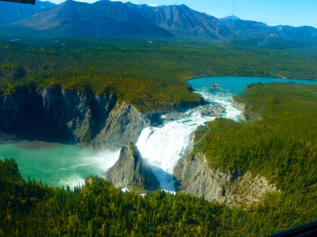
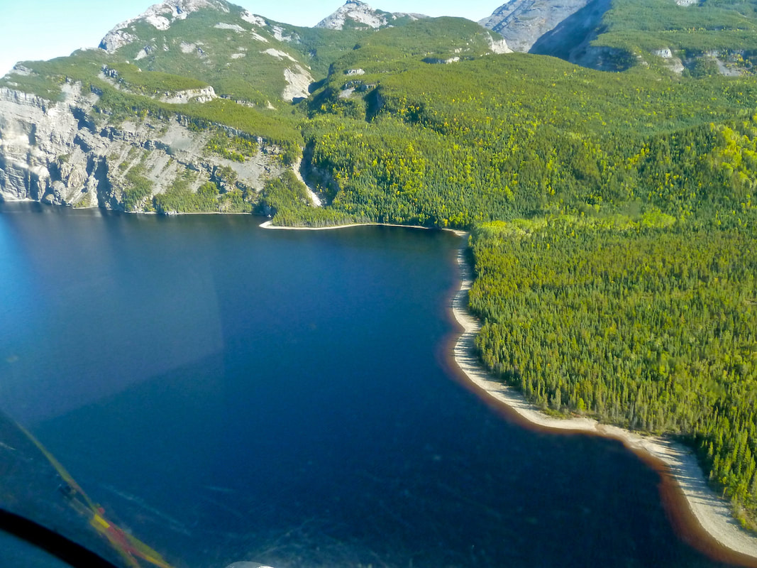
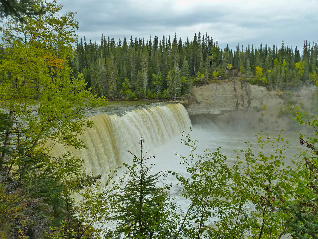
We flew close to canyons, table-top mountains, sparkling tarns and winding rivers and the spectacular Virginia Falls. The world below us lay dotted in vibrant, golden yellows and reds – fall was well underway. We also glimpsed groups of mountain sheep. My camera snapped almost non-stop; I was in awe. When we landed at Virginia Falls, I convinced our pilot to walk the trail down to the base of the falls, one of the perks of having a private tour! In light of the frustrations and disappointments we’d experienced along the way on this trip, we felt fortunate to have this amazing day in the sun.
To view these, and other photos, in larger size, click the Gallery button (at the top of the page), then click on individual photos.
 Bundled up against the storm at Great Slave Lake.
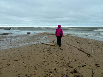
The very next day, September 7, clouds and showers returned. It was 5° C. As we drove east the fall colours intensified (golden yellows, amber and crimson), and despite the drizzle we stopped to visit three beautiful waterfalls. We camped at Hay River on Great Slave Lake. Unfortunately, we had to move camp after dark when partyers began arriving at the site next door. This was not the first time we found ourselves picking up the tent and carrying it to a new location. I’d hoped to swim in Great Slave Lake (I swim in almost every body of water I encounter, even glacial lakes), but the morning brought rain and a blustery cold wind, which, in addition to the cough I’d developed, didn’t entice me one bit. Instead, we walked along the shore of the lake, bundled up against the storm.
One of the many beautiful waterfalls south of Hay River.
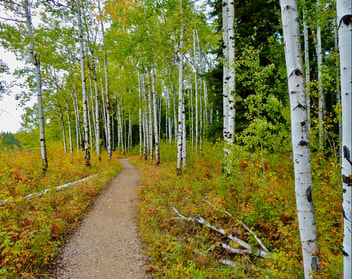 Forest trail that connects Alexandra Falls and Louise Falls.
In hopes of milder temperatures, we left Hay River that same day and headed south towards Alberta. We first checked out Alexandra Falls (32 m drop) and the lower Louise Falls situated on the Hay River. The rain stopped long enough for us to hike the lovely forest trail, ablaze with fall colours, that connected the twin falls. At one point, after I’d stopped to take a photo at the Louise Falls, Henning was nowhere in sight. I raced ahead in one direction, then backtracked and tried two other trails until they petered out, all the time yelling as loud as I could. No Henning. When he was not waiting for me at the top of the long spiral staircase, some 15-20 minutes later, I started to panic. Had he slipped down a steep embankment? I decided to head back on the main trail 2 km to the parking lot but wondered what I’d do if Henning wasn’t at the jeep. Wait an hour, and then drive to the Police Station back in Hay River? Fortunately, Henning was waiting; he thought I’d seen him scramble down into the gorge where I’d stopped to take a photo.
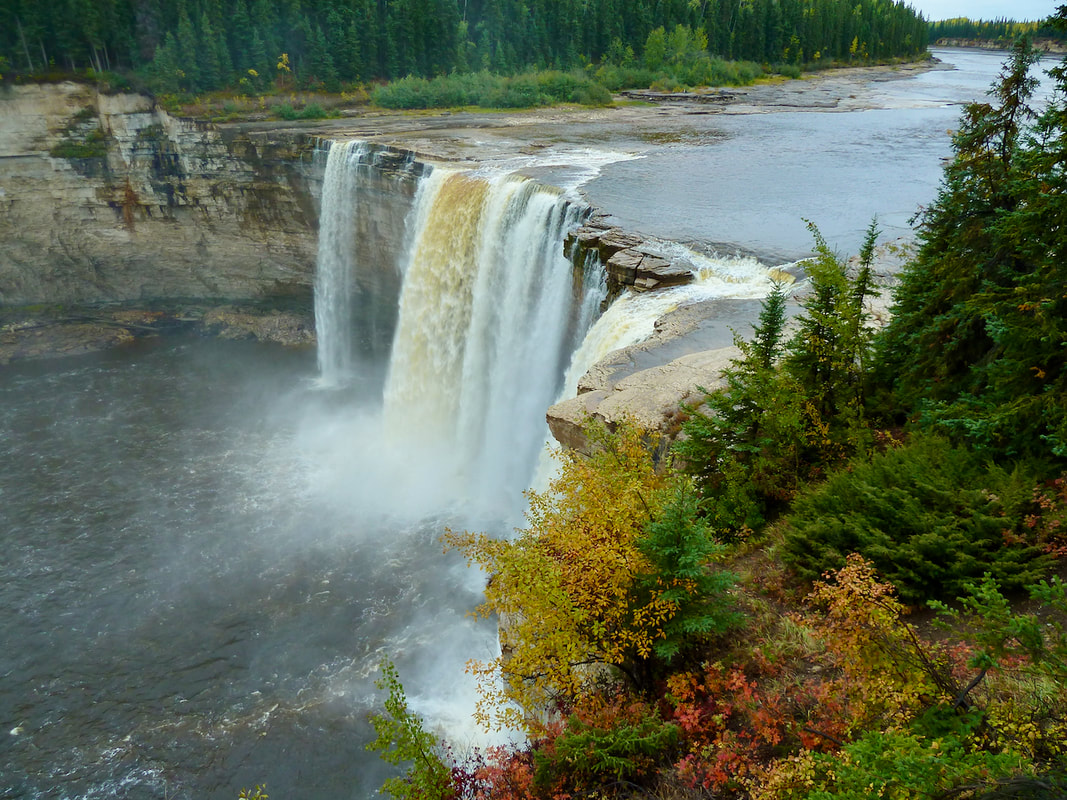
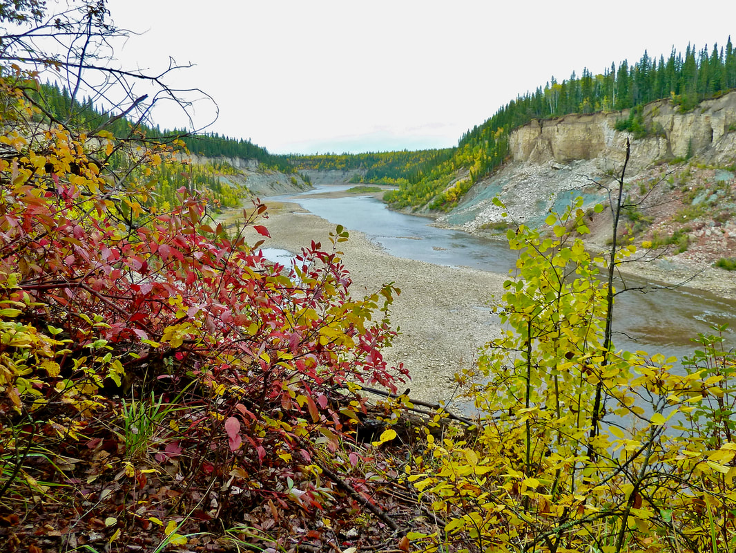
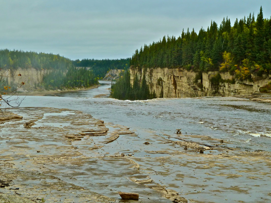
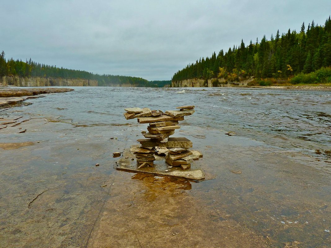
Alexandra Falls, situated on the Hay River, NWT.
Further south we drove through grasslands, marsh and lakes that gave way to vast fields of grain, grain silos and oil pumpjacks. We camped near Grimshaw, Alberta, managing to erect the tent before the rain began. As on many occasions,we found a campsite shelter out of the rain and wind where we could breakfast. The forecast for the next 3-4 days was for more rain, but after that sun was expected at Mt. Robson. We considered hiking Berg Mountain, but with highs of 0° C and lows down to -5° C, we had to admit that we weren’t equipped for winter camping. So, a little weary and a little downhearted, we made the decision to head for home. It was September 9. We drove through the rolling hills of the Peace River valley – I was saddened thinking about the Site C dam flooding this beautiful and fertile land – and once south of Chetwynd the temperature climbed to 12° C! Further south the caribou valley was starting to display fall colours – golden grasses and crimson shrubs. We stopped at the Goldpan campsite near Spences Bridge to dry out the tents and tarps. It was 20° C and sunny, and the first time in many weeks that I could get out of the car wearing only a T-shirt. Warmth at last! We got out our camp chairs and relaxed in the shade by the river, only hours from home.
